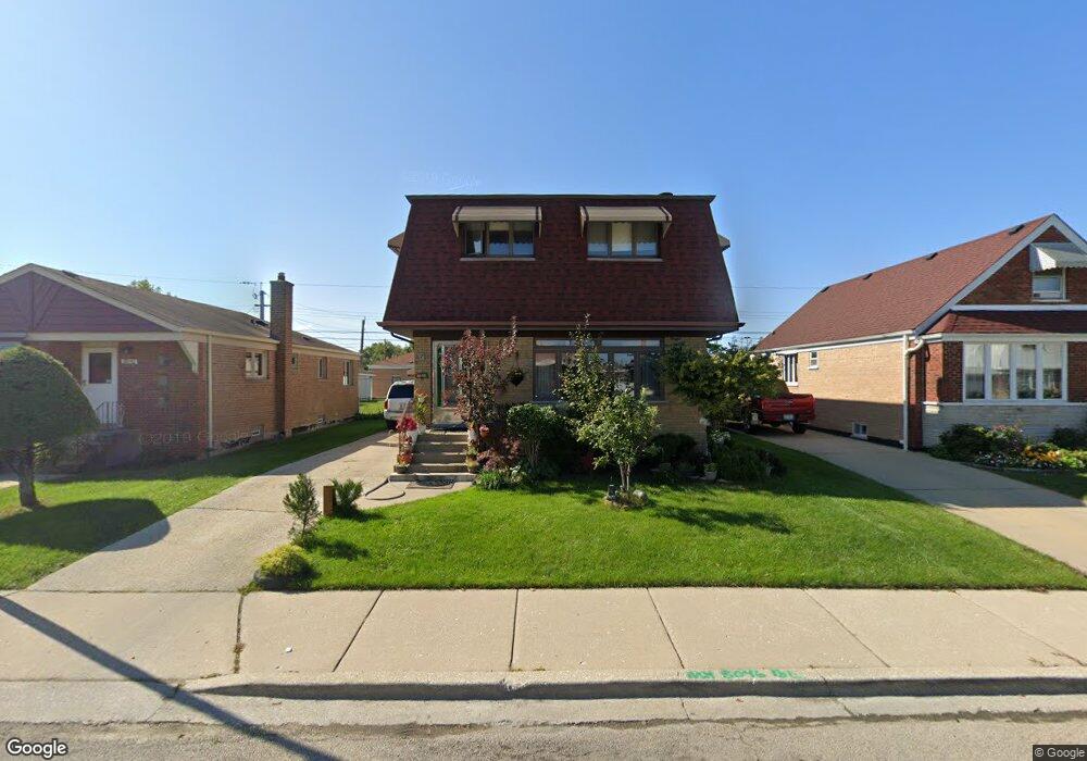
8046 S Kolin Ave Chicago, IL 60652
Scottsdale NeighborhoodEstimated Value: $295,130 - $389,000
2
Beds
1
Bath
1,531
Sq Ft
$225/Sq Ft
Est. Value
About This Home
This home is located at 8046 S Kolin Ave, Chicago, IL 60652 and is currently estimated at $344,783, approximately $225 per square foot. 8046 S Kolin Ave is a home located in Cook County with nearby schools including Stevenson Elementary School, Bogan Computer Technical High School, and St Bede-Venerable School.
Ownership History
Date
Name
Owned For
Owner Type
Purchase Details
Closed on
Nov 15, 2004
Sold by
Hughes Dennis W and Hughes Mary Lou
Bought by
Valdez Jose M
Current Estimated Value
Home Financials for this Owner
Home Financials are based on the most recent Mortgage that was taken out on this home.
Original Mortgage
$200,000
Outstanding Balance
$100,072
Interest Rate
5.82%
Mortgage Type
Unknown
Estimated Equity
$244,711
Create a Home Valuation Report for This Property
The Home Valuation Report is an in-depth analysis detailing your home's value as well as a comparison with similar homes in the area
Home Values in the Area
Average Home Value in this Area
Purchase History
| Date | Buyer | Sale Price | Title Company |
|---|---|---|---|
| Valdez Jose M | $274,000 | Cti |
Source: Public Records
Mortgage History
| Date | Status | Borrower | Loan Amount |
|---|---|---|---|
| Open | Valdez Jose M | $200,000 |
Source: Public Records
Tax History Compared to Growth
Tax History
| Year | Tax Paid | Tax Assessment Tax Assessment Total Assessment is a certain percentage of the fair market value that is determined by local assessors to be the total taxable value of land and additions on the property. | Land | Improvement |
|---|---|---|---|---|
| 2024 | $3,546 | $25,000 | $2,735 | $22,265 |
| 2023 | $3,436 | $20,001 | $3,419 | $16,582 |
| 2022 | $3,436 | $20,001 | $3,419 | $16,582 |
| 2021 | $3,378 | $19,999 | $3,418 | $16,581 |
| 2020 | $3,350 | $18,012 | $3,418 | $14,594 |
| 2019 | $3,406 | $20,239 | $3,418 | $16,821 |
| 2018 | $3,348 | $20,239 | $3,418 | $16,821 |
| 2017 | $2,962 | $17,008 | $2,962 | $14,046 |
| 2016 | $2,932 | $17,008 | $2,962 | $14,046 |
| 2015 | $2,661 | $17,008 | $2,962 | $14,046 |
| 2014 | $2,465 | $15,720 | $2,734 | $12,986 |
| 2013 | $2,405 | $15,720 | $2,734 | $12,986 |
Source: Public Records
Map
Nearby Homes
- 4327 W 81st St
- 4263 W 81st St
- 8100 S Kildare Ave
- 7964 S Tripp Ave
- 8069 S Kolmar Ave
- 7917 S Kostner Ave
- 8053 S Kenton Ave
- 4536 W 83rd St
- 7958 S Knox Ave
- 8001 S Kilpatrick Ave
- 8100 S Kilpatrick Ave
- 7817 S Kenton Ave
- 7746 S Kolmar Ave
- 7932 S Pulaski Rd Unit 301
- 4244 W 77th St Unit 102
- 4222 W 77th St Unit 202
- 4222 W 77th St Unit 204
- 3928 W 82nd Place
- 4350 W Ford City Dr Unit B1402
- 4605 W 84th Place
- 8050 S Kolin Ave
- 8042 S Kolin Ave
- 8038 S Kolin Ave
- 8054 S Kolin Ave
- 8101 S Kostner Ave
- 8105 S Kostner Ave
- 8043 S Kostner Ave
- 8034 S Kolin Ave
- 8039 S Kostner Ave
- 8111 S Kostner Ave
- 8058 S Kolin Ave
- 8047 S Kolin Ave
- 8123 S Kostner Ave
- 8043 S Kolin Ave
- 8051 S Kolin Ave
- 8035 S Kostner Ave
- 8030 S Kolin Ave
- 8039 S Kolin Ave
- 8059 S Kolin Ave
- 8127 S Kostner Ave