Estimated Value: $412,000 - $452,813
3
Beds
3
Baths
1,784
Sq Ft
$243/Sq Ft
Est. Value
About This Home
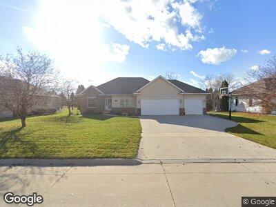
This home is located at 805 Fox Ridge Rd, Dike, IA 50624 and is currently estimated at $432,703, approximately $242 per square foot. 805 Fox Ridge Rd is a home with nearby schools including Dike Elementary School, New Hartford Elementary School, and Dike-New Hartford Junior High School.
Ownership History
Date
Name
Owned For
Owner Type
Purchase Details
Closed on
Aug 11, 2022
Sold by
Vanderlind Joseph P
Bought by
Petersen Dan M
Current Estimated Value
Purchase Details
Closed on
Oct 1, 2010
Sold by
Gibbons Kevin
Bought by
Vanderlind Joseph P and Vanderlind Stefanie L
Home Financials for this Owner
Home Financials are based on the most recent Mortgage that was taken out on this home.
Original Mortgage
$208,000
Interest Rate
4.36%
Mortgage Type
New Conventional
Create a Home Valuation Report for This Property
The Home Valuation Report is an in-depth analysis detailing your home's value as well as a comparison with similar homes in the area
Home Values in the Area
Average Home Value in this Area
Purchase History
| Date | Buyer | Sale Price | Title Company |
|---|---|---|---|
| Petersen Dan M | $428,000 | None Listed On Document | |
| Vanderlind Joseph P | $268,500 | -- |
Source: Public Records
Mortgage History
| Date | Status | Borrower | Loan Amount |
|---|---|---|---|
| Previous Owner | Vanderlind Joseph P | $35,000 | |
| Previous Owner | Vanderlind Joseph P | $178,701 | |
| Previous Owner | Vanderlind Joseph P | $25,000 | |
| Previous Owner | Vanderlind Joseph P | $197,000 | |
| Previous Owner | Vanderlind Joseph P | $208,000 | |
| Previous Owner | Gibbons Kevin L | $18,000 | |
| Previous Owner | Gibbons Kevin L | $215,000 |
Source: Public Records
Tax History Compared to Growth
Tax History
| Year | Tax Paid | Tax Assessment Tax Assessment Total Assessment is a certain percentage of the fair market value that is determined by local assessors to be the total taxable value of land and additions on the property. | Land | Improvement |
|---|---|---|---|---|
| 2024 | $6,484 | $397,210 | $48,450 | $348,760 |
| 2023 | $6,484 | $397,210 | $48,450 | $348,760 |
| 2022 | $5,656 | $320,120 | $45,900 | $274,220 |
| 2021 | $5,656 | $320,120 | $45,900 | $274,220 |
| 2020 | $5,396 | $302,320 | $45,900 | $256,420 |
| 2019 | $5,084 | $302,320 | $45,900 | $256,420 |
| 2018 | $4,774 | $285,170 | $45,900 | $239,270 |
| 2017 | $4,852 | $285,170 | $45,900 | $239,270 |
| 2016 | $4,852 | $278,900 | $0 | $0 |
| 2015 | $4,852 | $255,910 | $0 | $0 |
| 2014 | $4,546 | $255,910 | $0 | $0 |
Source: Public Records
Map
Nearby Homes
- 138 E Elder St
- 607 4th St Unit North unit
- 617 4th St Unit middle unit
- 4515 Grundy Rd
- 28708 215th St
- 0000 S Ave
- Field 3 S Ave
- Field 4 S Ave
- Field 2 S Ave
- 4718 Wild Horse Dr
- 4016 Wild Horse Dr
- 4010 Wild Horse Dr
- 4004 Wild Horse Dr
- 4007 Wild Horse Dr
- 4517 Granite Ridge Rd
- 5417 Fernwood Dr
- 5403 Fernwood Dr
- 5423 Fernwood Dr
- 4531 Sonoma Dr
- 4525 Sonoma Dr