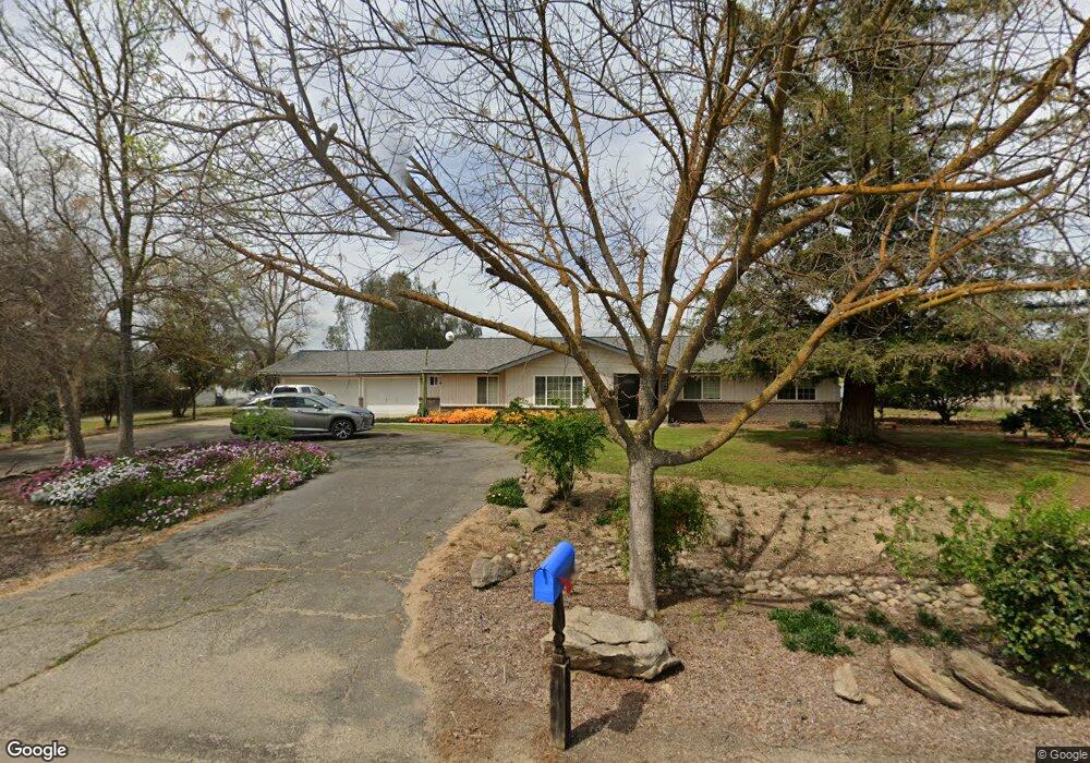
8052 E Paul Ave Clovis, CA 93619
Estimated Value: $685,000 - $813,323
4
Beds
3
Baths
2,294
Sq Ft
$333/Sq Ft
Est. Value
About This Home
This home is located at 8052 E Paul Ave, Clovis, CA 93619 and is currently estimated at $763,108, approximately $332 per square foot. 8052 E Paul Ave is a home located in Fresno County with nearby schools including Cedarwood Elementary School, Clark Intermediate School, and Clovis High School.
Ownership History
Date
Name
Owned For
Owner Type
Purchase Details
Closed on
Dec 16, 2010
Sold by
Wells Fargo Bank Na
Bought by
Vang Lue and Chang Che Nue
Current Estimated Value
Home Financials for this Owner
Home Financials are based on the most recent Mortgage that was taken out on this home.
Original Mortgage
$307,014
Outstanding Balance
$204,073
Interest Rate
4.34%
Mortgage Type
FHA
Estimated Equity
$559,035
Purchase Details
Closed on
Aug 11, 2010
Sold by
Jensen J M and Jensen Trudy
Bought by
Wells Fargo Bank Na
Create a Home Valuation Report for This Property
The Home Valuation Report is an in-depth analysis detailing your home's value as well as a comparison with similar homes in the area
Purchase History
| Date | Buyer | Sale Price | Title Company |
|---|---|---|---|
| Vang Lue | $315,000 | Chicago Title Company | |
| Vang Lue | -- | Chicago Title Company | |
| Wells Fargo Bank Na | $316,621 | Accommodation |
Source: Public Records
Mortgage History
| Date | Status | Borrower | Loan Amount |
|---|---|---|---|
| Open | Vang Lue | $307,014 | |
| Closed | Vang Lue | $307,014 |
Source: Public Records
Tax History
| Year | Tax Paid | Tax Assessment Tax Assessment Total Assessment is a certain percentage of the fair market value that is determined by local assessors to be the total taxable value of land and additions on the property. | Land | Improvement |
|---|---|---|---|---|
| 2025 | $4,936 | $403,557 | $192,170 | $211,387 |
| 2023 | $4,722 | $387,888 | $184,708 | $203,180 |
| 2022 | $4,602 | $380,284 | $181,087 | $199,197 |
| 2021 | $4,473 | $372,829 | $177,537 | $195,292 |
| 2020 | $4,454 | $369,007 | $175,717 | $193,290 |
| 2019 | $4,366 | $361,772 | $172,272 | $189,500 |
| 2018 | $4,270 | $354,680 | $168,895 | $185,785 |
| 2017 | $4,196 | $347,727 | $165,584 | $182,143 |
| 2016 | $4,046 | $340,910 | $162,338 | $178,572 |
| 2015 | $3,985 | $335,790 | $159,900 | $175,890 |
| 2014 | $3,913 | $329,213 | $156,768 | $172,445 |
Source: Public Records
Map
Nearby Homes
- 0 E Herndon Ave Unit WS25111634
- 603 Kaweah Ave
- 7272 N Traverse Ave
- 3255 Roberts Ave
- 637 Soledad Ave
- 1009 El Molino Ave
- 986 Encino Ave
- 3497 Lincoln Ave
- 3537 Lincoln Ave
- 637 Coventry Ave
- 1 Ave
- 3833 Hannah Ln
- 3267 Portals Ave
- 2578 Warner Ave
- 2963 Finchwood Ave
- 1043 La Jolla Ave
- 2691 Morris Ave
- 2535 Sierra Ave
- 1178 Blackwood Ave
- 2871 Wrenwood Ave
- 6618 N de Wolf Ave
- 8096 E Paul Ave
- 6572 N de Wolf Ave
- 6611 N de Wolf Ave
- 6698 N de Wolf Ave
- 6536 N de Wolf Ave
- 8115 E Paul Ave
- 8132 E Paul Ave
- 8168 E Paul Ave
- 8143 E Paul Ave
- 0 N de Wolf Ave
- 0 N de Wolf Ave
- 6555 N de Wolf Ave
- 6732 N de Wolf Ave
- 6502 N de Wolf Ave
- 6647 N de Wolf Ave
- 8196 E Paul Ave
- 6675 N de Wolf Ave
- 8181 E Paul Ave
- 6764 N de Wolf Ave
Your Personal Tour Guide
Ask me questions while you tour the home.