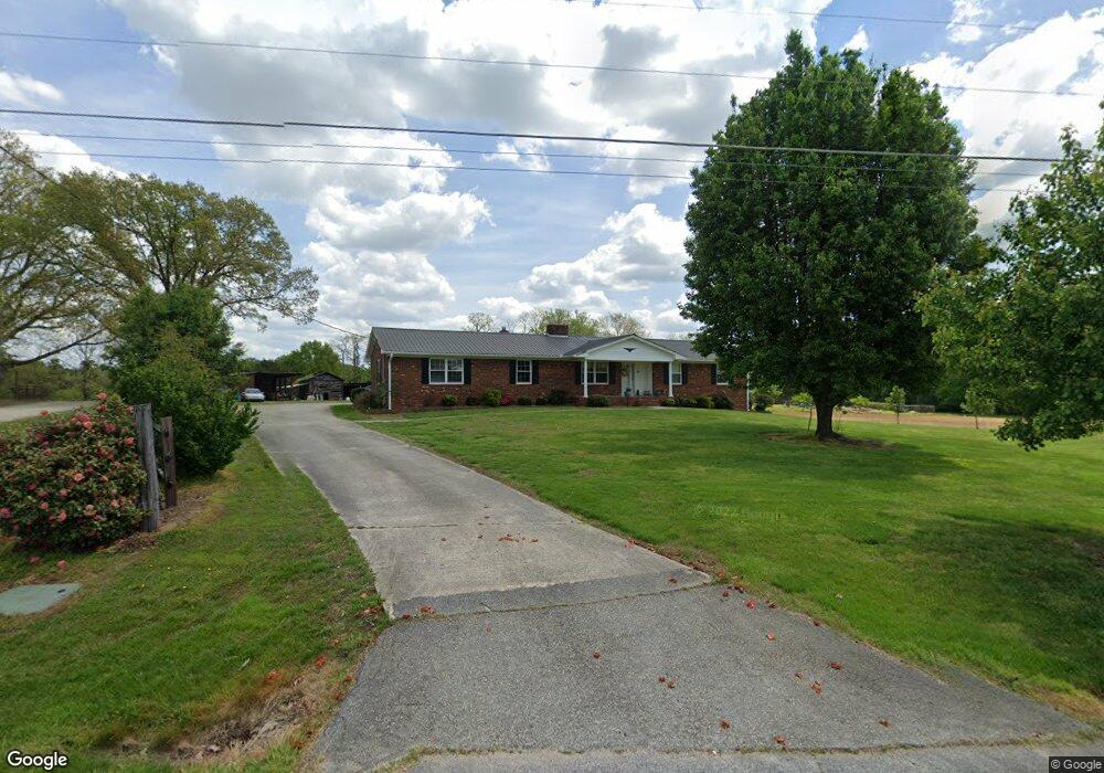
8059 National Service Rd Colfax, NC 27235
Colfax NeighborhoodEstimated Value: $260,000 - $285,000
3
Beds
2
Baths
1,724
Sq Ft
$159/Sq Ft
Est. Value
About This Home
This home is located at 8059 National Service Rd, Colfax, NC 27235 and is currently estimated at $274,652, approximately $159 per square foot. 8059 National Service Rd is a home located in Guilford County with nearby schools including Colfax Elementary School, Southwest Guilford Middle School, and Southwest Guilford High School.
Ownership History
Date
Name
Owned For
Owner Type
Purchase Details
Closed on
Jan 28, 2025
Sold by
Dillon Billy G and Dillon Jeanette C
Bought by
Soon Jon Nan
Current Estimated Value
Purchase Details
Closed on
Jan 22, 1999
Sold by
Dillon Linda S
Bought by
Dillon W Vernon
Create a Home Valuation Report for This Property
The Home Valuation Report is an in-depth analysis detailing your home's value as well as a comparison with similar homes in the area
Home Values in the Area
Average Home Value in this Area
Purchase History
| Date | Buyer | Sale Price | Title Company |
|---|---|---|---|
| Soon Jon Nan | -- | None Listed On Document | |
| Soon Jon Nan | -- | None Listed On Document | |
| Soon Jon Nan | $500,000 | None Listed On Document | |
| Soon Jon Nan | $500,000 | None Listed On Document | |
| Dillon W Vernon | -- | -- |
Source: Public Records
Tax History Compared to Growth
Tax History
| Year | Tax Paid | Tax Assessment Tax Assessment Total Assessment is a certain percentage of the fair market value that is determined by local assessors to be the total taxable value of land and additions on the property. | Land | Improvement |
|---|---|---|---|---|
| 2025 | $1,462 | $168,800 | $40,000 | $128,800 |
| 2024 | $1,462 | $168,800 | $40,000 | $128,800 |
| 2023 | $1,462 | $168,800 | $40,000 | $128,800 |
| 2022 | $1,434 | $168,800 | $40,000 | $128,800 |
| 2021 | $1,354 | $156,300 | $40,000 | $116,300 |
| 2020 | $1,354 | $156,300 | $40,000 | $116,300 |
| 2019 | $1,354 | $156,300 | $0 | $0 |
| 2018 | $1,347 | $156,300 | $0 | $0 |
| 2017 | $1,347 | $156,300 | $0 | $0 |
| 2016 | $1,330 | $149,300 | $0 | $0 |
| 2015 | $1,338 | $149,300 | $0 | $0 |
| 2014 | $1,353 | $149,300 | $0 | $0 |
Source: Public Records
Map
Nearby Homes
- 4603 Owls View Ct
- 4728 Sandy Camp Rd
- 2150 Alamar Dr
- 5012 Rosemont Ct
- 8774 Bame Rd
- 2156 Rosemont Dr
- 5707 Washburn Ln
- 1341 Grant Haven Ct
- 5705 Marblehead Dr
- 1593 Oakbluffs Dr
- 1569 Oakbluffs Dr
- Essex Plan at Northborough
- Franklin Plan at Northborough
- Kingston Plan at Northborough
- Greenwich Plan at Northborough
- Manhattan Plan at Northborough
- 1563 Oakbluffs Dr
- 1558 Oakbluffs Dr
- 1556 Oakbluffs Dr
- 1350 Grant Haven Ct
- 8051 National Service Rd
- 2525 Sandy Ridge Rd
- 2601 Sandy Ridge Rd
- 8047 National Service Rd
- 2520 Sandy Ridge Rd
- 2521 Sandy Ridge Rd
- 8046 National Service Rd
- 2611 Sandy Ridge Rd
- 8040 National Service Rd
- 2612 Sandy Ridge Rd
- 2519 Sandy Ridge Rd
- 2613 Sandy Ridge Rd
- 8201 Partridge Rd
- 3309 Dairy Point Dr
- 3313 Dairy Point Dr
- 3301 Dairy Point Dr
- 3317 Dairy Point Dr
- 3321 Dairy Point Dr
- 3325 Dairy Point Dr
- 3305 Dairy Point Dr