
807 N Thunder Ridge Cir Payson, AZ 85541
Estimated payment $664/month
About This Lot
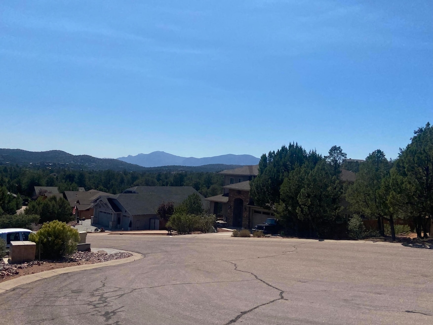
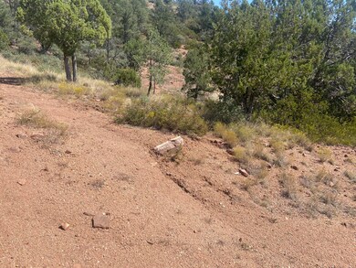
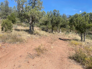
Great lot to build on with views of the mountains. Property is located in the desirable Woodhill subdivision.
Property Details
Property Type
- Land
Est. Annual Taxes
- $1,279
Lot Details
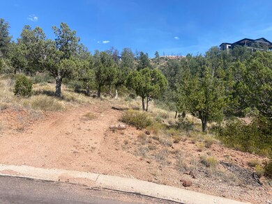
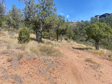
- 0.58 Acre Lot
- Lot Dimensions are 278.13x228.72x190.25
- Cul-De-Sac
- North Facing Home
- Corners Of The Lot Have Been Marked
- Sloped Lot
HOA Fees
- $4 Monthly HOA Fees
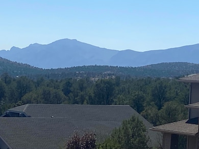
Property Views
- Panoramic
- Mountain
Listing and Financial Details
- Tax Lot 321
- Assessor Parcel Number 302-90-321
Map
Home Values in the Area
Average Home Value in this Area
Property History
| Date | Event | Price | List to Sale | Price per Sq Ft |
|---|---|---|---|---|
| 07/16/2025 07/16/25 | Price Changed | $105,000 | -3.7% | -- |
| 01/08/2025 01/08/25 | For Sale | $109,000 | 0.0% | -- |
| 12/26/2024 12/26/24 | Pending | -- | -- | -- |
| 11/08/2024 11/08/24 | Price Changed | $109,000 | -5.2% | -- |
| 10/03/2024 10/03/24 | For Sale | $115,000 | -- | -- |
Source: Central Arizona Association of REALTORS®
MLS Number: 91135
Disclaimer: Certain information contained herein is derived from information provided by parties other than Homes.com. All information provided is deemed reliable, but is not guaranteed to be accurate and should be independently verified.
![]() IDX information is provided exclusively for personal, non-commercial use, and may not be used for any purpose other than to identify prospective properties consumers may be interested in purchasing. Information is deemed reliable but not guaranteed.
IDX information is provided exclusively for personal, non-commercial use, and may not be used for any purpose other than to identify prospective properties consumers may be interested in purchasing. Information is deemed reliable but not guaranteed.
- 801 N Thunder Ridge Cir Unit 318
- 1003 W Falcon Lookout Ln
- 1003 W Falcon Lookout Ln Unit 11
- 802 N Oak Point
- 1000 W Falcon Lookout Ln
- 1200 W Airport Rd
- 1200 W Airport Rd Unit 96F-I
- 800 N Oak Point
- 908 W Sherwood Dr
- 817 N Blue Spruce Cir Unit 284
- 819 N Blue Spruce Cir
- 1050 W Airport Rd
- 1050 W Airport Rd Unit 10
- 610 N Wilderness Trail
- 606 N Wilderness Trail
- 408 N Rim Ranch Point
- 830 W Sherwood Dr
- 912 W Wilderness Trail
- 1006 W Rock Springs Cir
- 603 N Blue Spruce Rd
- 1114 N Bavarian Way
- 605 N Spur Dr
- 1106 N Beeline Hwy Unit A
- 100 E Glade Ln
- 938 W Madera Ln
- 217 W Estate Ln
- 807 S Beeline Hwy Unit A
- 117 E Main St
- 906 N Autumn Sage Ct
- 2007 E Rainbow Trail
- 804 N Grapevine Dr
- 805 N Grapevine Cir
- 2609 E Pine Island Ln
- 8871 W Wild Turkey Ln
- 1042 S Hunter Creek Dr Unit 1
- 1042 S Hunter Creek Dr Unit 2
