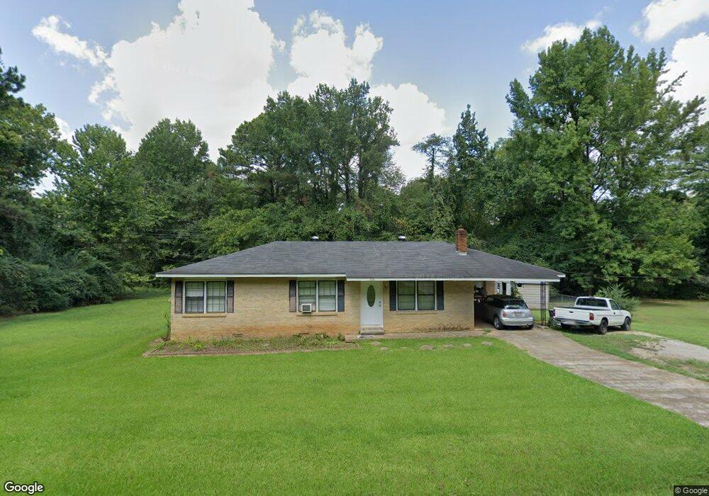
808 Shady Grove Rd New Albany, MS 38652
Estimated Value: $99,755 - $220,000
--
Bed
1
Bath
1,117
Sq Ft
$139/Sq Ft
Est. Value
About This Home
This home is located at 808 Shady Grove Rd, New Albany, MS 38652 and is currently estimated at $155,439, approximately $139 per square foot. 808 Shady Grove Rd is a home located in Union County with nearby schools including New Albany Elementary School, New Albany/S.Tippah/Union County Alternative School, and New Albany Middle School.
Ownership History
Date
Name
Owned For
Owner Type
Purchase Details
Closed on
Mar 7, 2020
Sold by
Estrada Walter and Estrada Aldys
Bought by
Rodriguez Alejandro Perez and Castillo Jara Ma
Current Estimated Value
Purchase Details
Closed on
Mar 22, 2018
Sold by
Estrada Aldys
Bought by
Estrada Walter and Estrada Tristan
Home Financials for this Owner
Home Financials are based on the most recent Mortgage that was taken out on this home.
Original Mortgage
$33,250
Interest Rate
4.43%
Mortgage Type
New Conventional
Purchase Details
Closed on
Jun 5, 2006
Sold by
Warren Cynthia and Short Warren
Bought by
Estrada Aldys
Create a Home Valuation Report for This Property
The Home Valuation Report is an in-depth analysis detailing your home's value as well as a comparison with similar homes in the area
Home Values in the Area
Average Home Value in this Area
Purchase History
| Date | Buyer | Sale Price | Title Company |
|---|---|---|---|
| Rodriguez Alejandro Perez | -- | None Available | |
| Estrada Walter | -- | None Available | |
| Estrada Aldys | -- | -- |
Source: Public Records
Mortgage History
| Date | Status | Borrower | Loan Amount |
|---|---|---|---|
| Previous Owner | Estrada Walter | $33,250 |
Source: Public Records
Tax History Compared to Growth
Tax History
| Year | Tax Paid | Tax Assessment Tax Assessment Total Assessment is a certain percentage of the fair market value that is determined by local assessors to be the total taxable value of land and additions on the property. | Land | Improvement |
|---|---|---|---|---|
| 2024 | $569 | $5,567 | $0 | $0 |
| 2023 | $571 | $5,567 | $0 | $0 |
| 2022 | $473 | $4,576 | $0 | $0 |
| 2021 | $961 | $6,857 | $0 | $0 |
| 2020 | $454 | $4,571 | $0 | $0 |
| 2019 | $961 | $6,857 | $0 | $0 |
| 2018 | $434 | $4,339 | $0 | $0 |
| 2017 | $400 | $4,218 | $0 | $0 |
| 2016 | $381 | $4,218 | $0 | $0 |
| 2015 | -- | $4,218 | $0 | $0 |
| 2014 | -- | $4,008 | $0 | $0 |
Source: Public Records
Map
Nearby Homes
- 0 Coulter Dr Denton Rd Unit 24-3689
- 816 W Bankhead St
- 202 Robbins Dr
- 0 Highway 30 W
- 0 Coulter Cove + - 52 Ac
- Lot 102 Greenhaven Dr
- Lot 92 Greenhaven Dr
- Lot 100 Greenhaven Dr
- Lot 84 Greenhaven Dr
- Lot 78 Greenhaven Dr
- Lot 80 Greenhaven Dr
- Lot 76 Greenhaven Dr
- Lot 75 Greenhaven Dr
- 0 Lot 4 Sam T Barkley Dr
- 0 Lot 3 Sam T Barkley Dr
- 0 Lot 2 Sam Tbarkley Dr Unit 23-1317
- 0 Lot 5 Sam T Barkley Dr
- 0 Lot 6 Sam T Barkley Dr
- 931 Reed St
- 0 Lot 8 Sam T Barkley Dr
- 1220 Shady Grove Rd
- 1248 Shady Grove Rd
- 806 Shady Grove Rd
- 0 Shady Grove (Lot 5 Colonial) Rd Unit 22-3162
- 1095 Shady Grove Rd
- 812 Moss Hill Dr
- 809 Shady Grove Rd
- 807 Shady Grove Rd
- 807 Shady Grove Rd
- 814 Moss Hill Dr
- 804 Shady Grove Rd
- 816 Moss Hill Dr
- 810 N Hilldale Dr
- 303 Cole Dr
- 309 Cole Dr
- 309 Cole Dr
- 816 Moss Hill Dr
- 303 Cole Dr
- 305 Cole Dr
- 900 Moss Hill Dr