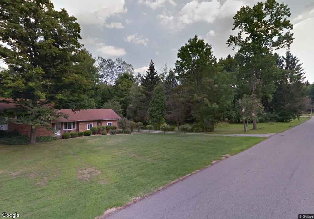
8081 Paulin Dr Youngstown, OH 44514
Estimated Value: $133,250 - $182,000
2
Beds
1
Bath
966
Sq Ft
$170/Sq Ft
Est. Value
About This Home
This home is located at 8081 Paulin Dr, Youngstown, OH 44514 and is currently estimated at $164,563, approximately $170 per square foot. 8081 Paulin Dr is a home located in Mahoning County with nearby schools including Robinwood Lane Elementary School, Boardman Glenwood Junior High School, and Boardman High School.
Ownership History
Date
Name
Owned For
Owner Type
Purchase Details
Closed on
Aug 29, 2003
Sold by
Sturgeon John E
Bought by
Monteleone Kathleen E
Current Estimated Value
Home Financials for this Owner
Home Financials are based on the most recent Mortgage that was taken out on this home.
Original Mortgage
$70,125
Outstanding Balance
$31,926
Interest Rate
5.97%
Mortgage Type
Purchase Money Mortgage
Estimated Equity
$132,637
Purchase Details
Closed on
Oct 4, 1999
Sold by
Callahan Joseph J
Bought by
Sturgeon John E
Home Financials for this Owner
Home Financials are based on the most recent Mortgage that was taken out on this home.
Original Mortgage
$66,800
Interest Rate
7.83%
Purchase Details
Closed on
Apr 14, 1994
Bought by
Callahan Joseph J
Create a Home Valuation Report for This Property
The Home Valuation Report is an in-depth analysis detailing your home's value as well as a comparison with similar homes in the area
Home Values in the Area
Average Home Value in this Area
Purchase History
| Date | Buyer | Sale Price | Title Company |
|---|---|---|---|
| Monteleone Kathleen E | $82,500 | -- | |
| Sturgeon John E | $83,500 | -- | |
| Callahan Joseph J | $61,000 | -- |
Source: Public Records
Mortgage History
| Date | Status | Borrower | Loan Amount |
|---|---|---|---|
| Open | Monteleone Kathleen E | $70,125 | |
| Previous Owner | Sturgeon John E | $66,800 | |
| Closed | Monteleone Kathleen E | $8,250 |
Source: Public Records
Tax History Compared to Growth
Tax History
| Year | Tax Paid | Tax Assessment Tax Assessment Total Assessment is a certain percentage of the fair market value that is determined by local assessors to be the total taxable value of land and additions on the property. | Land | Improvement |
|---|---|---|---|---|
| 2024 | $1,461 | $28,430 | $15,890 | $12,540 |
| 2023 | $1,442 | $28,430 | $15,890 | $12,540 |
| 2022 | $1,696 | $25,710 | $15,890 | $9,820 |
| 2021 | $1,697 | $25,710 | $15,890 | $9,820 |
| 2020 | $1,706 | $25,710 | $15,890 | $9,820 |
| 2019 | $1,837 | $24,580 | $15,890 | $8,690 |
| 2018 | $1,560 | $24,580 | $15,890 | $8,690 |
| 2017 | $1,649 | $24,580 | $15,890 | $8,690 |
| 2016 | $1,740 | $27,210 | $15,890 | $11,320 |
| 2015 | $1,705 | $27,210 | $15,890 | $11,320 |
| 2014 | $1,710 | $27,210 | $15,890 | $11,320 |
| 2013 | $1,689 | $27,210 | $15,890 | $11,320 |
Source: Public Records
Map
Nearby Homes
- 8010 Sigle Ln
- 8129 South Ave
- 806 Woodfield Ct Unit B
- 8484 Ivy Hill Dr
- 7680 Paulin Dr
- 873 Auburn Hills Dr Unit 3
- 7354 Yellow Creek Dr
- 712 Mcclurg Rd
- 7733 Crimson Trail Unit B
- Lot #1 Heritage Trail
- 8518 Ivy Hill Dr
- 8082 N Lima Rd
- 7708 Buchanan Dr
- 8531 Ivy Hill Dr
- 8187 N Lima Rd
- 0 Eaton Unit 5149277
- 7108 Indian Trail
- 820 Southwestern Run
- 1780 Woodland Cir
- 681 Saddlebrook Dr
- 8071 Paulin Dr
- 1480 Walker Mill Rd
- 8057 Paulin Dr
- 1474 Walker Mill Rd
- 8080 Paulin Dr
- 8070 Paulin Dr
- 0 Walker Mill Rd Unit 3666051
- 8060 Paulin Dr
- 1464 Walker Mill Rd
- 1552 Walker Mill Rd
- 1448 Walker Mill Rd
- 8047 Paulin Dr
- 1558 Walker Mill Rd
- 1551 Walker Mill Rd
- 8046 Paulin Dr
- 8041 Paulin Dr
- 1557 Walker Mill Rd
- 8077 Sigle Ln
- 8069 Sigle Ln
- 8087 Sigle Ln