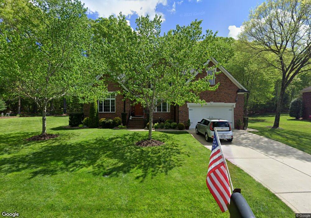
8097 Malibu Pointe Ln Denver, NC 28037
Estimated Value: $708,000 - $899,000
3
Beds
3
Baths
2,970
Sq Ft
$270/Sq Ft
Est. Value
About This Home
This home is located at 8097 Malibu Pointe Ln, Denver, NC 28037 and is currently estimated at $802,241, approximately $270 per square foot. 8097 Malibu Pointe Ln is a home located in Lincoln County with nearby schools including St. James Elementary School, East Lincoln Middle School, and East Lincoln High School.
Ownership History
Date
Name
Owned For
Owner Type
Purchase Details
Closed on
Sep 15, 2006
Sold by
Long Anthony D and Long Allison F
Bought by
Cieslinski Daniel and Cieslinski Heather R
Current Estimated Value
Home Financials for this Owner
Home Financials are based on the most recent Mortgage that was taken out on this home.
Original Mortgage
$292,000
Outstanding Balance
$174,496
Interest Rate
6.58%
Mortgage Type
New Conventional
Estimated Equity
$627,745
Purchase Details
Closed on
Apr 5, 2005
Sold by
Dellinger Gary G and Dellinger Viriginia Cherry
Bought by
Long Anthony D and Long Allison F
Home Financials for this Owner
Home Financials are based on the most recent Mortgage that was taken out on this home.
Original Mortgage
$262,200
Interest Rate
5.62%
Mortgage Type
Adjustable Rate Mortgage/ARM
Create a Home Valuation Report for This Property
The Home Valuation Report is an in-depth analysis detailing your home's value as well as a comparison with similar homes in the area
Home Values in the Area
Average Home Value in this Area
Purchase History
| Date | Buyer | Sale Price | Title Company |
|---|---|---|---|
| Cieslinski Daniel | $365,000 | None Available | |
| Long Anthony D | $46,000 | None Available |
Source: Public Records
Mortgage History
| Date | Status | Borrower | Loan Amount |
|---|---|---|---|
| Open | Cieslinski Daniel | $292,000 | |
| Previous Owner | Long Anthony D | $262,200 |
Source: Public Records
Tax History Compared to Growth
Tax History
| Year | Tax Paid | Tax Assessment Tax Assessment Total Assessment is a certain percentage of the fair market value that is determined by local assessors to be the total taxable value of land and additions on the property. | Land | Improvement |
|---|---|---|---|---|
| 2025 | $4,355 | $697,781 | $75,734 | $622,047 |
| 2024 | $4,316 | $697,781 | $75,734 | $622,047 |
| 2023 | $4,316 | $697,781 | $75,734 | $622,047 |
| 2022 | $3,410 | $442,526 | $60,316 | $382,210 |
| 2021 | $3,407 | $442,526 | $60,316 | $382,210 |
| 2020 | $3,084 | $442,526 | $60,316 | $382,210 |
| 2019 | $3,084 | $442,526 | $60,316 | $382,210 |
| 2018 | $2,744 | $377,501 | $56,148 | $321,353 |
| 2017 | $2,643 | $377,501 | $56,148 | $321,353 |
| 2016 | $2,631 | $377,501 | $56,148 | $321,353 |
| 2015 | $2,781 | $377,501 | $56,148 | $321,353 |
| 2014 | $2,685 | $379,427 | $61,988 | $317,439 |
Source: Public Records
Map
Nearby Homes
- 8150 Malibu Pointe Ln
- 1925 Cameron Heights Cir
- 1751 Knights Dr
- 8260 Graham Rd
- 1959 Rock Springs Cir
- 7958 Unity Church Rd
- 0 Rufus Rd
- 8194 Mallard Rd
- 6273 Ashton Park Dr
- 6242 Ashton Park Dr
- St. Andrews Plan at Wildbrook
- Pinehurst Plan at Wildbrook
- Muirfield Plan at Wildbrook
- Augusta Plan at Wildbrook
- Bethpage Plan at Wildbrook
- 4178 Millstream Rd
- 11 Serenity Place
- 4168 Millstream Rd
- 8188 Normandy Rd
- 7184 Indigo Way
- 8115 Malibu Pointe Ln
- 8098 Malibu Pointe Ln
- 8106 Malibu Pointe Ln
- 8088 Malibu Pointe Ln
- 8118 Malibu Pointe Ln
- 8131 Malibu Pointe Ln
- 8074 Malibu Pointe Ln
- 8128 Malibu Pointe Ln
- 8064 Malibu Pointe Ln
- 8136 Malibu Pointe Ln
- 8314 Graham Rd
- 8147 Malibu Pointe Ln
- 8144 Malibu Pointe Ln
- 1899 Cameron Heights Cir
- 1887 Cameron Heights Cir
- 1907 Cameron Heights Cir
- 1877 Cameron Heights Cir
- 1917 Cameron Heights Cir
- 8169 Malibu Pointe Ln
- 1865 Cameron Heights Cir