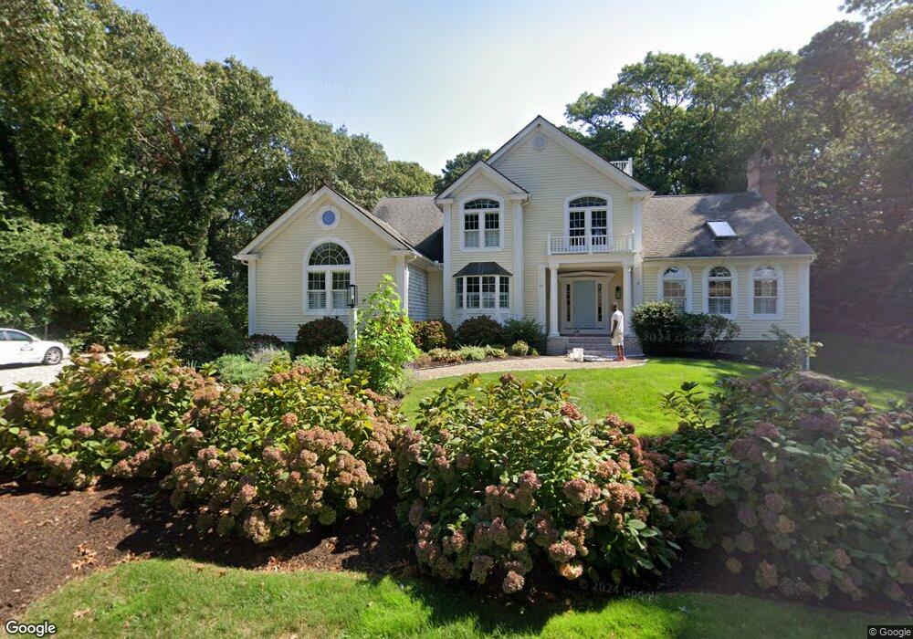
81 Clam Shell Point Ln Barnstable, MA 02635
Cotuit NeighborhoodEstimated Value: $1,621,078 - $1,986,000
3
Beds
4
Baths
3,486
Sq Ft
$531/Sq Ft
Est. Value
About This Home
This home is located at 81 Clam Shell Point Ln, Barnstable, MA 02635 and is currently estimated at $1,849,520, approximately $530 per square foot. 81 Clam Shell Point Ln is a home located in Barnstable County with nearby schools including West Villages Elementary School, Barnstable United Elementary School, and Barnstable Intermediate School.
Ownership History
Date
Name
Owned For
Owner Type
Purchase Details
Closed on
Mar 31, 2025
Sold by
Leonard Elizabeth M
Bought by
Elizabeth M Leonard T M and Elizabeth Leonard
Current Estimated Value
Purchase Details
Closed on
Apr 8, 2022
Sold by
81 Clamshell Pt Lane Rt and Dergarabedian
Bought by
Leonard Elizabeth M
Purchase Details
Closed on
May 26, 2009
Sold by
Dergarabedian Isabelle
Bought by
81 Clamshell Point Ln and Dergarabedian
Create a Home Valuation Report for This Property
The Home Valuation Report is an in-depth analysis detailing your home's value as well as a comparison with similar homes in the area
Home Values in the Area
Average Home Value in this Area
Purchase History
| Date | Buyer | Sale Price | Title Company |
|---|---|---|---|
| Elizabeth M Leonard T M | -- | None Available | |
| Elizabeth M Leonard T M | -- | None Available | |
| Leonard Elizabeth M | $1,500,000 | None Available | |
| Leonard Elizabeth M | $1,500,000 | None Available | |
| 81 Clamshell Point Ln | -- | -- | |
| 81 Clamshell Point Ln | -- | -- |
Source: Public Records
Tax History
| Year | Tax Paid | Tax Assessment Tax Assessment Total Assessment is a certain percentage of the fair market value that is determined by local assessors to be the total taxable value of land and additions on the property. | Land | Improvement |
|---|---|---|---|---|
| 2025 | $12,153 | $1,455,500 | $263,800 | $1,191,700 |
| 2024 | $10,335 | $1,311,500 | $263,800 | $1,047,700 |
| 2023 | $9,652 | $1,153,200 | $261,000 | $892,200 |
| 2022 | $9,331 | $902,400 | $167,200 | $735,200 |
| 2021 | $9,391 | $850,600 | $177,700 | $672,900 |
| 2020 | $9,442 | $806,300 | $188,100 | $618,200 |
| 2019 | $9,435 | $794,200 | $198,600 | $595,600 |
| 2018 | $3,608 | $714,300 | $198,000 | $516,300 |
| 2017 | $8,271 | $700,900 | $203,500 | $497,400 |
| 2016 | $8,088 | $702,700 | $205,300 | $497,400 |
| 2015 | $7,972 | $692,000 | $200,400 | $491,600 |
Source: Public Records
Map
Nearby Homes
- 85 Clamshell Cove Rd
- 239 Clamshell Cove Rd
- 12 Tracey Rd
- 640 Poponessett Rd
- 640 Poponessett Rd
- 11 Teal Cir
- 311 Waquoit Rd
- 20 Mutiny Way
- 35 Spinnaker Dr W
- 61 Shoestring Bay Rd
- 52 Old Dock Ln
- 6 Cedar St
- 6 Cedar St
- 34 Rainbow Ln
- 1412 Main St
- 25 Rainbow Ln
- 444 Vineyard Rd
- 188 Ocean View Ave
- 30 Wings Ln
- 1081 Main St
- 81 Clamshell Point Ln
- 100 Clamshell Cove Rd
- 98 Clamshell Cove Rd
- 110 Clamshell Cove Rd
- 61 Clamshell Point Ln
- 86 Clamshell Point Ln
- 72 Clam Shell Point Ln
- 72 Clamshell Point Ln
- 37 Clamshell Point Ln
- 100 Clamshell Point Ln
- 60 Clamshell Point Ln
- 17 Clam Shell Point Ln
- 101 Clamshell Cove Rd
- 17 Clamshell Point Ln
- 82 Clamshell Cove Rd
- 115 Clamshell Cove Rd
- 50 Clam Shell Point Ln
- 50 Clamshell Point Ln
- 131 Clamshell Cove Rd
- 130 Clamshell Cove Rd
Your Personal Tour Guide
Ask me questions while you tour the home.