Estimated Value: $445,000 - $485,000
3
Beds
2
Baths
1,722
Sq Ft
$270/Sq Ft
Est. Value
About This Home
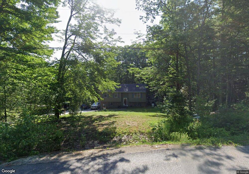
This home is located at 81 Guys Ln, Weare, NH 03281 and is currently estimated at $464,623, approximately $269 per square foot. 81 Guys Ln is a home with nearby schools including Center Woods Elementary School, Weare Middle School, and John Stark Regional High School.
Ownership History
Date
Name
Owned For
Owner Type
Purchase Details
Closed on
Feb 22, 2023
Sold by
Rheaume Gerald R and Rheaume Theresa Y
Bought by
Rheaume Ft
Current Estimated Value
Purchase Details
Closed on
Nov 2, 1999
Sold by
Geisler Charles W and Geisler Carol A
Bought by
Rheaume Gerald R
Purchase Details
Closed on
Aug 3, 1998
Sold by
Talbot Douglas R and Talbot Christina G
Bought by
Geisler Charles W and Geisler Carol A
Create a Home Valuation Report for This Property
The Home Valuation Report is an in-depth analysis detailing your home's value as well as a comparison with similar homes in the area
Home Values in the Area
Average Home Value in this Area
Purchase History
| Date | Buyer | Sale Price | Title Company |
|---|---|---|---|
| Rheaume Ft | -- | None Available | |
| Rheaume Gerald R | $114,000 | -- | |
| Geisler Charles W | $112,500 | -- |
Source: Public Records
Mortgage History
| Date | Status | Borrower | Loan Amount |
|---|---|---|---|
| Previous Owner | Geisler Charles W | $33,922 | |
| Previous Owner | Geisler Charles W | $155,914 | |
| Previous Owner | Geisler Charles W | $100,000 |
Source: Public Records
Tax History Compared to Growth
Tax History
| Year | Tax Paid | Tax Assessment Tax Assessment Total Assessment is a certain percentage of the fair market value that is determined by local assessors to be the total taxable value of land and additions on the property. | Land | Improvement |
|---|---|---|---|---|
| 2024 | $6,129 | $300,600 | $119,300 | $181,300 |
| 2023 | $5,663 | $300,600 | $119,300 | $181,300 |
| 2022 | $5,230 | $300,600 | $119,300 | $181,300 |
| 2021 | $5,086 | $295,700 | $119,300 | $176,400 |
| 2020 | $4,936 | $206,100 | $84,600 | $121,500 |
| 2019 | $4,801 | $202,500 | $84,600 | $117,900 |
| 2018 | $4,664 | $202,500 | $84,600 | $117,900 |
| 2016 | $4,530 | $202,500 | $84,600 | $117,900 |
| 2015 | $4,262 | $190,200 | $84,600 | $105,600 |
| 2014 | $4,224 | $190,200 | $84,600 | $105,600 |
| 2013 | $4,137 | $190,200 | $84,600 | $105,600 |
Source: Public Records
Map
Nearby Homes
- 73 Guys Ln
- 31 Chuck St S
- 22 Greenwood Rd
- 174 S Stark Hwy Unit 13
- 155 Clough Park Rd
- 62 Hilbren Rd
- 42 Twin Bridge Rd
- 103 Renshaw Rd
- 77 Gould Rd
- 5 Karen Rd
- 3 Stephanie Rd
- 849 River Rd
- 924 River Rd
- 33 Orchard St
- 221 Dustin Tavern Rd
- 22 Fairway Dr
- 18 Country Club Dr
- 88 Saunders Rd
- 1097 River Rd
- 116 Martin Rd