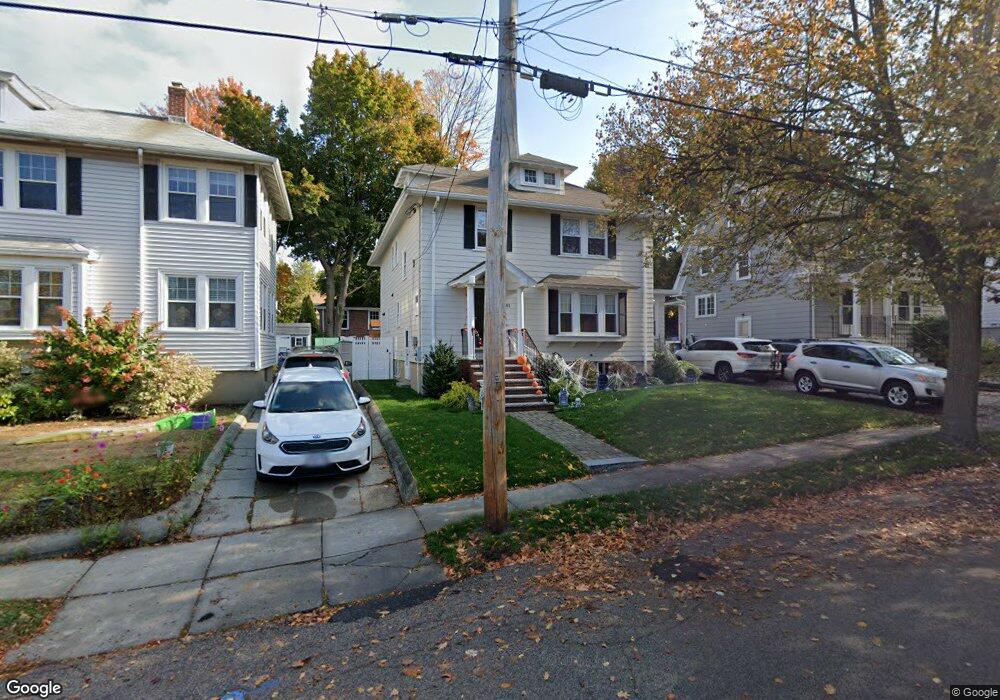
81 Hammond Rd Belmont, MA 02478
Cushing Square NeighborhoodEstimated Value: $1,509,000 - $1,705,662
3
Beds
2
Baths
1,544
Sq Ft
$1,051/Sq Ft
Est. Value
About This Home
This home is located at 81 Hammond Rd, Belmont, MA 02478 and is currently estimated at $1,622,666, approximately $1,050 per square foot. 81 Hammond Rd is a home located in Middlesex County with nearby schools including Roger Wellington Elementary School, Winthrop L Chenery Middle School, and Belmont High School.
Ownership History
Date
Name
Owned For
Owner Type
Purchase Details
Closed on
Jun 8, 2009
Sold by
Ghiozzi Kevin M and Ghiozzi Diane M
Bought by
Cardello Nicholas J and Cardello Kristina A
Current Estimated Value
Home Financials for this Owner
Home Financials are based on the most recent Mortgage that was taken out on this home.
Original Mortgage
$463,200
Outstanding Balance
$293,602
Interest Rate
4.83%
Mortgage Type
Purchase Money Mortgage
Estimated Equity
$1,329,064
Purchase Details
Closed on
Apr 14, 2004
Sold by
Kenney Edward L and Kenney Lucille A
Bought by
Ghiozzi Diane M and Ghiozzi Kevin M
Home Financials for this Owner
Home Financials are based on the most recent Mortgage that was taken out on this home.
Original Mortgage
$428,000
Interest Rate
5.58%
Mortgage Type
Purchase Money Mortgage
Create a Home Valuation Report for This Property
The Home Valuation Report is an in-depth analysis detailing your home's value as well as a comparison with similar homes in the area
Home Values in the Area
Average Home Value in this Area
Purchase History
| Date | Buyer | Sale Price | Title Company |
|---|---|---|---|
| Cardello Nicholas J | $579,000 | -- | |
| Ghiozzi Diane M | $535,000 | -- |
Source: Public Records
Mortgage History
| Date | Status | Borrower | Loan Amount |
|---|---|---|---|
| Open | Cardello Nicholas J | $463,200 | |
| Previous Owner | Ghiozzi Diane M | $428,000 |
Source: Public Records
Tax History Compared to Growth
Tax History
| Year | Tax Paid | Tax Assessment Tax Assessment Total Assessment is a certain percentage of the fair market value that is determined by local assessors to be the total taxable value of land and additions on the property. | Land | Improvement |
|---|---|---|---|---|
| 2025 | $18,224 | $1,600,000 | $784,000 | $816,000 |
| 2024 | $15,090 | $1,429,000 | $791,000 | $638,000 |
| 2023 | $15,376 | $1,368,000 | $790,000 | $578,000 |
| 2022 | $14,600 | $1,263,000 | $723,000 | $540,000 |
| 2021 | $5,690 | $1,281,000 | $835,000 | $446,000 |
| 2020 | $12,562 | $1,142,000 | $705,000 | $437,000 |
| 2019 | $12,849 | $1,101,000 | $695,000 | $406,000 |
| 2018 | $9,647 | $794,000 | $561,000 | $233,000 |
| 2017 | $9,492 | $748,000 | $515,000 | $233,000 |
| 2016 | $9,370 | $746,000 | $515,000 | $231,000 |
| 2015 | $8,656 | $671,000 | $440,000 | $231,000 |
Source: Public Records
Map
Nearby Homes
- 50 Hammond Rd
- 333 Common St
- 59-61 Gilbert Rd
- 88 Palfrey Rd Unit 88
- 11 Payson Rd Unit 11
- 125 Trapelo Rd Unit 23
- 125 Trapelo Rd Unit 21
- 263 Common St
- 2 Bartlett Ave Unit 1
- 38-40 Wiley Rd
- 68 Payson Rd
- 239 Beech St
- 52-54 Vincent Ave
- 532 Belmont St
- 30 Merrill Rd
- 18 Wilson Ave Unit 2
- 99 Beech St
- 46 Hall Ave Unit 2
- 88 Bartlett Ave
- 160 Waverley St
- 85 Hammond Rd
- 77 Hammond Rd
- 89 Hammond Rd
- 73 Hammond Rd
- 34 Bay State Rd
- 40 Bay State Rd
- 28 Bay State Rd
- 80 Hammond Rd
- 95 Hammond Rd
- 69 Hammond Rd
- 22 Bay State Rd
- 56 Gorham Rd
- 46 Bay State Rd
- 99 Hammond Rd
- 99 Hammond Rd Unit 1
- 64 Hammond Rd
- 65 Hammond Rd
- 52 Gorham Rd
- 101 Hammond Rd Unit 103
- 16 Bay State Rd