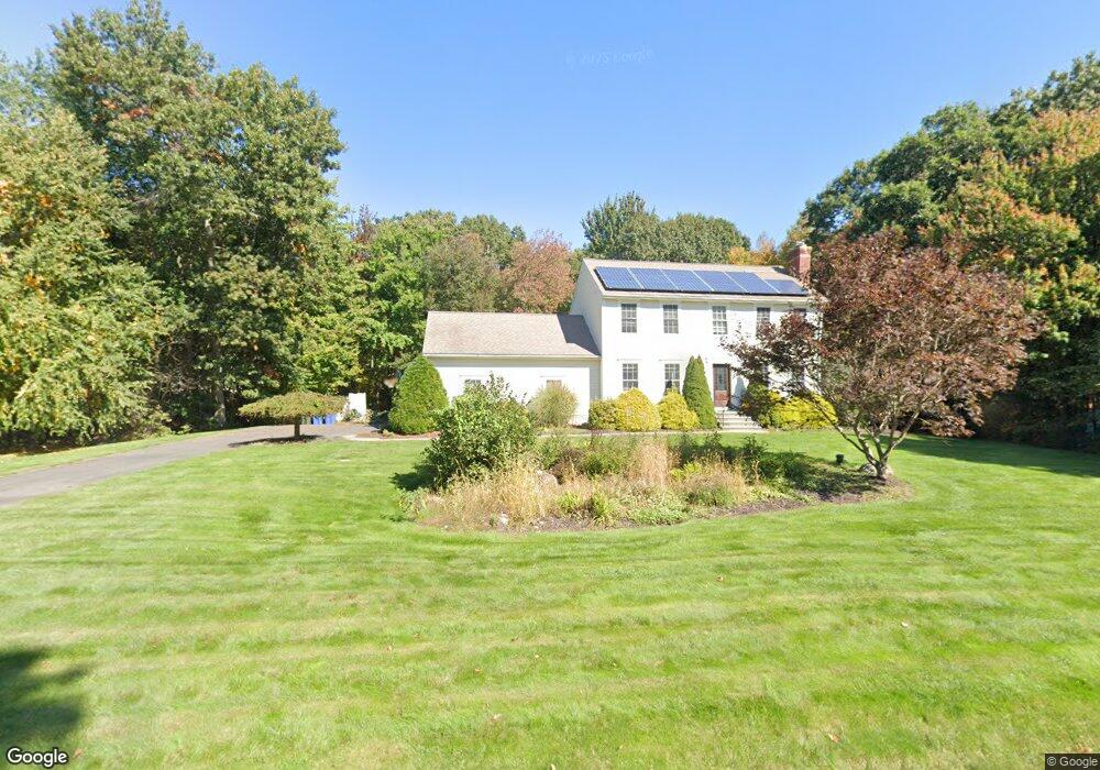
81 Mt Laurel Dr Tolland, CT 06084
Estimated Value: $558,023 - $606,000
3
Beds
3
Baths
2,006
Sq Ft
$292/Sq Ft
Est. Value
About This Home
This home is located at 81 Mt Laurel Dr, Tolland, CT 06084 and is currently estimated at $585,006, approximately $291 per square foot. 81 Mt Laurel Dr is a home located in Tolland County with nearby schools including Birch Grove Primary School, Tolland Intermediate School, and Tolland Middle School.
Ownership History
Date
Name
Owned For
Owner Type
Purchase Details
Closed on
Jul 20, 2022
Sold by
Latour Rebecca
Bought by
Latour Robert
Current Estimated Value
Home Financials for this Owner
Home Financials are based on the most recent Mortgage that was taken out on this home.
Original Mortgage
$355,000
Outstanding Balance
$339,752
Interest Rate
5.81%
Mortgage Type
Stand Alone Refi Refinance Of Original Loan
Estimated Equity
$245,254
Purchase Details
Closed on
Jun 6, 2017
Sold by
Dooley George K and Dooley Linda E
Bought by
Latour Rebecca and Latour Robert
Home Financials for this Owner
Home Financials are based on the most recent Mortgage that was taken out on this home.
Original Mortgage
$318,250
Interest Rate
3.97%
Mortgage Type
Purchase Money Mortgage
Purchase Details
Closed on
Jul 27, 2000
Sold by
Clm Const Llc
Bought by
Dooley George and Dooley Linda
Create a Home Valuation Report for This Property
The Home Valuation Report is an in-depth analysis detailing your home's value as well as a comparison with similar homes in the area
Home Values in the Area
Average Home Value in this Area
Purchase History
| Date | Buyer | Sale Price | Title Company |
|---|---|---|---|
| Latour Robert | -- | None Available | |
| Latour Robert | -- | None Available | |
| Latour Robert | -- | None Available | |
| Latour Rebecca | $335,000 | -- | |
| Dooley George | $362,800 | -- | |
| Latour Rebecca | $335,000 | -- | |
| Dooley George | $362,800 | -- |
Source: Public Records
Mortgage History
| Date | Status | Borrower | Loan Amount |
|---|---|---|---|
| Open | Latour Robert | $355,000 | |
| Closed | Latour Robert | $355,000 | |
| Previous Owner | Dooley George | $318,250 |
Source: Public Records
Tax History Compared to Growth
Tax History
| Year | Tax Paid | Tax Assessment Tax Assessment Total Assessment is a certain percentage of the fair market value that is determined by local assessors to be the total taxable value of land and additions on the property. | Land | Improvement |
|---|---|---|---|---|
| 2025 | $8,557 | $314,700 | $78,700 | $236,000 |
| 2024 | $8,083 | $214,000 | $75,000 | $139,000 |
| 2023 | $7,989 | $214,000 | $75,000 | $139,000 |
| 2022 | $7,828 | $214,000 | $75,000 | $139,000 |
| 2021 | $7,942 | $214,000 | $75,000 | $139,000 |
| 2020 | $7,715 | $214,000 | $75,000 | $139,000 |
| 2019 | $8,054 | $223,400 | $77,300 | $146,100 |
| 2018 | $7,819 | $223,400 | $77,300 | $146,100 |
| 2017 | $7,638 | $223,400 | $77,300 | $146,100 |
| 2016 | $7,638 | $223,400 | $77,300 | $146,100 |
| 2015 | $7,453 | $223,400 | $77,300 | $146,100 |
| 2014 | $7,284 | $234,600 | $85,900 | $148,700 |
Source: Public Records
Map
Nearby Homes
- 487 Buff Cap Rd
- 644 Buff Cap Rd
- 745 Old Stafford Rd
- 8 Neff Hill Rd
- 0 Tolland Turnpike
- 15 Usher Ridge
- 68 Usher Ridge
- 36 Usher Ridge
- 110 Neff Hill Rd
- 130 Neff Hill Rd
- 105 Neff Hill Rd
- 137 Neff Hill Rd
- 100 Neff Hill Rd
- 77 Neff Hill Rd
- 84 Neff Hill Rd
- 71 Neff Hill Rd
- 5 Melissa Way
- 42 Ladd Rd
- 476 Old Stafford Rd
- 68 Cook Rd
- 81 Mountain Laurel Dr
- 89 Mt Laurel Dr
- 89 Mountain Laurel Dr
- 74 Mt Laurel Dr
- 73 Mt Laurel Dr
- 182 Charles St
- 124 Deerwood Rd
- 119 Deerwood Rd
- 65 Mt Laurel Dr
- 137 Deerwood Rd
- 66 Mt Laurel Dr
- 174 Charles St
- 111 Deerwood Rd
- 166 Charles St
- 195 Charles St
- 140 Deerwood Rd
- 66 Mt Laurel Dr
- 116 Deerwood Rd
- 58 Mountain Laurel Dr
- 171 Charles St