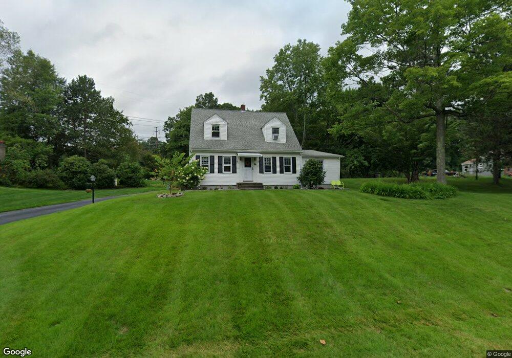
81 Nicholas Ave Boylston, MA 01505
Estimated Value: $531,000 - $598,000
4
Beds
2
Baths
1,678
Sq Ft
$331/Sq Ft
Est. Value
About This Home
This home is located at 81 Nicholas Ave, Boylston, MA 01505 and is currently estimated at $555,066, approximately $330 per square foot. 81 Nicholas Ave is a home located in Worcester County with nearby schools including Tahanto Regional High School, Central New England Christian Academy, and Nativity School of Worcester.
Ownership History
Date
Name
Owned For
Owner Type
Purchase Details
Closed on
Dec 1, 2016
Sold by
Nost Nicole K
Bought by
Nost Erik D and Nost Nicole K
Current Estimated Value
Home Financials for this Owner
Home Financials are based on the most recent Mortgage that was taken out on this home.
Original Mortgage
$200,000
Outstanding Balance
$161,496
Interest Rate
3.52%
Mortgage Type
New Conventional
Estimated Equity
$393,570
Create a Home Valuation Report for This Property
The Home Valuation Report is an in-depth analysis detailing your home's value as well as a comparison with similar homes in the area
Home Values in the Area
Average Home Value in this Area
Purchase History
| Date | Buyer | Sale Price | Title Company |
|---|---|---|---|
| Nost Erik D | -- | -- | |
| Nost Nicole K | -- | -- | |
| Beshai Kathllen J | -- | -- |
Source: Public Records
Mortgage History
| Date | Status | Borrower | Loan Amount |
|---|---|---|---|
| Open | Beshai Kathllen J | $200,000 | |
| Closed | Nost Nicole K | $200,000 |
Source: Public Records
Tax History Compared to Growth
Tax History
| Year | Tax Paid | Tax Assessment Tax Assessment Total Assessment is a certain percentage of the fair market value that is determined by local assessors to be the total taxable value of land and additions on the property. | Land | Improvement |
|---|---|---|---|---|
| 2025 | $6,409 | $463,400 | $159,500 | $303,900 |
| 2024 | $5,447 | $394,400 | $159,500 | $234,900 |
| 2023 | $5,731 | $398,000 | $150,500 | $247,500 |
| 2022 | $5,088 | $321,200 | $150,500 | $170,700 |
| 2021 | $5,240 | $308,600 | $150,500 | $158,100 |
| 2020 | $4,527 | $273,700 | $126,300 | $147,400 |
| 2019 | $4,236 | $264,100 | $124,100 | $140,000 |
| 2018 | $4,308 | $257,500 | $124,100 | $133,400 |
| 2017 | $3,832 | $237,700 | $124,100 | $113,600 |
| 2016 | $3,827 | $233,800 | $118,000 | $115,800 |
| 2015 | $4,070 | $233,800 | $118,000 | $115,800 |
| 2014 | $3,755 | $215,900 | $105,600 | $110,300 |
Source: Public Records
Map
Nearby Homes
- 88 Nicholas Ave
- 2 Poe Ave Unit 1
- 12 Birchwood Dr
- 2 Morgan Cir Unit 16
- 45 Compass Cir Unit 45A
- 291 Sewall St Unit 291
- 289 Sewall St Unit 289
- 281 Sewall St Unit 281
- 345 Sewall St
- 279 Sewall St Unit 279
- 28 Sewall St
- 2 Burkhardt Cir Unit 5
- 313 Gulf St
- 22 Ridge Rd
- 234 Edgebrook Dr
- 207 Edgebrook Dr Unit 2-11
- 217 Edgebrook Dr
- 26 W Temple St
- 35 Cobblestone Ln Unit 35
- 15 Cobblestone Ln Unit 15
- 77 Nicholas Ave
- 87 Nicholas Ave
- 82 Nicholas Ave
- 93 Nicholas Ave
- 69 Melrose St
- 72 Nicholas Ave
- 94 Nicholas Ave
- 98 Nicholas Ave
- 61 Melrose St
- 99 Nicholas Ave
- 100 Nicholas Ave
- 25 Coderre Rd
- 64 Melrose St
- 103 Nicholas Ave
- 28A Brookside Ave
- 102 Nicholas Ave
- 55 Melrose St
- 28 Brookside Ave Unit A
- 28 Brookside Ave Unit 1
- 106 Nicholas Ave