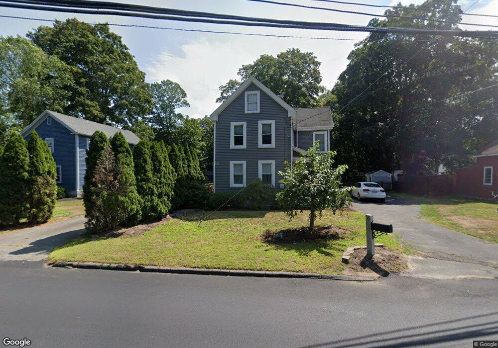
81 North St Unit single fam. Georgetown, MA 01833
Estimated Value: $603,000 - $651,149
3
Beds
2
Baths
1,610
Sq Ft
$395/Sq Ft
Est. Value
About This Home
This home is located at 81 North St Unit single fam., Georgetown, MA 01833 and is currently estimated at $636,037, approximately $395 per square foot. 81 North St Unit single fam. is a home located in Essex County with nearby schools including Perley Elementary School, Penn Brook School, and Georgetown High School.
Ownership History
Date
Name
Owned For
Owner Type
Purchase Details
Closed on
Apr 12, 2019
Sold by
Fiore Clayton L
Bought by
Oliver Margaret and Manzi Richard E
Current Estimated Value
Home Financials for this Owner
Home Financials are based on the most recent Mortgage that was taken out on this home.
Original Mortgage
$344,350
Outstanding Balance
$301,504
Interest Rate
4.3%
Mortgage Type
New Conventional
Estimated Equity
$334,533
Purchase Details
Closed on
Oct 7, 2015
Sold by
Desantis John C and Desantis Lisa A
Bought by
Fiore Clayton L
Home Financials for this Owner
Home Financials are based on the most recent Mortgage that was taken out on this home.
Original Mortgage
$299,475
Interest Rate
3.87%
Mortgage Type
FHA
Purchase Details
Closed on
Jul 29, 2005
Sold by
Johnson Diane L and Johnson Wayne
Bought by
Desantis John C
Home Financials for this Owner
Home Financials are based on the most recent Mortgage that was taken out on this home.
Original Mortgage
$296,000
Interest Rate
5.67%
Mortgage Type
Purchase Money Mortgage
Create a Home Valuation Report for This Property
The Home Valuation Report is an in-depth analysis detailing your home's value as well as a comparison with similar homes in the area
Home Values in the Area
Average Home Value in this Area
Purchase History
| Date | Buyer | Sale Price | Title Company |
|---|---|---|---|
| Oliver Margaret | $355,000 | -- | |
| Oliver Margaret | $355,000 | -- | |
| Fiore Clayton L | $305,000 | -- | |
| Desantis John C | $370,000 | -- | |
| Desantis John C | $370,000 | -- |
Source: Public Records
Mortgage History
| Date | Status | Borrower | Loan Amount |
|---|---|---|---|
| Open | Oliver Margaret | $344,350 | |
| Closed | Oliver Margaret | $344,350 | |
| Previous Owner | Fiore Clayton L | $299,475 | |
| Previous Owner | Desantis John C | $296,000 |
Source: Public Records
Tax History Compared to Growth
Tax History
| Year | Tax Paid | Tax Assessment Tax Assessment Total Assessment is a certain percentage of the fair market value that is determined by local assessors to be the total taxable value of land and additions on the property. | Land | Improvement |
|---|---|---|---|---|
| 2025 | $6,514 | $589,000 | $256,000 | $333,000 |
| 2024 | $5,973 | $475,900 | $176,500 | $299,400 |
| 2023 | $6,324 | $487,200 | $176,500 | $310,700 |
| 2022 | $6,529 | $463,700 | $153,500 | $310,200 |
| 2021 | $5,473 | $344,400 | $153,500 | $190,900 |
| 2020 | $5,000 | $314,100 | $153,500 | $160,600 |
| 2019 | $4,789 | $303,500 | $150,400 | $153,100 |
| 2018 | $4,820 | $303,500 | $150,400 | $153,100 |
| 2017 | $4,824 | $297,600 | $150,400 | $147,200 |
| 2016 | $4,037 | $254,400 | $150,400 | $104,000 |
| 2015 | $4,011 | $250,200 | $150,400 | $99,800 |
| 2014 | $3,515 | $250,200 | $150,400 | $99,800 |
Source: Public Records
Map
Nearby Homes
- 18 Larch Rd
- 51 W Main St Unit 6
- 34 E Main St Unit 2
- 6 Winter St
- 52 E Main St
- 123 Pond St
- 79 Andover St
- 11 Canterbury Dr
- 135 Central St
- 41 Searle St
- 206 W Main St Unit 3
- 206 W Main St Unit 5
- 206 W Main St Unit 6
- 206 W Main St Unit 4
- 231 W Main St
- 278 Central St
- 5 Charles St
- 9 Hawk Way
- 4 Swanton Way
- 10 Noyes Rd