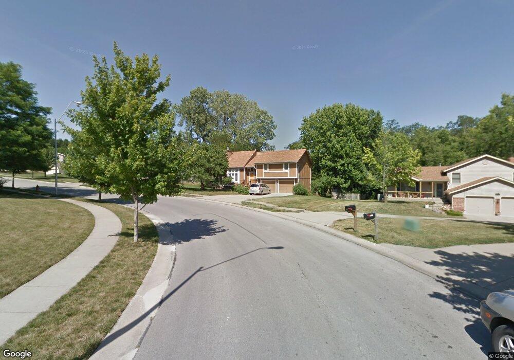
8115 N Wayland Dr Kansas City, MO 64152
Estimated Value: $378,000 - $450,000
4
Beds
3
Baths
1,775
Sq Ft
$231/Sq Ft
Est. Value
About This Home
This home is located at 8115 N Wayland Dr, Kansas City, MO 64152 and is currently estimated at $410,428, approximately $231 per square foot. 8115 N Wayland Dr is a home located in Platte County with nearby schools including Hawthorn Elementary School, Congress Middle School, and Plaza Middle School.
Ownership History
Date
Name
Owned For
Owner Type
Purchase Details
Closed on
Jul 8, 2016
Sold by
Cenac Gregory J and Cenac Gregory Joseph
Bought by
Cenac Gregory J and The Gregory J Cenac Revocable Living Tr
Current Estimated Value
Purchase Details
Closed on
May 31, 2013
Sold by
Cenac Gregory J and Cenac Gregory
Bought by
Cenac Gregory J
Home Financials for this Owner
Home Financials are based on the most recent Mortgage that was taken out on this home.
Original Mortgage
$130,000
Interest Rate
3.41%
Mortgage Type
New Conventional
Create a Home Valuation Report for This Property
The Home Valuation Report is an in-depth analysis detailing your home's value as well as a comparison with similar homes in the area
Home Values in the Area
Average Home Value in this Area
Purchase History
| Date | Buyer | Sale Price | Title Company |
|---|---|---|---|
| Cenac Gregory J | -- | None Available | |
| Cenac Gregory J | -- | None Available | |
| Cenac Gregory J | -- | Platinum Title |
Source: Public Records
Mortgage History
| Date | Status | Borrower | Loan Amount |
|---|---|---|---|
| Closed | Cenac Gregory J | $130,000 |
Source: Public Records
Tax History Compared to Growth
Tax History
| Year | Tax Paid | Tax Assessment Tax Assessment Total Assessment is a certain percentage of the fair market value that is determined by local assessors to be the total taxable value of land and additions on the property. | Land | Improvement |
|---|---|---|---|---|
| 2024 | $4,145 | $49,855 | $15,299 | $34,556 |
| 2023 | $4,145 | $49,855 | $15,299 | $34,556 |
| 2022 | $3,695 | $43,542 | $15,299 | $28,243 |
| 2021 | $3,701 | $43,542 | $15,299 | $28,243 |
| 2020 | $3,044 | $35,081 | $11,546 | $23,535 |
| 2019 | $3,044 | $35,081 | $11,546 | $23,535 |
| 2018 | $3,045 | $34,144 | $7,600 | $26,544 |
| 2017 | $3,233 | $34,144 | $7,600 | $26,544 |
| 2016 | $3,264 | $34,144 | $7,600 | $26,544 |
| 2015 | $3,283 | $34,144 | $7,600 | $26,544 |
| 2013 | $2,430 | $34,144 | $0 | $0 |
Source: Public Records
Map
Nearby Homes
- 8211 NW High Point Dr
- 8000 NW Potomac Ave
- 9601 NW Barry Rd Unit B
- 8310 NW Forest Dr
- 8305 NW Forest Dr
- 10207 NW Barry Rd
- 10307 NW Barry Rd
- 7809 NW Scenic Dr
- 8502 N Carson Ave
- 7600 NW Westside Dr
- 8209 NW Mace Rd
- 7803 NW Lynns Ln
- 8623 N McDonald Ave
- 8714 NW 85th Terrace
- 8706 N Wheaton Ct
- 8708 N Wheaton Ct
- 8701 NW 82nd St
- 8727 N Winan Ave
- 9807 NW 75th Terrace
- 7610 NW Westside Dr
- 8117 N Wayland Dr
- 8111 N Wayland Dr
- 8114 NW Hillside Dr
- 8110 NW Hillside Dr
- 8120 NW Hillside Dr
- 8119 N Wayland Dr
- 8108 NW Hillside Dr
- 8200 NW High Point Dr
- 8201 NW High Point Dr
- 8107 NW Potomac Ave
- 8201 NW Potomac Ave
- 8111 NW Hillside Dr
- 8204 NW High Point Dr
- 8115 NW Hillside Dr
- 8109 NW Hillside Dr
- 8104 NW Hillside Dr
- 8118 NW Potomac Ave
- 8203 NW High Point Dr
- 8120 NW Potomac Ave
- 8205 NW Potomac Ave