812 Railroad Ln Lewistown, MT 59457
Estimated Value: $548,254 - $1,910,000
3
Beds
2
Baths
1,890
Sq Ft
$550/Sq Ft
Est. Value
About This Home
This home is located at 812 Railroad Ln, Lewistown, MT 59457 and is currently estimated at $1,039,751, approximately $550 per square foot. 812 Railroad Ln is a home located in Fergus County with nearby schools including Fergus High School.
Ownership History
Date
Name
Owned For
Owner Type
Purchase Details
Closed on
Aug 1, 2020
Sold by
Kuehn and Alana
Bought by
Snitily Thomas
Current Estimated Value
Home Financials for this Owner
Home Financials are based on the most recent Mortgage that was taken out on this home.
Original Mortgage
$200,000
Interest Rate
3.1%
Mortgage Type
Construction
Purchase Details
Closed on
Jul 28, 2017
Sold by
Carol Schroeder
Bought by
Kuehn Ryan and Kuehn Alana
Home Financials for this Owner
Home Financials are based on the most recent Mortgage that was taken out on this home.
Original Mortgage
$185,000
Interest Rate
3.9%
Mortgage Type
New Conventional
Create a Home Valuation Report for This Property
The Home Valuation Report is an in-depth analysis detailing your home's value as well as a comparison with similar homes in the area
Home Values in the Area
Average Home Value in this Area
Purchase History
| Date | Buyer | Sale Price | Title Company |
|---|---|---|---|
| Snitily Thomas | $250,000 | Realty Title Inc | |
| Kuehn Ryan | $231,350 | First American Title |
Source: Public Records
Mortgage History
| Date | Status | Borrower | Loan Amount |
|---|---|---|---|
| Open | Snitily Thomas | $237,250 | |
| Closed | Snitily Thomas | $200,000 | |
| Previous Owner | Kuehn Ryan | $185,000 |
Source: Public Records
Tax History Compared to Growth
Tax History
| Year | Tax Paid | Tax Assessment Tax Assessment Total Assessment is a certain percentage of the fair market value that is determined by local assessors to be the total taxable value of land and additions on the property. | Land | Improvement |
|---|---|---|---|---|
| 2024 | $2,867 | $354,300 | $0 | $0 |
| 2023 | $2,905 | $354,300 | $0 | $0 |
| 2022 | $2,705 | $271,723 | $0 | $0 |
| 2021 | $2,337 | $271,723 | $0 | $0 |
| 2020 | $2,317 | $264,904 | $0 | $0 |
| 2019 | $2,305 | $264,904 | $0 | $0 |
| 2018 | $2,227 | $251,958 | $0 | $0 |
| 2017 | $2,088 | $247,908 | $0 | $0 |
| 2016 | $1,715 | $199,035 | $0 | $0 |
| 2015 | $1,635 | $199,035 | $0 | $0 |
| 2014 | $1,610 | $109,869 | $0 | $0 |
Source: Public Records
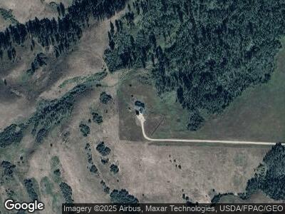
Map
Nearby Homes
- TBD Forest Grove Rd
- 240 Forest Ln
- Lot 9 Terra Vista Way
- 170 Burly Beach Rd
- 2887 Piper Cutoff S
- 91026 Us Highway 87
- 91026 U S 87
- 289 Castle Ridge Dr
- 115 SW Ash St
- 297 Paper Trail
- 1316 6th Ave S
- 1203 3rd Ave S
- 1201 3rd Ave S
- 614 W Belden St
- LOT 015B Shadows Loop
- 303 Brassey St
- LOT 013B Shadows Loop
- LOT 10B Southern Shadows Dr
- LOT 014B Shadows Loop
- 0 Northern Shadows Dr
- 812 Railroad Ln
- 812 Railroad Ln
- 337 Railroad Ln
- TBD Railroad Ln
- 17 Forest Grove Rd
- 235 Honeydew Ln
- 0 E Fork Rd
- TBD E Rail Road Ln
- 172 Honeydew Ln
- #29 Grove Rd
- 29 Grove Rd
- 29 Grove Ln
- 57 Hoot Owl Ln
- 298 Forest Grove Rd
- TBD Grove Ln
- 41 Grove Ln
- 81 Timber Tracts Rd
- 45 Grove Ln
- 308 Simonson Ln
- 239 Timber Tracts Rd