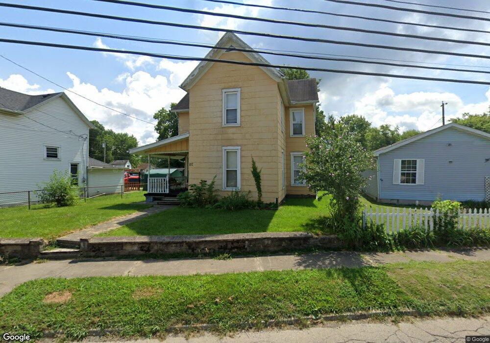
812 Union Rd Franklin, OH 45005
Estimated Value: $126,000 - $180,000
3
Beds
1
Bath
1,412
Sq Ft
$112/Sq Ft
Est. Value
About This Home
This home is located at 812 Union Rd, Franklin, OH 45005 and is currently estimated at $158,270, approximately $112 per square foot. 812 Union Rd is a home located in Warren County with nearby schools including Franklin High School.
Ownership History
Date
Name
Owned For
Owner Type
Purchase Details
Closed on
Feb 8, 2020
Sold by
Mullins Shelley K
Bought by
Mullins Kevin S
Current Estimated Value
Purchase Details
Closed on
Aug 23, 2007
Sold by
U S Bank Na
Bought by
Mullins Kevin S and Mullins Shelley K
Home Financials for this Owner
Home Financials are based on the most recent Mortgage that was taken out on this home.
Original Mortgage
$34,300
Outstanding Balance
$21,314
Interest Rate
6.66%
Mortgage Type
Purchase Money Mortgage
Estimated Equity
$136,956
Purchase Details
Closed on
Feb 20, 2007
Sold by
Wright Jason and Case #06Cv66918
Bought by
Us Bank Na
Purchase Details
Closed on
Nov 16, 2005
Sold by
Maloney Jesse and Maloney Margaret
Bought by
Wright Jason and Wright Erika
Home Financials for this Owner
Home Financials are based on the most recent Mortgage that was taken out on this home.
Original Mortgage
$98,910
Interest Rate
8.7%
Mortgage Type
Fannie Mae Freddie Mac
Create a Home Valuation Report for This Property
The Home Valuation Report is an in-depth analysis detailing your home's value as well as a comparison with similar homes in the area
Home Values in the Area
Average Home Value in this Area
Purchase History
| Date | Buyer | Sale Price | Title Company |
|---|---|---|---|
| Mullins Kevin S | -- | None Available | |
| Mullins Kevin S | $49,000 | Resource Title | |
| Us Bank Na | $73,334 | None Available | |
| Wright Jason | $110,833 | Prominent Title |
Source: Public Records
Mortgage History
| Date | Status | Borrower | Loan Amount |
|---|---|---|---|
| Open | Mullins Kevin S | $34,300 | |
| Previous Owner | Wright Jason | $98,910 |
Source: Public Records
Tax History
| Year | Tax Paid | Tax Assessment Tax Assessment Total Assessment is a certain percentage of the fair market value that is determined by local assessors to be the total taxable value of land and additions on the property. | Land | Improvement |
|---|---|---|---|---|
| 2025 | $1,710 | $34,030 | $8,380 | $25,650 |
| 2024 | $1,710 | $34,030 | $8,380 | $25,650 |
| 2023 | $1,397 | $25,777 | $4,749 | $21,028 |
| 2022 | $1,369 | $25,778 | $4,750 | $21,028 |
| 2021 | $1,298 | $25,778 | $4,750 | $21,028 |
| 2020 | $1,170 | $20,458 | $3,770 | $16,688 |
| 2019 | $1,067 | $20,458 | $3,770 | $16,688 |
| 2018 | $1,039 | $20,458 | $3,770 | $16,688 |
| 2017 | $1,105 | $19,373 | $3,619 | $15,754 |
| 2016 | $1,127 | $19,373 | $3,619 | $15,754 |
| 2015 | $1,127 | $19,373 | $3,619 | $15,754 |
| 2014 | $1,155 | $19,370 | $3,620 | $15,750 |
| 2013 | $972 | $22,410 | $4,190 | $18,220 |
Source: Public Records
Map
Nearby Homes
- 218 Roberts Ave
- 1200 Riley Blvd
- 139 E 6th St
- 7189 Shaker Rd
- 627 S River St
- 0 E 4th St
- 0 Kathy Ln Unit 1834240
- 0 Kathy Ln Unit 930066
- 1117 S Main St
- 5684 Olive Rd
- 202 E 2nd St
- 309 Oxford Rd
- 388 Thomas Dr
- 210 N Riley Blvd
- 205 Oxford Rd
- 5 S River St
- 410 Park Ave
- 509 Forest Ave
- 511 Forest Ave
- 747 David Blvd
Your Personal Tour Guide
Ask me questions while you tour the home.