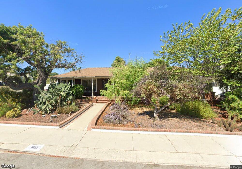
8123 Flight Ave Los Angeles, CA 90045
Westchester NeighborhoodEstimated Value: $1,476,893 - $1,625,000
3
Beds
2
Baths
1,848
Sq Ft
$852/Sq Ft
Est. Value
About This Home
This home is located at 8123 Flight Ave, Los Angeles, CA 90045 and is currently estimated at $1,573,723, approximately $851 per square foot. 8123 Flight Ave is a home located in Los Angeles County with nearby schools including Westport Heights Elementary, Wright Middle School STEAM Magnet, and Westchester Enriched Sciences Magnets.
Ownership History
Date
Name
Owned For
Owner Type
Purchase Details
Closed on
Jan 7, 2016
Sold by
Dale John A and Dale Barbara J
Bought by
Dale John A and Dale Barbara J
Current Estimated Value
Purchase Details
Closed on
Mar 19, 2002
Sold by
Thomas James Earl
Bought by
Thomas Sue Ann
Home Financials for this Owner
Home Financials are based on the most recent Mortgage that was taken out on this home.
Original Mortgage
$200,000
Outstanding Balance
$82,428
Interest Rate
6.87%
Estimated Equity
$1,491,295
Purchase Details
Closed on
Mar 14, 2002
Sold by
Thomas Sue Ann
Bought by
Dale John A and Dale Barbara J
Home Financials for this Owner
Home Financials are based on the most recent Mortgage that was taken out on this home.
Original Mortgage
$200,000
Outstanding Balance
$82,428
Interest Rate
6.87%
Estimated Equity
$1,491,295
Purchase Details
Closed on
Feb 16, 1994
Sold by
Thomas James Earl
Bought by
Thomas Sue Ann
Create a Home Valuation Report for This Property
The Home Valuation Report is an in-depth analysis detailing your home's value as well as a comparison with similar homes in the area
Home Values in the Area
Average Home Value in this Area
Purchase History
| Date | Buyer | Sale Price | Title Company |
|---|---|---|---|
| Dale John A | -- | None Available | |
| Thomas Sue Ann | -- | First American Title Co | |
| Dale John A | $450,000 | First American Title Co | |
| Thomas Sue Ann | -- | -- |
Source: Public Records
Mortgage History
| Date | Status | Borrower | Loan Amount |
|---|---|---|---|
| Open | Dale John A | $200,000 | |
| Closed | Dale John A | $30,000 |
Source: Public Records
Tax History Compared to Growth
Tax History
| Year | Tax Paid | Tax Assessment Tax Assessment Total Assessment is a certain percentage of the fair market value that is determined by local assessors to be the total taxable value of land and additions on the property. | Land | Improvement |
|---|---|---|---|---|
| 2025 | $1,984 | $144,395 | $62,701 | $81,694 |
| 2024 | $1,984 | $141,565 | $61,472 | $80,093 |
| 2023 | $1,954 | $138,790 | $60,267 | $78,523 |
| 2022 | $1,874 | $136,070 | $59,086 | $76,984 |
| 2021 | $1,839 | $133,403 | $57,928 | $75,475 |
| 2019 | $1,789 | $129,449 | $56,211 | $73,238 |
| 2018 | $1,703 | $126,911 | $55,109 | $71,802 |
| 2016 | $1,611 | $121,985 | $52,970 | $69,015 |
| 2015 | $1,589 | $120,154 | $52,175 | $67,979 |
| 2014 | $1,606 | $117,801 | $51,153 | $66,648 |
Source: Public Records
Map
Nearby Homes
- 8313 Kittyhawk Ave
- 8312 Barnsley Ave
- 7840 Boeing Ave
- 8418 Belford Ave
- 7832 Bleriot Ave
- 8512 Belford Ave
- 7842 Croydon Ave
- 8620 Belford Ave Unit 604
- 8620 Belford Ave Unit 608
- 7817 Truxton Ave
- 7901 Winsford Ave
- 8130 Grimsby Ave
- 8815 Glider Ave
- 5966 Abernathy Dr
- 8650 Belford Ave Unit 116A
- 8710 Belford Ave Unit 215B
- 8710 Belford Ave Unit 106B
- 5858 Abernathy Dr
- 8210 Alverstone Ave
- 8507 Naylor Ave
- 8117 Flight Ave
- 8120 Glider Ave
- 8116 Glider Ave
- 8111 Flight Ave
- 8110 Glider Ave
- 6000 W 82nd St
- 8120 Flight Ave
- 8126 Flight Ave
- 8130 Flight Ave
- 8116 Flight Ave
- 8105 Flight Ave
- 6004 W 82nd St
- 8106 Glider Ave
- 8200 Flight Ave
- 8110 Flight Ave
- 7949 Flight Place
- 6006 W 82nd St
- 7949 Flight Place
- 8117 Glider Ave
- 8106 Flight Ave