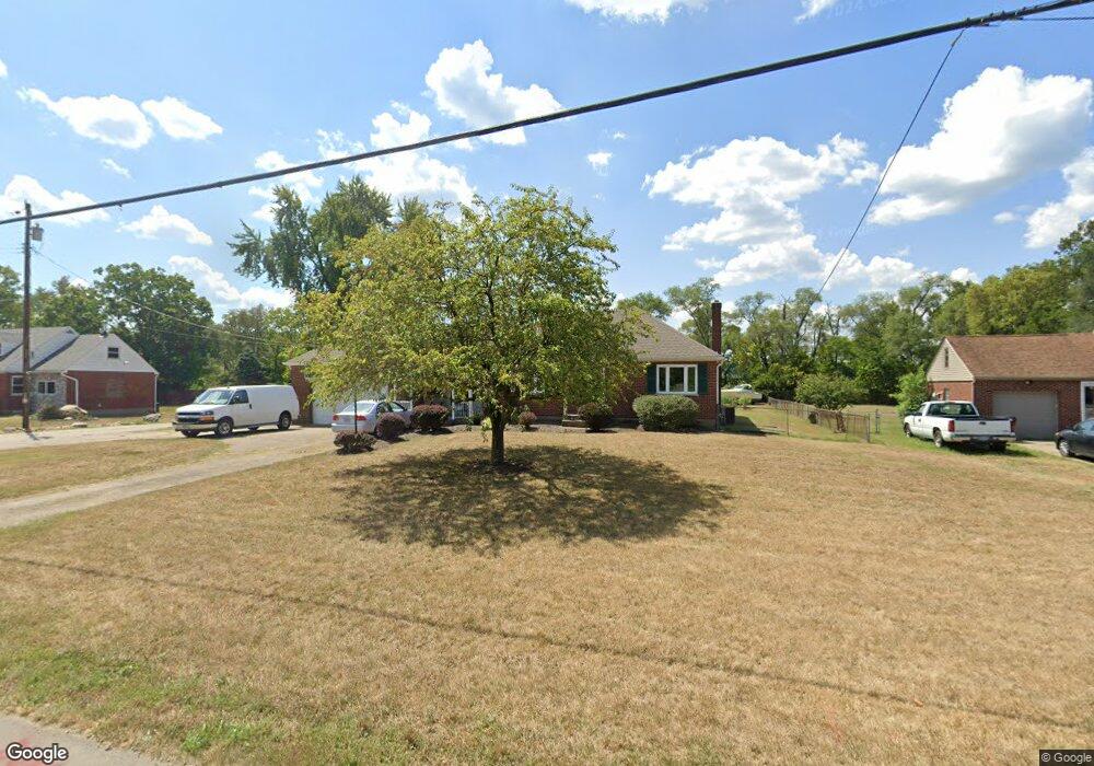
8139 Broadwell Rd Cincinnati, OH 45244
Estimated Value: $277,000 - $321,169
2
Beds
2
Baths
2,068
Sq Ft
$147/Sq Ft
Est. Value
About This Home
This home is located at 8139 Broadwell Rd, Cincinnati, OH 45244 and is currently estimated at $303,292, approximately $146 per square foot. 8139 Broadwell Rd is a home located in Hamilton County with nearby schools including Mercer Elementary School, Nagel Middle School, and Turpin High School.
Ownership History
Date
Name
Owned For
Owner Type
Purchase Details
Closed on
Mar 25, 2010
Sold by
B E E Holding Limited Partnership
Bought by
Evans Michael
Current Estimated Value
Purchase Details
Closed on
May 12, 2006
Sold by
Latham Virginia Lee and Latham Robert L
Bought by
B E E Holdings Lp
Purchase Details
Closed on
Feb 22, 1999
Sold by
Latham Virginia Lee
Bought by
Latham Virginia Lee and Latham Robert L
Create a Home Valuation Report for This Property
The Home Valuation Report is an in-depth analysis detailing your home's value as well as a comparison with similar homes in the area
Home Values in the Area
Average Home Value in this Area
Purchase History
| Date | Buyer | Sale Price | Title Company |
|---|---|---|---|
| Evans Michael | $145,000 | Attorney | |
| B E E Holdings Lp | $145,000 | Summit Title Agency Inc | |
| Latham Virginia Lee | -- | -- |
Source: Public Records
Tax History
| Year | Tax Paid | Tax Assessment Tax Assessment Total Assessment is a certain percentage of the fair market value that is determined by local assessors to be the total taxable value of land and additions on the property. | Land | Improvement |
|---|---|---|---|---|
| 2025 | $5,259 | $83,937 | $6,517 | $77,420 |
| 2024 | $5,111 | $83,937 | $6,517 | $77,420 |
| 2023 | $4,862 | $83,937 | $6,517 | $77,420 |
| 2022 | $3,464 | $53,176 | $6,444 | $46,732 |
| 2021 | $3,382 | $53,176 | $6,444 | $46,732 |
| 2020 | $3,421 | $53,176 | $6,444 | $46,732 |
| 2019 | $3,336 | $47,058 | $5,702 | $41,356 |
| 2018 | $3,126 | $47,058 | $5,702 | $41,356 |
| 2017 | $2,949 | $47,058 | $5,702 | $41,356 |
| 2016 | $2,550 | $39,718 | $5,530 | $34,188 |
| 2015 | $2,477 | $39,718 | $5,530 | $34,188 |
| 2014 | $2,479 | $39,718 | $5,530 | $34,188 |
| 2013 | $2,417 | $40,947 | $5,702 | $35,245 |
Source: Public Records
Map
Nearby Homes
- 0 Pearl St Unit 1225343
- 0 Pearl St Unit 1841806
- 2 Mount Carmel Rd
- 3 Noel Ln
- 4885 Beechwood Rd
- 141 Wrenwood Ln
- 822 Stanton Ave
- 602 Stanton Ave
- 3420 Oyster Bay Ct
- 2 Kris Cir
- 4806 Forest Meadows Ct
- 4834 Summerside Rd
- 3130 Wolf Run Ct
- 9200 Indian Hill Rd
- 8815 Old Indian Hill Rd
- 4773 Beechwood Rd
- 481 Big Moe Dr
- 732 Wooster Pike
- 8340 Indian Hill Rd
- 4085 Walton Creek Rd
- 8131 Broadwell Rd
- 8155 Broadwell Rd
- 8161 Broadwell Rd
- 8121 Broadwell Rd
- 8121 Broadwell Rd
- 8099 Broadwell Rd
- 8067 Broadwell Rd
- 8057 Broadwell Rd
- 7973 Broadwell Rd
- 7968 Broadwell Rd
- 0 Round Bottom Rd Unit 1358581
- 4178 Round Bottom Rd
- 4138 Round Bottom Rd
- 4138 Round Bottom Rd
- 4138 Round Bottom Rd
- 4138 Round Bottom Rd
- 4162 Round Bottom Rd
- 4207 Round Bottom Rd
- 4217 Round Bottom Rd
- 4150 Round Bottom Rd
Your Personal Tour Guide
Ask me questions while you tour the home.