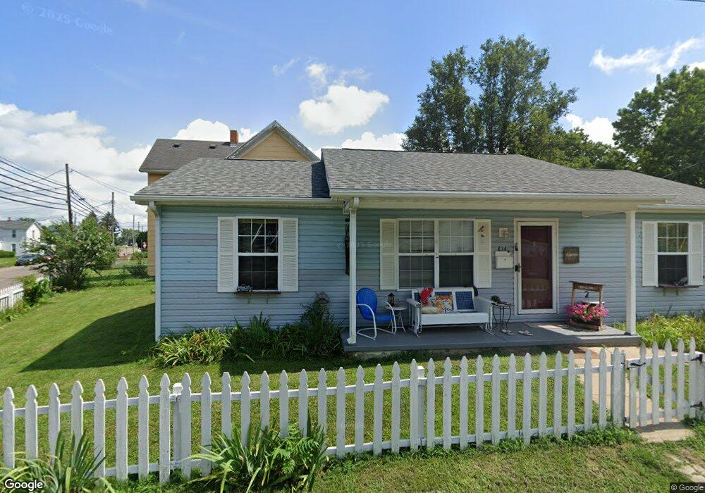
814 Union Rd Franklin, OH 45005
Estimated Value: $138,000 - $209,000
3
Beds
2
Baths
1,056
Sq Ft
$169/Sq Ft
Est. Value
About This Home
This home is located at 814 Union Rd, Franklin, OH 45005 and is currently estimated at $178,555, approximately $169 per square foot. 814 Union Rd is a home located in Warren County with nearby schools including Franklin High School.
Ownership History
Date
Name
Owned For
Owner Type
Purchase Details
Closed on
Sep 29, 2021
Sold by
Osborne Carol
Bought by
Osborne Carol and Winkler Douglas A
Current Estimated Value
Home Financials for this Owner
Home Financials are based on the most recent Mortgage that was taken out on this home.
Original Mortgage
$76,700
Interest Rate
2.99%
Mortgage Type
New Conventional
Purchase Details
Closed on
Sep 26, 2003
Sold by
Habitat For Humanity Tristate Ohio Kentu
Bought by
Osbone Carol
Home Financials for this Owner
Home Financials are based on the most recent Mortgage that was taken out on this home.
Original Mortgage
$58,500
Interest Rate
6.23%
Mortgage Type
Seller Take Back
Purchase Details
Closed on
May 18, 2001
Sold by
Phillips Michael
Bought by
Habitat For Humanity
Purchase Details
Closed on
Mar 13, 2001
Sold by
Phillips Connie S
Bought by
Phillips Michael R and Phillips Glenda G
Purchase Details
Closed on
Oct 12, 1999
Sold by
Young Joe E
Bought by
Phillips Michael R and Phillips Connie S
Home Financials for this Owner
Home Financials are based on the most recent Mortgage that was taken out on this home.
Original Mortgage
$45,900
Interest Rate
8.5%
Mortgage Type
New Conventional
Purchase Details
Closed on
Aug 24, 1983
Sold by
Alexander Alexander and Alexander Esmer
Bought by
Young Young and Young Joe E
Create a Home Valuation Report for This Property
The Home Valuation Report is an in-depth analysis detailing your home's value as well as a comparison with similar homes in the area
Home Values in the Area
Average Home Value in this Area
Purchase History
| Date | Buyer | Sale Price | Title Company |
|---|---|---|---|
| Osborne Carol | -- | None Listed On Document | |
| Osbone Carol | -- | Nations Title Agency Inc | |
| Habitat For Humanity | $12,000 | -- | |
| Phillips Michael R | $17,000 | -- | |
| Phillips Michael R | $49,500 | -- | |
| Young Young | $10,000 | -- |
Source: Public Records
Mortgage History
| Date | Status | Borrower | Loan Amount |
|---|---|---|---|
| Previous Owner | Osborne Carol | $76,700 | |
| Previous Owner | Osbone Carol | $58,500 | |
| Previous Owner | Phillips Michael R | $45,900 | |
| Closed | Osbone Carol | $21,500 |
Source: Public Records
Tax History
| Year | Tax Paid | Tax Assessment Tax Assessment Total Assessment is a certain percentage of the fair market value that is determined by local assessors to be the total taxable value of land and additions on the property. | Land | Improvement |
|---|---|---|---|---|
| 2025 | $1,711 | $45,270 | $8,380 | $36,890 |
| 2024 | $1,711 | $45,270 | $8,380 | $36,890 |
| 2023 | $1,402 | $35,003 | $4,749 | $30,254 |
| 2022 | $1,375 | $35,004 | $4,750 | $30,254 |
| 2021 | $1,305 | $35,004 | $4,750 | $30,254 |
| 2020 | $1,038 | $27,048 | $3,770 | $23,279 |
| 2019 | $946 | $27,048 | $3,770 | $23,279 |
| 2018 | $908 | $27,048 | $3,770 | $23,279 |
| 2017 | $952 | $25,582 | $3,619 | $21,963 |
| 2016 | $970 | $25,582 | $3,619 | $21,963 |
| 2015 | $970 | $25,582 | $3,619 | $21,963 |
| 2014 | $957 | $25,580 | $3,620 | $21,960 |
| 2013 | $821 | $29,590 | $4,190 | $25,400 |
Source: Public Records
Map
Nearby Homes
- 218 Roberts Ave
- 1200 Riley Blvd
- 139 E 6th St
- 7189 Shaker Rd
- 627 S River St
- 0 E 4th St
- 0 Kathy Ln Unit 1834240
- 0 Kathy Ln Unit 930066
- 1117 S Main St
- 5684 Olive Rd
- 202 E 2nd St
- 309 Oxford Rd
- 388 Thomas Dr
- 210 N Riley Blvd
- 205 Oxford Rd
- 5 S River St
- 410 Park Ave
- 509 Forest Ave
- 511 Forest Ave
- 747 David Blvd
Your Personal Tour Guide
Ask me questions while you tour the home.