Estimated Value: $208,126 - $256,000
2
Beds
3
Baths
1,592
Sq Ft
$143/Sq Ft
Est. Value
About This Home
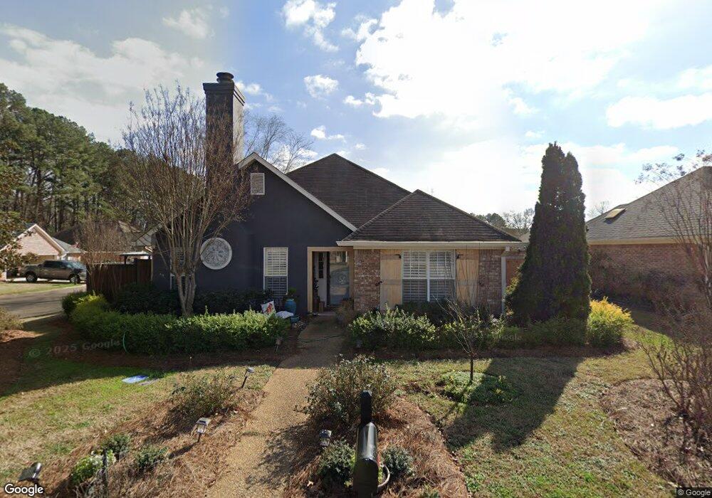
This home is located at 815 Lynwood Ln, Pearl, MS 39208 and is currently estimated at $227,782, approximately $143 per square foot. 815 Lynwood Ln is a home located in Rankin County with nearby schools including Pearl Lower Elementary School, Pearl Upper School, and Northside Elementary School.
Ownership History
Date
Name
Owned For
Owner Type
Purchase Details
Closed on
Nov 15, 2019
Sold by
Porter Land Co
Bought by
Alpha Investments Llc
Current Estimated Value
Purchase Details
Closed on
Feb 27, 2014
Sold by
Margo C Margo C
Bought by
Porter Catherine Sue
Purchase Details
Closed on
Sep 28, 2009
Sold by
Louie W Louie W and Odom Charlotte A
Bought by
Evans Margo C
Home Financials for this Owner
Home Financials are based on the most recent Mortgage that was taken out on this home.
Original Mortgage
$133,045
Interest Rate
5.1%
Mortgage Type
FHA
Create a Home Valuation Report for This Property
The Home Valuation Report is an in-depth analysis detailing your home's value as well as a comparison with similar homes in the area
Home Values in the Area
Average Home Value in this Area
Purchase History
| Date | Buyer | Sale Price | Title Company |
|---|---|---|---|
| Alpha Investments Llc | -- | -- | |
| Porter Catherine Sue | -- | -- | |
| Evans Margo C | -- | -- |
Source: Public Records
Mortgage History
| Date | Status | Borrower | Loan Amount |
|---|---|---|---|
| Previous Owner | Alpha Investments Llc | $100,000 | |
| Previous Owner | Evans Margo C | $133,045 |
Source: Public Records
Tax History Compared to Growth
Tax History
| Year | Tax Paid | Tax Assessment Tax Assessment Total Assessment is a certain percentage of the fair market value that is determined by local assessors to be the total taxable value of land and additions on the property. | Land | Improvement |
|---|---|---|---|---|
| 2024 | $2,233 | $17,523 | $0 | $0 |
| 2023 | $2,218 | $17,334 | $0 | $0 |
| 2022 | $2,192 | $17,334 | $0 | $0 |
| 2021 | $2,192 | $11,556 | $0 | $0 |
| 2020 | $372 | $11,556 | $0 | $0 |
| 2019 | $377 | $10,440 | $0 | $0 |
| 2018 | $377 | $10,440 | $0 | $0 |
| 2017 | $377 | $10,440 | $0 | $0 |
| 2016 | $340 | $10,151 | $0 | $0 |
| 2015 | $340 | $10,151 | $0 | $0 |
| 2014 | $1,001 | $10,151 | $0 | $0 |
| 2013 | -- | $10,151 | $0 | $0 |
Source: Public Records
Map
Nearby Homes
- 623 Corbett Dr
- 0 Cross Park Dr
- Lot C Park Place Cove
- Lot B Park Place Cove
- 703 Tower Ridge Cove
- 168 Pleasant Grove Dr
- HOLLY Plan at The Hollows
- IRIS Plan at The Hollows
- DESTIN Plan at The Hollows
- RHETT Plan at The Hollows
- RIVERSIDE Plan at The Hollows
- MADISON Plan at The Hollows
- 426 Piney Dr
- 432 Piney Dr
- 425 Piney Dr
- 430 Piney Dr
- 0 La Gail Dr
- 225 Burnham Rd
- 248 La Gail Dr
- 301 Belvedere Dr
- 811 Lynwood Ln
- 1012 Lynwood Ln
- 1008 Lynwood Ln
- 3482 Saint Marie Place
- 807 Lynwood Ln
- 3488 Saint Marie Place
- 3492 Saint Marie Place
- 810 Lynwood Ln
- 3476 Saint Marie Place
- 3496 Saint Marie Place
- 1004 Lynwood Ln
- 803 Lynwood Ln
- 3470 Saint Marie Place
- 806 Lynwood Ln
- 1009 Lynwood Ln
- 1017 Lynwood Ln
- 802 Lynwood Ln
- 3502 St Marie Place
- 3502 Saint Marie Place
- 3464 Saint Marie Place