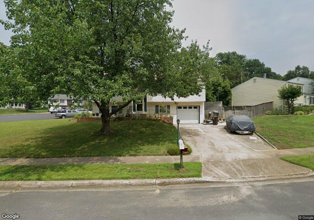
815 Macsherry Dr Arnold, MD 21012
Estimated Value: $415,357 - $578,000
Studio
2
Baths
1,220
Sq Ft
$417/Sq Ft
Est. Value
About This Home
This home is located at 815 Macsherry Dr, Arnold, MD 21012 and is currently estimated at $508,339, approximately $416 per square foot. 815 Macsherry Dr is a home located in Anne Arundel County with nearby schools including Belvedere Elementary School, Severn River Middle School, and Broadneck High School.
Ownership History
Date
Name
Owned For
Owner Type
Purchase Details
Closed on
Jun 21, 1995
Sold by
Brenner Charles
Bought by
Candell Michael C
Current Estimated Value
Home Financials for this Owner
Home Financials are based on the most recent Mortgage that was taken out on this home.
Original Mortgage
$148,250
Interest Rate
7.82%
Purchase Details
Closed on
Oct 31, 1989
Sold by
Oster Joanne V
Bought by
Brenner Charles
Home Financials for this Owner
Home Financials are based on the most recent Mortgage that was taken out on this home.
Original Mortgage
$50,000
Interest Rate
9.82%
Create a Home Valuation Report for This Property
The Home Valuation Report is an in-depth analysis detailing your home's value as well as a comparison with similar homes in the area
Home Values in the Area
Average Home Value in this Area
Purchase History
| Date | Buyer | Sale Price | Title Company |
|---|---|---|---|
| Candell Michael C | $150,000 | -- | |
| Brenner Charles | $127,000 | -- |
Source: Public Records
Mortgage History
| Date | Status | Borrower | Loan Amount |
|---|---|---|---|
| Closed | Candell Michael C | $148,250 | |
| Previous Owner | Brenner Charles | $50,000 |
Source: Public Records
Tax History
| Year | Tax Paid | Tax Assessment Tax Assessment Total Assessment is a certain percentage of the fair market value that is determined by local assessors to be the total taxable value of land and additions on the property. | Land | Improvement |
|---|---|---|---|---|
| 2025 | $2,991 | $392,400 | -- | -- |
| 2024 | $2,991 | $372,600 | $235,100 | $137,500 |
| 2023 | $2,908 | $365,267 | $0 | $0 |
| 2022 | $2,721 | $357,933 | $0 | $0 |
| 2020 | $2,590 | $343,233 | $0 | $0 |
| 2019 | $2,548 | $335,867 | $0 | $0 |
| 2018 | $3,331 | $328,500 | $186,300 | $142,200 |
| 2017 | $2,395 | $310,867 | $0 | $0 |
| 2016 | -- | $293,233 | $0 | $0 |
| 2015 | -- | $275,600 | $0 | $0 |
| 2014 | -- | $274,400 | $0 | $0 |
Source: Public Records
Map
Nearby Homes
- 785 Macsherry Dr
- 243 and 245 Haverton Rd
- 394 Kings College Dr
- 201 Mill Ct
- 93 Jones Station Rd
- 813 Mago Vista Rd
- 1078 Brightleaf Ct
- 127 Cresston Rd
- 836 Mill Creek Rd
- 797 David Dr
- 303 Ternwing Dr
- 276 Overleaf Dr
- 404 Alameda Pkwy
- 774 Dividing Creek Rd
- 1277 Ritchie Hwy Unit 195
- 1232 Taylor Ave
- 1199 Asquithpines Place
- 707 Lynngate Rd Unit 12
- 539 Greenblades Ct
- 1159 Greenhill Rd
- 817 Macsherry Dr
- 813 Brechin Garth
- 819 Macsherry Dr
- 811 Brechin Garth
- 805 Macsherry Dr
- 812 Macsherry Dr
- 814 Macsherry Dr
- 821 Macsherry Dr
- 808 Macsherry Dr
- 816 Macsherry Dr
- 809 Brechin Garth
- 807 Brechin Garth
- 816 Ruxshire Dr
- 820 Grimsby Garth
- 818 Ruxshire Dr
- 814 Ruxshire Dr
- 803 Macsherry Dr
- 806 Macsherry Dr
- 812 Ruxshire Dr
- 820 Ruxshire Dr
Your Personal Tour Guide
Ask me questions while you tour the home.