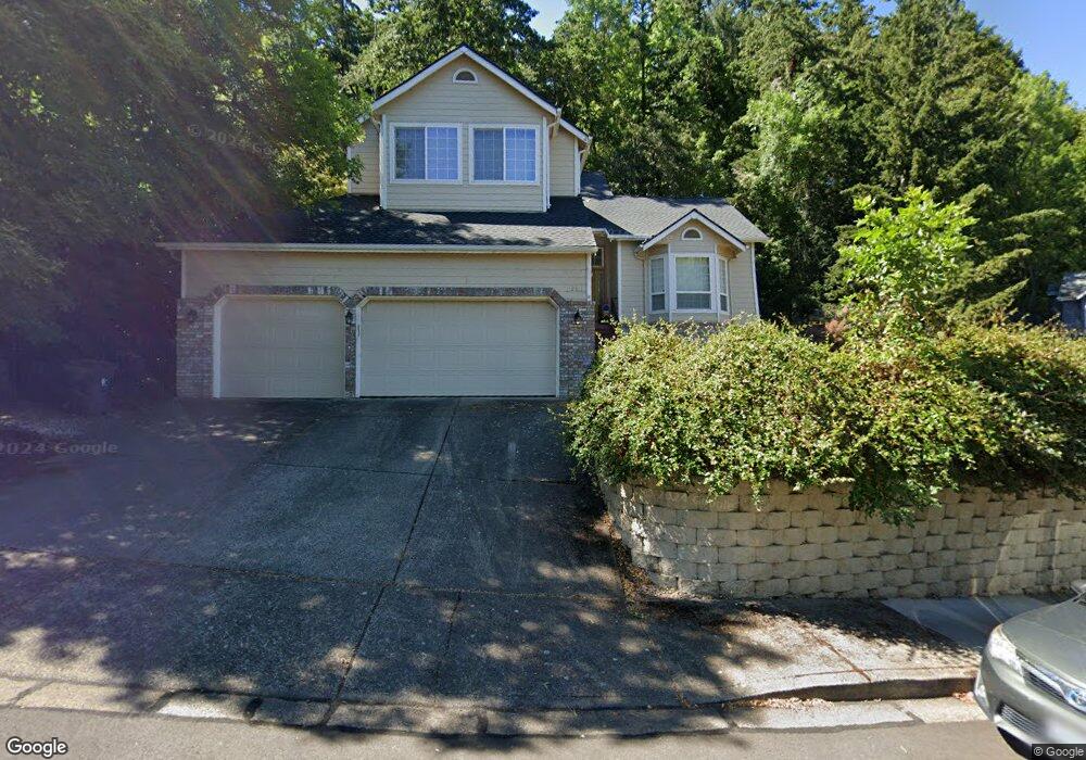
815 Sundance St Eugene, OR 97405
Crest Drive NeighborhoodEstimated Value: $682,000 - $795,000
4
Beds
3
Baths
2,509
Sq Ft
$297/Sq Ft
Est. Value
About This Home
This home is located at 815 Sundance St, Eugene, OR 97405 and is currently estimated at $744,809, approximately $296 per square foot. 815 Sundance St is a home located in Lane County with nearby schools including Edgewood Community Elementary School, Spencer Butte Middle School, and South Eugene High School.
Ownership History
Date
Name
Owned For
Owner Type
Purchase Details
Closed on
Jan 12, 2009
Sold by
Bartel Tad and Bartel Deborah A
Bought by
Singer Jeff S and Singer Amy G
Current Estimated Value
Home Financials for this Owner
Home Financials are based on the most recent Mortgage that was taken out on this home.
Original Mortgage
$392,277
Outstanding Balance
$255,026
Interest Rate
5.97%
Mortgage Type
Purchase Money Mortgage
Estimated Equity
$489,783
Purchase Details
Closed on
Nov 30, 2005
Sold by
Rippee Robert E and Rippee Andrea K
Bought by
Bartel Tad and Bartel Deborah A
Create a Home Valuation Report for This Property
The Home Valuation Report is an in-depth analysis detailing your home's value as well as a comparison with similar homes in the area
Home Values in the Area
Average Home Value in this Area
Purchase History
| Date | Buyer | Sale Price | Title Company |
|---|---|---|---|
| Singer Jeff S | $429,000 | First American Title | |
| Bartel Tad | $347,000 | Western Title & Escrow Compa |
Source: Public Records
Mortgage History
| Date | Status | Borrower | Loan Amount |
|---|---|---|---|
| Open | Singer Jeff S | $392,277 |
Source: Public Records
Tax History
| Year | Tax Paid | Tax Assessment Tax Assessment Total Assessment is a certain percentage of the fair market value that is determined by local assessors to be the total taxable value of land and additions on the property. | Land | Improvement |
|---|---|---|---|---|
| 2025 | $8,607 | $441,731 | -- | -- |
| 2024 | $8,500 | $428,866 | -- | -- |
| 2023 | $8,500 | $416,375 | $0 | $0 |
| 2022 | $7,963 | $404,248 | $0 | $0 |
| 2021 | $7,462 | $392,474 | $0 | $0 |
| 2020 | $7,268 | $381,043 | $0 | $0 |
| 2019 | $7,069 | $369,945 | $0 | $0 |
| 2018 | $6,594 | $348,709 | $0 | $0 |
| 2017 | $6,174 | $348,709 | $0 | $0 |
| 2016 | $5,945 | $338,552 | $0 | $0 |
| 2015 | $5,774 | $328,691 | $0 | $0 |
| 2014 | $5,697 | $319,117 | $0 | $0 |
Source: Public Records
Map
Nearby Homes
- 806 Sundance St
- 3854 Monroe St
- 4040 Southpointe Dr
- 0 Pine View Ct Unit 758820410
- 453 Dellwood Dr
- 3593 Lawrence St
- 357 W 37th Ave
- 320 Dellwood Dr
- 0 W 40th Ave Unit 3 545854116
- 0 W 40th Ave Unit 3 639571582
- 605 Fulvue Dr
- 0 Hidden Meadows
- 1 Storey Blvd
- 2 Storey Blvd
- 653 Brookside Dr
- 3160 Whitten Dr
- 75 W 35th Place
- 3087 Whitbeck Blvd
- 278 Rockridge Ct
- 17 Westbrook Way
- 827 Sundance St
- 843 Sundance St
- 816 Sundance St
- 822 Sundance St
- 803 Sundance St
- 810 Sundance St
- 814 Sundance St
- 826 Sundance St
- 847 Sundance St
- 873 Sundance St
- 859 Sundance St
- 858 Sundance St
- 3902 Monroe St
- 3886 Monroe St
- 885 Sundance St
- 3889 Blanton Rd
- 3965 Sundial Rd
- 876 Sundance St
- 3977 Sundial Rd
- 3941 Sundial Rd
Your Personal Tour Guide
Ask me questions while you tour the home.