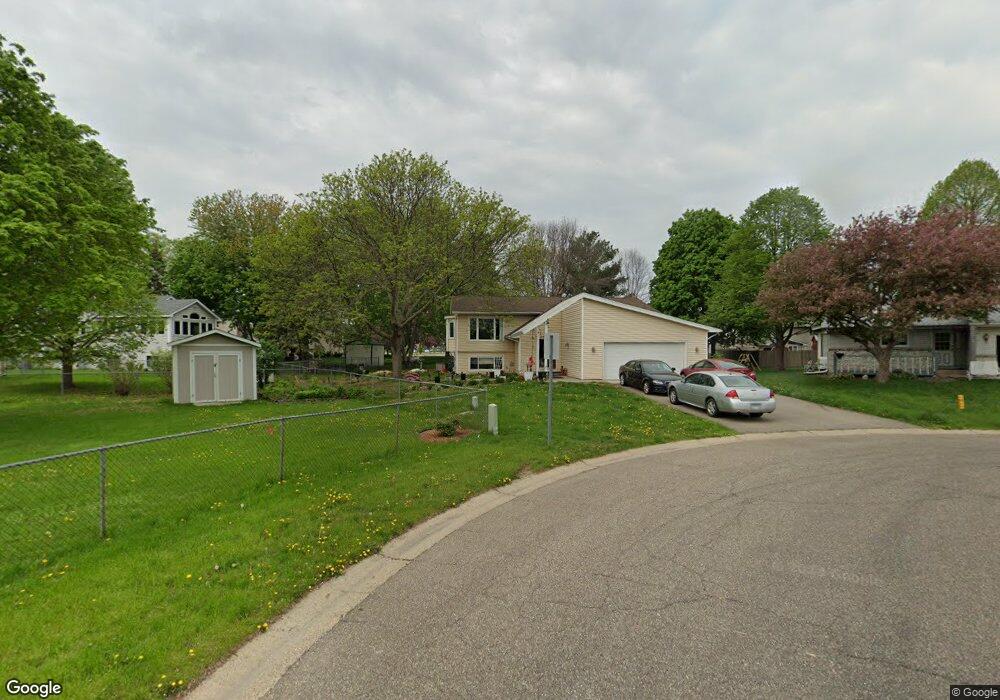
8163 Upper 145th St W Saint Paul, MN 55124
Redwood NeighborhoodEstimated Value: $437,000 - $453,000
5
Beds
2
Baths
1,276
Sq Ft
$348/Sq Ft
Est. Value
About This Home
This home is located at 8163 Upper 145th St W, Saint Paul, MN 55124 and is currently estimated at $443,781, approximately $347 per square foot. 8163 Upper 145th St W is a home located in Dakota County with nearby schools including Westview Elementary School, Valley Middle School, and Apple Valley Senior High School.
Ownership History
Date
Name
Owned For
Owner Type
Purchase Details
Closed on
Mar 2, 2020
Sold by
Sandigo William and Sandigo Carolyn M
Bought by
Runningen Tamie S
Current Estimated Value
Home Financials for this Owner
Home Financials are based on the most recent Mortgage that was taken out on this home.
Original Mortgage
$329,900
Outstanding Balance
$292,725
Interest Rate
3.6%
Mortgage Type
VA
Estimated Equity
$151,056
Create a Home Valuation Report for This Property
The Home Valuation Report is an in-depth analysis detailing your home's value as well as a comparison with similar homes in the area
Home Values in the Area
Average Home Value in this Area
Purchase History
| Date | Buyer | Sale Price | Title Company |
|---|---|---|---|
| Runningen Tamie S | $329,900 | Executive Title |
Source: Public Records
Mortgage History
| Date | Status | Borrower | Loan Amount |
|---|---|---|---|
| Open | Runningen Tamie S | $329,900 |
Source: Public Records
Tax History Compared to Growth
Tax History
| Year | Tax Paid | Tax Assessment Tax Assessment Total Assessment is a certain percentage of the fair market value that is determined by local assessors to be the total taxable value of land and additions on the property. | Land | Improvement |
|---|---|---|---|---|
| 2024 | $4,792 | $415,800 | $90,400 | $325,400 |
| 2023 | $4,792 | $422,300 | $90,600 | $331,700 |
| 2022 | $3,934 | $400,900 | $90,300 | $310,600 |
| 2021 | $3,888 | $342,400 | $78,500 | $263,900 |
| 2020 | $3,758 | $331,700 | $78,500 | $253,200 |
| 2019 | $3,505 | $312,400 | $74,700 | $237,700 |
| 2018 | $3,351 | $305,200 | $71,200 | $234,000 |
| 2017 | $3,231 | $281,100 | $67,800 | $213,300 |
| 2016 | $3,239 | $259,200 | $64,500 | $194,700 |
| 2015 | $2,991 | $242,890 | $59,825 | $183,065 |
| 2014 | -- | $225,450 | $57,064 | $168,386 |
| 2013 | -- | $206,048 | $52,066 | $153,982 |
Source: Public Records
Map
Nearby Homes
- 14350 Hickory Way
- 14208 Heritage Ln
- 14786 Hallmark Dr
- 441 Walnut Ln
- 249 Elm Dr
- 8681 144th Street Ct
- 14132 Heywood Path
- 148 Spruce Dr
- 13780 Hanover Way
- 14242 Glencove Trail
- 13902 Herald Way
- 14115 Pennock Ave Unit 301
- 7662 142nd St W
- 13910 Herald Ct
- 834 Fireside Dr
- 921 Cortland Dr S
- 14709 White Oak Dr
- 841 Cortland Dr
- 13761 Hollybrook Cir
- 13751 Hollybrook Cir
- 8161 Upper 145th St W
- 8205 Upper 145th St W
- 14556 Hayes Rd
- 8189 Upper 145th St W
- 14544 Hayes Rd
- 8175 Upper 145th St W
- 8219 Upper 145th St W
- 14532 Hayes Rd
- 8159 Upper 145th St W
- 8235 Upper 145th St W
- 14518 Hayes Rd
- 8153 Upper 145th St W
- 8157 Upper 145th St W
- 14605 Harrington Place
- 8143 Upper 145th St W
- 8176 Upper 145th St W
- 14608 Hayes Rd
- 8164 Upper 145th St W
- 14604 Harrington Place
- 8154 Upper 145th St W