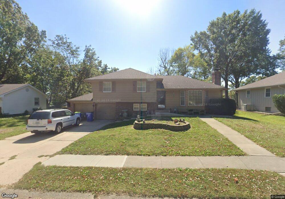
817 NE Chestnut St Lees Summit, MO 64086
Estimated Value: $280,695 - $301,000
3
Beds
2
Baths
1,192
Sq Ft
$242/Sq Ft
Est. Value
About This Home
This home is located at 817 NE Chestnut St, Lees Summit, MO 64086 and is currently estimated at $287,924, approximately $241 per square foot. 817 NE Chestnut St is a home located in Jackson County with nearby schools including Meadow Lane Elementary School, Bernard C. Campbell Middle School, and Lee's Summit North High School.
Ownership History
Date
Name
Owned For
Owner Type
Purchase Details
Closed on
Mar 25, 2013
Sold by
Peniston David I and Peniston David I
Bought by
Peniston David I and Peniston Tiffany D
Current Estimated Value
Home Financials for this Owner
Home Financials are based on the most recent Mortgage that was taken out on this home.
Original Mortgage
$94,000
Outstanding Balance
$66,483
Interest Rate
3.59%
Mortgage Type
New Conventional
Estimated Equity
$221,441
Purchase Details
Closed on
Apr 27, 2004
Sold by
Luetjen Marvin R and Luetjen Virginia R
Bought by
Peniston David I and Peniston Linda D
Home Financials for this Owner
Home Financials are based on the most recent Mortgage that was taken out on this home.
Original Mortgage
$135,850
Interest Rate
5%
Mortgage Type
Purchase Money Mortgage
Create a Home Valuation Report for This Property
The Home Valuation Report is an in-depth analysis detailing your home's value as well as a comparison with similar homes in the area
Home Values in the Area
Average Home Value in this Area
Purchase History
| Date | Buyer | Sale Price | Title Company |
|---|---|---|---|
| Peniston David I | -- | Chesterfield Title Agency Ll | |
| Peniston David I | -- | Ati Title |
Source: Public Records
Mortgage History
| Date | Status | Borrower | Loan Amount |
|---|---|---|---|
| Open | Peniston David I | $94,000 | |
| Closed | Peniston David I | $135,850 |
Source: Public Records
Tax History
| Year | Tax Paid | Tax Assessment Tax Assessment Total Assessment is a certain percentage of the fair market value that is determined by local assessors to be the total taxable value of land and additions on the property. | Land | Improvement |
|---|---|---|---|---|
| 2025 | $2,215 | $35,283 | $6,629 | $28,654 |
| 2024 | $2,199 | $30,681 | $6,456 | $24,225 |
| 2023 | $2,199 | $30,681 | $4,423 | $26,258 |
| 2022 | $2,239 | $27,740 | $4,122 | $23,618 |
| 2021 | $2,286 | $27,740 | $4,122 | $23,618 |
| 2020 | $2,199 | $26,423 | $4,122 | $22,301 |
| 2019 | $2,139 | $26,423 | $4,122 | $22,301 |
| 2018 | $2,006 | $22,996 | $3,587 | $19,409 |
| 2017 | $2,006 | $22,996 | $3,587 | $19,409 |
| 2016 | $1,975 | $22,420 | $3,572 | $18,848 |
Source: Public Records
Map
Nearby Homes
- 810 NE Chestnut St
- 809 NE Cedar St
- 809 NE Mulberry St
- 718 NE Mulberry St
- 1490 NE Independence Ave
- 717 NE Mulberry St
- 1708 NE Balboa St
- 1525 NE Yorkshire Dr
- 1625 NE Thames Dr
- 1300 NE Browning Ln
- 401 NE Mulberry St
- 400 NE Mulberry St
- 1141 NE Hunters Ridge
- 1128 NE Westwind Dr
- .342 acres NE Victoria Dr
- 1412 NE Ernest Way
- 1617 NE Auburn Dr
- 1016 NE Depot Dr
- 1116 NE Woodbury Ct
- 1401 NE Ernest Way
- 819 NE Chestnut St
- 815 NE Chestnut St
- 814 NE Chestnut St
- 816 NE Chestnut St
- 821 NE Chestnut St
- 812 NE Chestnut St
- 811 NE Chestnut St
- 814 NE Mulberry St
- 816 NE Mulberry St
- 818 NE Chestnut St
- 809 NE Chestnut St
- 818 NE Mulberry St
- 810 NE Mulberry St
- 808 NE Chestnut St
- 1601 NE White Dr Unit A
- 815 NE Mulberry St
- 1511 NE White Dr Unit A
- 817 NE Mulberry St
- 1515 NE White Dr Unit A
- 1515 NE White Dr
Your Personal Tour Guide
Ask me questions while you tour the home.