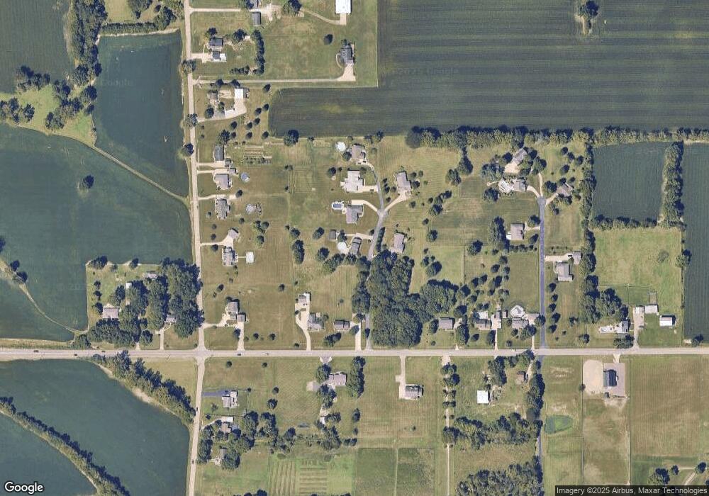
8176 New Haven Rd Harrison, OH 45030
Estimated Value: $453,000 - $548,000
3
Beds
3
Baths
2,336
Sq Ft
$208/Sq Ft
Est. Value
About This Home
This home is located at 8176 New Haven Rd, Harrison, OH 45030 and is currently estimated at $484,991, approximately $207 per square foot. 8176 New Haven Rd is a home located in Hamilton County with nearby schools including William Henry Harrison High School.
Ownership History
Date
Name
Owned For
Owner Type
Purchase Details
Closed on
Jun 30, 2003
Sold by
Long Brian W and Whitmer Alissa Whitmer
Bought by
Drew Douglas T and Radford Kristel J
Current Estimated Value
Home Financials for this Owner
Home Financials are based on the most recent Mortgage that was taken out on this home.
Original Mortgage
$202,900
Outstanding Balance
$86,913
Interest Rate
5.36%
Mortgage Type
Unknown
Estimated Equity
$398,078
Purchase Details
Closed on
Jun 19, 2000
Sold by
David L Schmidt Jr Builder Inc
Bought by
Long Brian W and Long Alissa Whitmer
Home Financials for this Owner
Home Financials are based on the most recent Mortgage that was taken out on this home.
Original Mortgage
$180,400
Interest Rate
8.56%
Purchase Details
Closed on
Nov 4, 1999
Sold by
Frost Matthew L and Frost Abbey Abirached
Bought by
David L Schmidt Jr Builder Inc
Purchase Details
Closed on
Dec 11, 1998
Sold by
Reuter Development Company Inc
Bought by
Frost Matthew L and Frost Abbey Abirached
Create a Home Valuation Report for This Property
The Home Valuation Report is an in-depth analysis detailing your home's value as well as a comparison with similar homes in the area
Home Values in the Area
Average Home Value in this Area
Purchase History
| Date | Buyer | Sale Price | Title Company |
|---|---|---|---|
| Drew Douglas T | $225,500 | Advanced Land Title Agency L | |
| Long Brian W | $189,900 | L & D Title Agency Inc | |
| David L Schmidt Jr Builder Inc | $34,500 | -- | |
| Frost Matthew L | $30,000 | Vintage Title Agency Inc |
Source: Public Records
Mortgage History
| Date | Status | Borrower | Loan Amount |
|---|---|---|---|
| Open | Drew Douglas T | $202,900 | |
| Previous Owner | Long Brian W | $180,400 |
Source: Public Records
Tax History Compared to Growth
Tax History
| Year | Tax Paid | Tax Assessment Tax Assessment Total Assessment is a certain percentage of the fair market value that is determined by local assessors to be the total taxable value of land and additions on the property. | Land | Improvement |
|---|---|---|---|---|
| 2024 | $5,604 | $133,781 | $20,381 | $113,400 |
| 2023 | $5,643 | $133,781 | $20,381 | $113,400 |
| 2022 | $5,259 | $108,808 | $16,030 | $92,778 |
| 2021 | $5,209 | $108,808 | $16,030 | $92,778 |
| 2020 | $5,260 | $108,808 | $16,030 | $92,778 |
| 2019 | $4,635 | $91,438 | $13,472 | $77,966 |
| 2018 | $4,670 | $91,438 | $13,472 | $77,966 |
| 2017 | $4,385 | $91,438 | $13,472 | $77,966 |
| 2016 | $3,850 | $84,928 | $13,472 | $71,456 |
| 2015 | $3,797 | $84,928 | $13,472 | $71,456 |
| 2014 | $3,817 | $84,928 | $13,472 | $71,456 |
| 2013 | $3,888 | $84,928 | $13,472 | $71,456 |
Source: Public Records
Map
Nearby Homes
- 10337 Paddys Run Rd
- 0 Hamilton Cleves Rd Unit 1796060
- 9730 Ohio 128
- 7376 New Haven Rd
- 7380 New Haven Rd
- 7506 Harbor Way
- 7522 Harbor Way
- 10522 Atterbury Dr
- 7117 Fort Scott Blvd
- 7113 Fort Scott Blvd
- 7079 Fort Scott Blvd
- Brennan Plan at Trailhead - Trailhead Denali
- Bennett Plan at Trailhead - Trailhead Denali
- Vanderburgh Plan at Trailhead - Trailhead Denali
- Stratton Plan at Trailhead - Trailhead Denali
- Buchanan Plan at Trailhead - Trailhead Denali
- Lyndhurst Plan at Trailhead - Trailhead Denali
- Alden Plan at Trailhead - Trailhead Denali
- Naples Plan at Trailhead - Trailhead Denali
- Quentin Plan at Trailhead - Trailhead Denali
- 8174 New Haven Rd
- 8160 New Haven Rd
- 8172 New Haven Rd
- 8180 New Haven Rd
- 8200 New Haven Rd
- 8168 New Haven Rd
- 8170 New Haven Rd
- 8140 New Haven Rd
- 10750 Crosby Rd
- 8197 New Haven Rd
- 10720 Crosby Rd
- 10780 Crosby Rd
- 8130 New Haven Rd
- 10790 Crosby Rd
- 8165 New Haven Rd
- 8106 New Haven Rd
- 10810 Crosby Rd
- 8100 New Haven Rd
- 8102 New Haven Rd
- 8110 New Haven Rd
