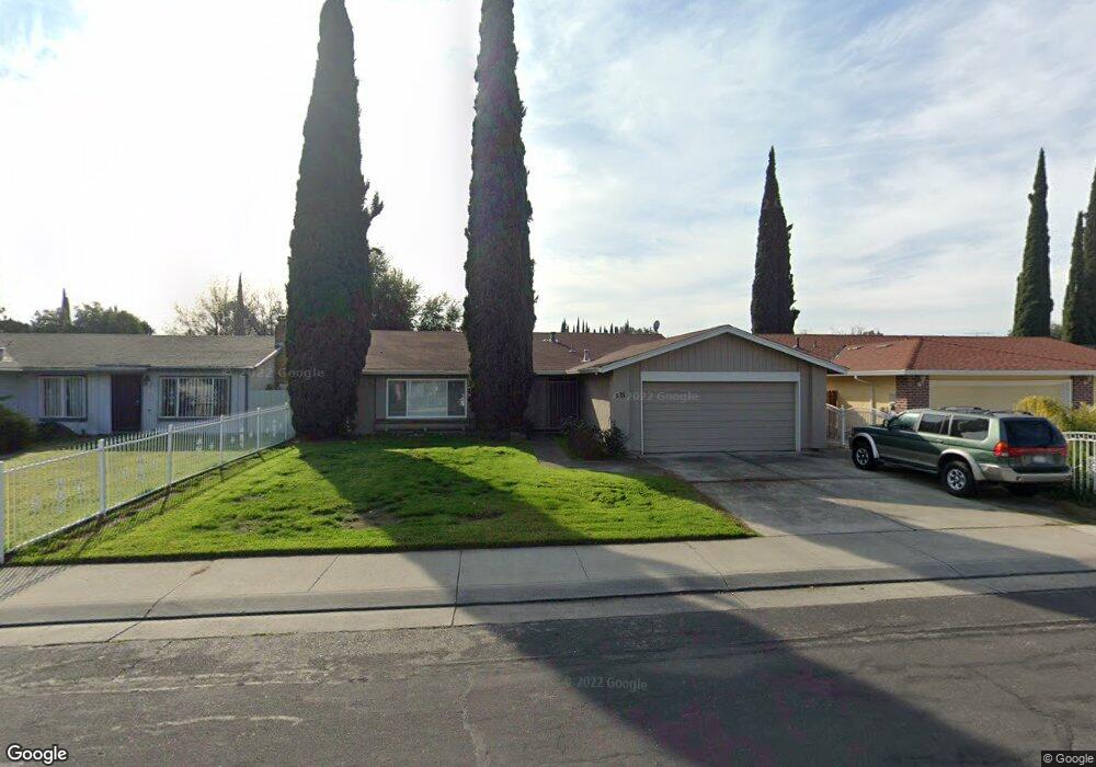
818 Dupont Dr Stockton, CA 95210
Valley Oak NeighborhoodEstimated Value: $230,000 - $416,000
3
Beds
2
Baths
1,536
Sq Ft
$238/Sq Ft
Est. Value
About This Home
This home is located at 818 Dupont Dr, Stockton, CA 95210 and is currently estimated at $364,884, approximately $237 per square foot. 818 Dupont Dr is a home located in San Joaquin County with nearby schools including Parklane Elementary School, Delta Sierra Middle School, and Ronald E. McNair High School.
Ownership History
Date
Name
Owned For
Owner Type
Purchase Details
Closed on
Nov 6, 2017
Sold by
Central Valley Capital Iv Lp
Bought by
Central Valley Capital I Llc
Current Estimated Value
Home Financials for this Owner
Home Financials are based on the most recent Mortgage that was taken out on this home.
Original Mortgage
$28,500,000
Interest Rate
3.94%
Mortgage Type
Commercial
Purchase Details
Closed on
Jul 24, 2017
Sold by
Delcarlo Dario and Del Carlo Margaret M
Bought by
Central Valley Capital Iv Lp
Home Financials for this Owner
Home Financials are based on the most recent Mortgage that was taken out on this home.
Original Mortgage
$130,500
Interest Rate
3.91%
Mortgage Type
Purchase Money Mortgage
Purchase Details
Closed on
Aug 12, 1996
Sold by
Delcarlo Dario and Delcarlo Margaret M
Bought by
Delcarlo Dario and Delcarlo Margaret M
Create a Home Valuation Report for This Property
The Home Valuation Report is an in-depth analysis detailing your home's value as well as a comparison with similar homes in the area
Home Values in the Area
Average Home Value in this Area
Purchase History
| Date | Buyer | Sale Price | Title Company |
|---|---|---|---|
| Central Valley Capital I Llc | $1,348,000 | None Available | |
| Central Valley Capital Iv Lp | $145,000 | Placer Title Company | |
| Delcarlo Dario | -- | -- | |
| Delcarlo Dario | -- | -- |
Source: Public Records
Mortgage History
| Date | Status | Borrower | Loan Amount |
|---|---|---|---|
| Previous Owner | Central Valley Capital I Llc | $28,500,000 | |
| Previous Owner | Central Valley Capital Iv Lp | $130,500 |
Source: Public Records
Tax History Compared to Growth
Tax History
| Year | Tax Paid | Tax Assessment Tax Assessment Total Assessment is a certain percentage of the fair market value that is determined by local assessors to be the total taxable value of land and additions on the property. | Land | Improvement |
|---|---|---|---|---|
| 2025 | $3,361 | $261,699 | $79,647 | $182,052 |
| 2024 | $2,795 | $245,410 | $66,929 | $178,481 |
| 2023 | $2,763 | $240,599 | $65,617 | $174,982 |
| 2022 | $2,675 | $235,882 | $64,331 | $171,551 |
| 2021 | $2,737 | $231,258 | $63,070 | $168,188 |
| 2020 | $2,672 | $228,888 | $62,424 | $166,464 |
| 2019 | $2,610 | $224,400 | $61,200 | $163,200 |
| 2018 | $2,563 | $220,000 | $60,000 | $160,000 |
| 2017 | $746 | $69,492 | $11,934 | $57,558 |
| 2016 | $702 | $68,129 | $11,700 | $56,429 |
| 2014 | $692 | $65,792 | $11,299 | $54,493 |
Source: Public Records
Map
Nearby Homes
- 723 Clinton Dr
- 801 Astor St
- 617 Clinton Dr
- 4424 Ijams Lot #6
- 4424
- 8024 Albany Dr
- 8226 Manhattan Dr
- 8219 New York Dr
- 1103 Summerview Dr
- 352 Jill Cir
- 7941 Diana Marie Dr
- 436 Morro Ln
- 8815 Damian Ct
- 1553 Pyrenees Ave Unit 35
- 1545 Pyrenees Ave Unit 30
- 1545 Pyrenees Ave Unit 27
- 1537 Pyrenees Ave Unit 21
- 1699 Pyrenees Ave Unit 96
- 7025 Kermit Ln
- 1725 Pyrenees Ave Unit 113