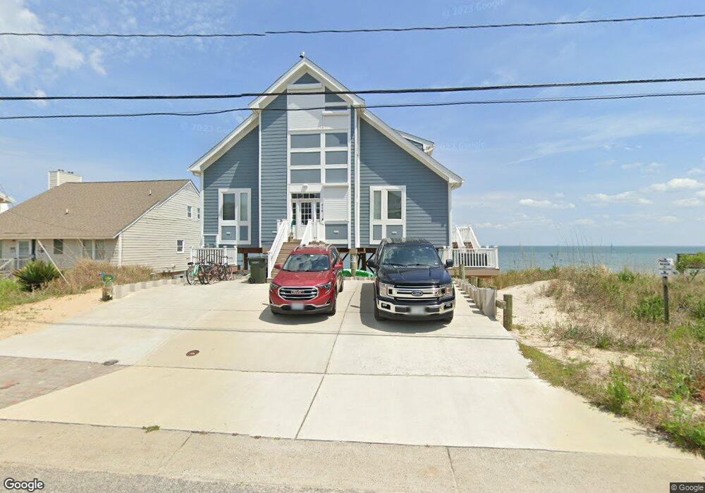
818 N First St Hampton, VA 23664
Buckroe Beach NeighborhoodEstimated Value: $1,009,214 - $1,182,000
4
Beds
4
Baths
2,546
Sq Ft
$427/Sq Ft
Est. Value
About This Home
This home is located at 818 N First St, Hampton, VA 23664 and is currently estimated at $1,087,554, approximately $427 per square foot. 818 N First St is a home located in Hampton City with nearby schools including Francis Asbury Elementary School, Benjamin Syms Middle School, and Phoebus High School.
Ownership History
Date
Name
Owned For
Owner Type
Purchase Details
Closed on
Aug 21, 2025
Sold by
Rolfe David J and Rolfe Susan C
Bought by
Rolfe Revocable Living Trust and Rolfe
Current Estimated Value
Purchase Details
Closed on
Nov 16, 2020
Sold by
Rolfe David J and Rolfe Susan C
Bought by
Rolfe David J and Rolfe Susan C
Purchase Details
Closed on
Mar 14, 2018
Sold by
Rolfe David J and Rolfe Susan C
Bought by
Rolfe David J and Rolfe Susan C
Purchase Details
Closed on
Oct 9, 2014
Sold by
Sheikh Zeehat and Bastawrous Sarah H
Bought by
Rolfe David J
Create a Home Valuation Report for This Property
The Home Valuation Report is an in-depth analysis detailing your home's value as well as a comparison with similar homes in the area
Home Values in the Area
Average Home Value in this Area
Purchase History
| Date | Buyer | Sale Price | Title Company |
|---|---|---|---|
| Rolfe Revocable Living Trust | -- | None Listed On Document | |
| Rolfe David J | -- | None Available | |
| Rolfe David J | -- | None Available | |
| Rolfe David J | $181,500 | -- |
Source: Public Records
Tax History
| Year | Tax Paid | Tax Assessment Tax Assessment Total Assessment is a certain percentage of the fair market value that is determined by local assessors to be the total taxable value of land and additions on the property. | Land | Improvement |
|---|---|---|---|---|
| 2025 | $9,445 | $835,500 | $325,000 | $510,500 |
| 2024 | $9,069 | $788,600 | $301,300 | $487,300 |
| 2023 | $9,148 | $788,600 | $301,300 | $487,300 |
| 2022 | $7,607 | $644,700 | $230,000 | $414,700 |
| 2021 | $6,871 | $543,600 | $184,000 | $359,600 |
| 2020 | $6,424 | $518,100 | $184,000 | $334,100 |
| 2019 | $6,199 | $499,900 | $184,000 | $315,900 |
| 2018 | $4,287 | $499,900 | $184,000 | $315,900 |
| 2017 | $2,282 | $0 | $0 | $0 |
| 2016 | $2,282 | $184,000 | $0 | $0 |
| 2015 | $2,282 | $0 | $0 | $0 |
| 2014 | $3,388 | $245,000 | $245,000 | $0 |
Source: Public Records
Map
Nearby Homes
- 22 Channel Ln
- 34 Channel Ln
- 10 Channel Ln
- 6 Channel Ln
- 1031 High Dunes Quay Unit 103
- 786 N First St
- 14 Bay Front Place
- 1003 High Dunes Quay Unit 101
- 1030 Porte Harbour Arch
- 36 Bay Front Place
- 1040 Porte Harbour Arch
- 231 Benthall Rd
- 750 N First St
- 1044 Porte Harbour Arch Unit 202
- 42 Bay Front Place
- 242 Genoa Dr Unit 20
- 47 Bay Front Place
- 309 Benthall Rd
- 116 Genoa Dr
- 730 Charthouse Cir
Your Personal Tour Guide
Ask me questions while you tour the home.