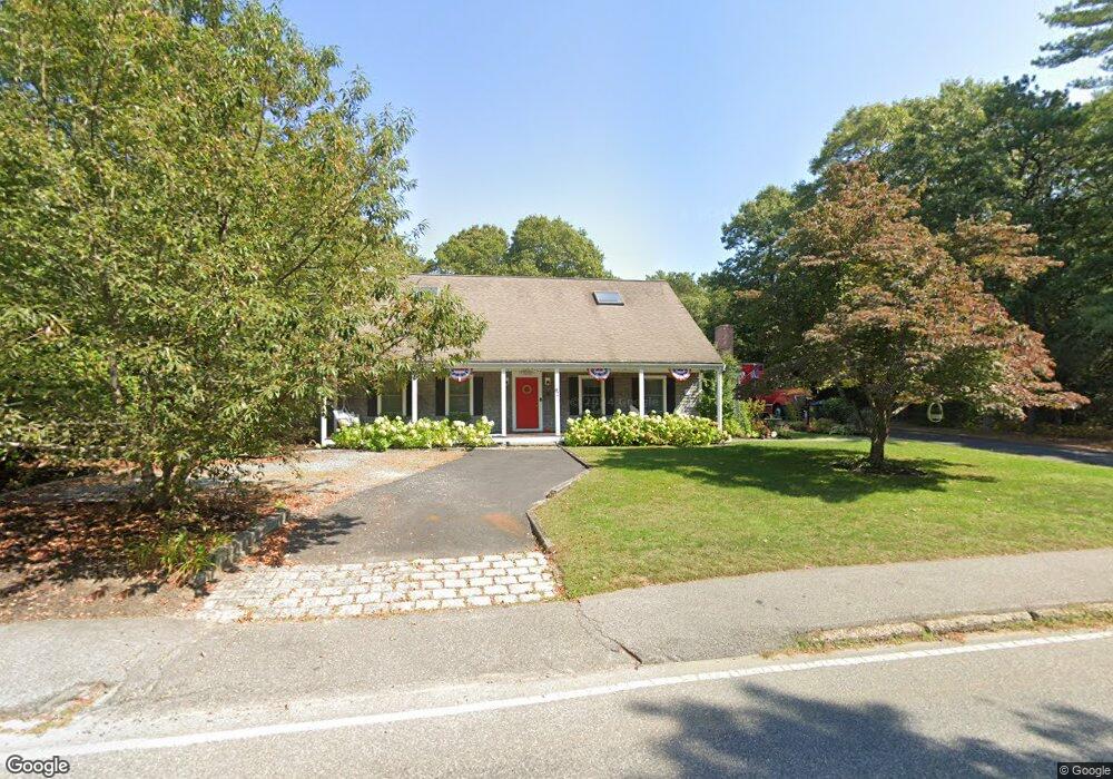
82 Old Oyster Rd Cotuit, MA 02635
Cotuit NeighborhoodEstimated Value: $1,024,027 - $1,584,000
3
Beds
4
Baths
2,809
Sq Ft
$448/Sq Ft
Est. Value
About This Home
This home is located at 82 Old Oyster Rd, Cotuit, MA 02635 and is currently estimated at $1,258,757, approximately $448 per square foot. 82 Old Oyster Rd is a home located in Barnstable County with nearby schools including West Villages Elementary School, Barnstable United Elementary School, and Barnstable Intermediate School.
Ownership History
Date
Name
Owned For
Owner Type
Purchase Details
Closed on
Sep 7, 2022
Sold by
Curtis James F
Bought by
Christine D Curtis T
Current Estimated Value
Purchase Details
Closed on
Jun 8, 2004
Sold by
Curtis Carol Grauer
Bought by
Curtis James F
Home Financials for this Owner
Home Financials are based on the most recent Mortgage that was taken out on this home.
Original Mortgage
$373,750
Interest Rate
5.94%
Mortgage Type
Purchase Money Mortgage
Create a Home Valuation Report for This Property
The Home Valuation Report is an in-depth analysis detailing your home's value as well as a comparison with similar homes in the area
Home Values in the Area
Average Home Value in this Area
Purchase History
| Date | Buyer | Sale Price | Title Company |
|---|---|---|---|
| Christine D Curtis T | -- | None Available | |
| Curtis James F | $575,000 | -- |
Source: Public Records
Mortgage History
| Date | Status | Borrower | Loan Amount |
|---|---|---|---|
| Previous Owner | Curtis James F | $373,750 |
Source: Public Records
Tax History
| Year | Tax Paid | Tax Assessment Tax Assessment Total Assessment is a certain percentage of the fair market value that is determined by local assessors to be the total taxable value of land and additions on the property. | Land | Improvement |
|---|---|---|---|---|
| 2025 | $7,551 | $904,300 | $228,000 | $676,300 |
| 2024 | $6,877 | $872,700 | $228,000 | $644,700 |
| 2023 | $6,607 | $789,400 | $207,300 | $582,100 |
| 2022 | $6,581 | $636,500 | $142,600 | $493,900 |
| 2021 | $6,303 | $570,900 | $144,800 | $426,100 |
| 2020 | $6,402 | $546,700 | $144,800 | $401,900 |
| 2019 | $6,157 | $518,300 | $153,600 | $364,700 |
| 2018 | $5,904 | $497,000 | $179,000 | $318,000 |
| 2017 | $5,745 | $486,900 | $179,000 | $307,900 |
| 2016 | $5,582 | $485,000 | $177,100 | $307,900 |
| 2015 | $5,671 | $492,300 | $177,300 | $315,000 |
Source: Public Records
Map
Nearby Homes
- 804 Main St
- 239 Oxford Dr
- 916 Main St
- 135 Putnam Avenue (Land)
- 33 Oyster Place Rd
- 30 Wings Ln
- 1081 Main St
- 6 Cedar St
- 6 Cedar St
- 188 Ocean View Ave
- 226 Dunrobin Rd
- 602 Putnam Ave
- 70 Simons Rd Unit E
- 70 Simons Rd
- 311 Waquoit Rd
- 70 Cape Dr Unit 14D
- 70 Cape Dr Unit 11D
- 70 Cape Dr Unit 11D
- 640 Poponessett Rd
- 640 Poponessett Rd
- 150 Highland Ave
- 160 Highland Ave
- 75 Old Oyster Rd
- 9 West St
- 26 Old Oyster Rd
- 136 Highland Ave
- 705 Main St
- 29 Old Oyster Rd
- 157 Highland Ave
- 141 Highland Ave
- 173 Highland Ave
- 124 Highland Ave
- 40 Lewis Pond Rd
- 50 West St
- 26 Lewis Pond Rd
- 19 Old Oyster Rd
- 125 Highland Ave
- 36 Peirson Way
- 82 Coolidge St
- 110 Highland Ave
Your Personal Tour Guide
Ask me questions while you tour the home.