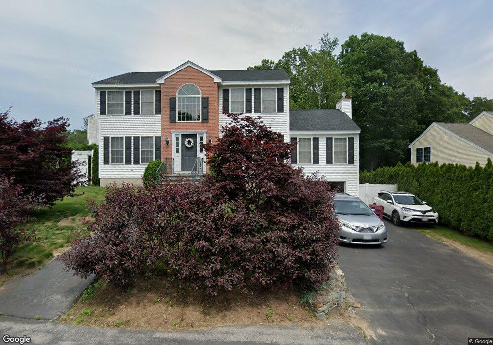
82 Photine Dr Lowell, MA 01854
Pawtucketville NeighborhoodEstimated Value: $703,496 - $788,000
About This Home
This home is located at 82 Photine Dr, Lowell, MA 01854 and is currently estimated at $729,374, approximately $297 per square foot. 82 Photine Dr is a home located in Middlesex County with nearby schools including Joseph McAvinnue Elementary School, Charlotte M. Murkland Elementary School, and Dr. Gertrude Bailey Elementary School.
Ownership History
We collect this data history from publicly available records. To have your information removed, we recommend requesting removal directly through your county’s website.
Purchase Details
Home Financials for this Owner
Home Financials are based on the most recent Mortgage that was taken out on this home.Home Values in the Area
Average Home Value in this Area
Purchase History
We collect this data history from publicly available records. To have your information removed, we recommend requesting removal directly through your county’s website.
| Date | Buyer | Sale Price | Title Company |
|---|---|---|---|
| $232,900 | -- | ||
| $232,900 | -- |
Mortgage History
We collect this data history from publicly available records. To have your information removed, we recommend requesting removal directly through your county’s website.
| Date | Status | Borrower | Loan Amount |
|---|---|---|---|
| Open | $150,000 | ||
| Closed | $150,000 |
Tax History
We collect this data history from publicly available records. To have your information removed, we recommend requesting removal directly through your county’s website.
| Year | Tax Paid | Tax Assessment Tax Assessment Total Assessment is a certain percentage of the fair market value that is determined by local assessors to be the total taxable value of land and additions on the property. | Land | Improvement |
|---|---|---|---|---|
| 2025 | $7,175 | $625,000 | $192,300 | $432,700 |
| 2024 | $7,297 | $612,700 | $179,800 | $432,900 |
| 2023 | $6,908 | $556,200 | $156,300 | $399,900 |
| 2022 | $6,368 | $501,800 | $142,200 | $359,600 |
| 2021 | $5,959 | $442,700 | $123,600 | $319,100 |
| 2020 | $5,768 | $431,700 | $126,100 | $305,600 |
| 2019 | $5,970 | $425,200 | $111,100 | $314,100 |
| 2018 | $5,934 | $412,400 | $105,800 | $306,600 |
| 2017 | $5,653 | $378,900 | $96,200 | $282,700 |
| 2016 | $5,646 | $372,400 | $89,700 | $282,700 |
| 2015 | $5,209 | $336,500 | $87,800 | $248,700 |
| 2013 | $4,953 | $330,000 | $110,500 | $219,500 |
Map
- 101 Laurie Ln
- 20 Laurie Ln
- 285 W Meadow Rd
- 15 Meadow Dr
- 364 W Meadow Rd
- 1510 Skyline Dr Unit 12
- 2400 Skyline Dr Unit 1
- 1600 Skyline Dr Unit 6
- 2510 Skyline Dr Unit 7
- 2200 Skyline Dr Unit 4
- 54 Shirley Ave
- 351 Pawtucket Blvd Unit 7
- 24 Royal Ave
- 88 Boulevard St
- 45 Hayes Ave
- 325 Mammoth Rd Unit 3
- 325 Mammoth Rd Unit 1
- 12 Gerrish Ave
- 84 Fowler Rd
- 57 Magnolia St
Ask me questions while you tour the home.