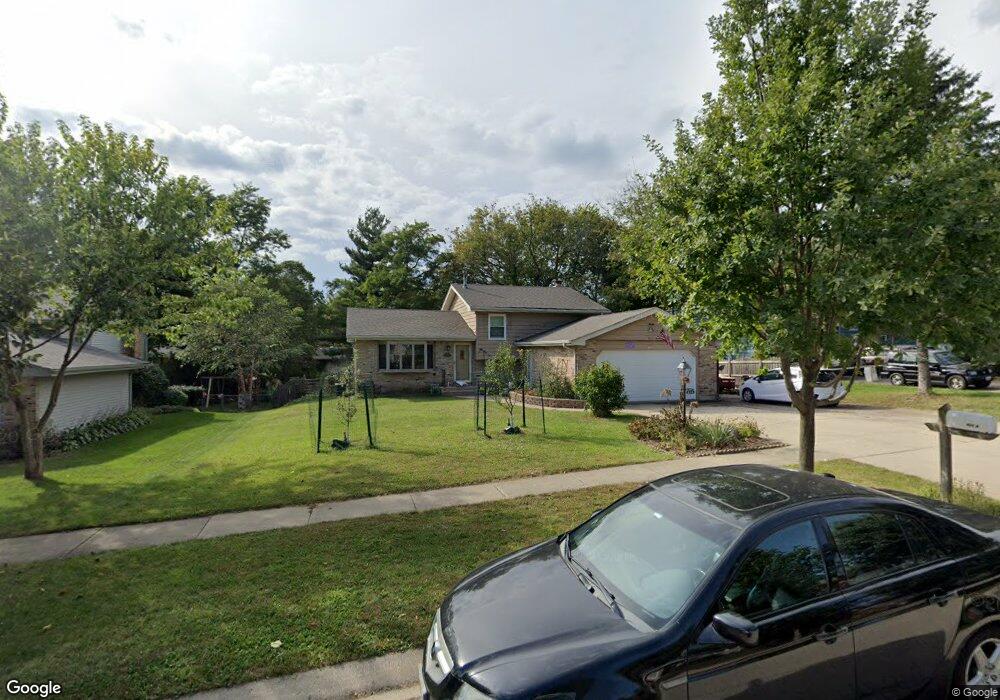
820 W Vista Dr Algonquin, IL 60102
Estimated Value: $348,171 - $454,000
4
Beds
3
Baths
1,864
Sq Ft
$216/Sq Ft
Est. Value
About This Home
This home is located at 820 W Vista Dr, Algonquin, IL 60102 and is currently estimated at $402,043, approximately $215 per square foot. 820 W Vista Dr is a home located in McHenry County with nearby schools including Eastview Elementary School, Algonquin Middle School, and Dundee-Crown High School.
Ownership History
Date
Name
Owned For
Owner Type
Purchase Details
Closed on
Apr 30, 2003
Sold by
Bronson James A and Bronson Jacqueline M
Bought by
Bedell Trephina L and Bedell Jonathon C
Current Estimated Value
Home Financials for this Owner
Home Financials are based on the most recent Mortgage that was taken out on this home.
Original Mortgage
$186,800
Outstanding Balance
$82,132
Interest Rate
5.95%
Mortgage Type
Unknown
Estimated Equity
$319,911
Create a Home Valuation Report for This Property
The Home Valuation Report is an in-depth analysis detailing your home's value as well as a comparison with similar homes in the area
Purchase History
| Date | Buyer | Sale Price | Title Company |
|---|---|---|---|
| Bedell Trephina L | $233,500 | Multiple |
Source: Public Records
Mortgage History
| Date | Status | Borrower | Loan Amount |
|---|---|---|---|
| Open | Bedell Trephina L | $186,800 | |
| Closed | Bedell Trephina L | $35,025 |
Source: Public Records
Tax History
| Year | Tax Paid | Tax Assessment Tax Assessment Total Assessment is a certain percentage of the fair market value that is determined by local assessors to be the total taxable value of land and additions on the property. | Land | Improvement |
|---|---|---|---|---|
| 2024 | $7,615 | $105,348 | $13,295 | $92,053 |
| 2023 | $7,218 | $94,221 | $11,891 | $82,330 |
| 2022 | $6,841 | $85,774 | $24,977 | $60,797 |
| 2021 | $6,558 | $79,909 | $23,269 | $56,640 |
| 2020 | $6,382 | $77,080 | $22,445 | $54,635 |
| 2019 | $6,223 | $73,775 | $21,483 | $52,292 |
| 2018 | $5,924 | $68,153 | $19,846 | $48,307 |
| 2017 | $5,796 | $64,204 | $18,696 | $45,508 |
| 2016 | $5,701 | $60,217 | $17,535 | $42,682 |
| 2013 | -- | $60,435 | $16,357 | $44,078 |
Source: Public Records
Map
Nearby Homes
- 0 Natoma Trail
- lot 25 Wabican Trail
- 719 Webster St
- 1420 Greenridge Ave
- Lot #3-5 Hayes Rd
- 21 Division St
- 600 E Algonquin Rd
- 407 La Fox River Dr
- 1188 E Algonquin Rd
- 0 River Dr N Unit MRD12473279
- 953 Old Oak Cir
- Lot 4 b Ryan Pkwy
- 1770 E Algonquin Rd
- 1031 Timberwood Ln
- 308 Rustic Ln
- 615 Harper Dr
- 1923 Ozark Pkwy
- 1906 Ozark Pkwy
- 1782 Cumberland Pkwy
- 1321 Big Sur Pkwy
Your Personal Tour Guide
Ask me questions while you tour the home.