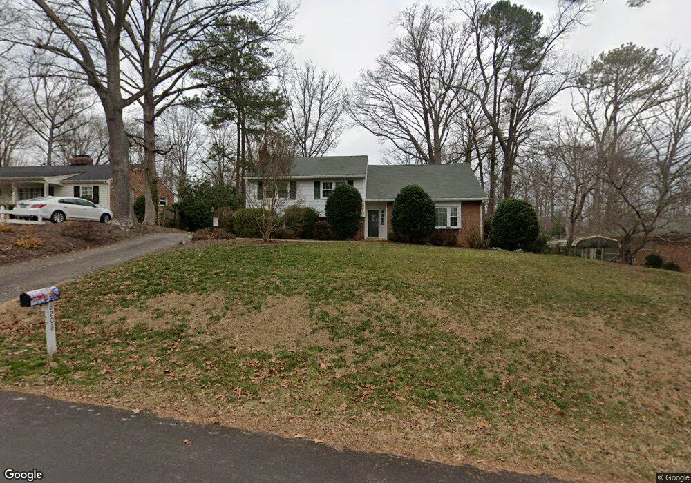
8208 Ammonett Dr Richmond, VA 23235
Oxford NeighborhoodEstimated Value: $492,961 - $627,000
4
Beds
3
Baths
2,443
Sq Ft
$226/Sq Ft
Est. Value
About This Home
This home is located at 8208 Ammonett Dr, Richmond, VA 23235 and is currently estimated at $551,740, approximately $225 per square foot. 8208 Ammonett Dr is a home located in Richmond City with nearby schools including J.B. Fisher Elementary School, Lucille M. Brown Middle, and Huguenot High School.
Ownership History
Date
Name
Owned For
Owner Type
Purchase Details
Closed on
Jun 13, 2023
Sold by
King Lenard G
Bought by
King Asset Protection Trust
Current Estimated Value
Purchase Details
Closed on
Sep 3, 2002
Sold by
Pritchard Frances A
Bought by
King Lenard G and King Mararet E
Home Financials for this Owner
Home Financials are based on the most recent Mortgage that was taken out on this home.
Original Mortgage
$120,000
Interest Rate
6.55%
Mortgage Type
New Conventional
Create a Home Valuation Report for This Property
The Home Valuation Report is an in-depth analysis detailing your home's value as well as a comparison with similar homes in the area
Home Values in the Area
Average Home Value in this Area
Purchase History
| Date | Buyer | Sale Price | Title Company |
|---|---|---|---|
| King Asset Protection Trust | -- | None Listed On Document | |
| King Lenard G | $172,500 | -- |
Source: Public Records
Mortgage History
| Date | Status | Borrower | Loan Amount |
|---|---|---|---|
| Previous Owner | King Lenard G | $120,000 |
Source: Public Records
Tax History Compared to Growth
Tax History
| Year | Tax Paid | Tax Assessment Tax Assessment Total Assessment is a certain percentage of the fair market value that is determined by local assessors to be the total taxable value of land and additions on the property. | Land | Improvement |
|---|---|---|---|---|
| 2025 | $4,176 | $348,000 | $108,000 | $240,000 |
| 2024 | $4,032 | $336,000 | $96,000 | $240,000 |
| 2023 | $3,816 | $318,000 | $86,000 | $232,000 |
| 2022 | $3,300 | $275,000 | $70,000 | $205,000 |
| 2021 | $2,964 | $248,000 | $50,000 | $198,000 |
| 2020 | $2,964 | $247,000 | $50,000 | $197,000 |
| 2019 | $2,712 | $226,000 | $50,000 | $176,000 |
| 2018 | $2,496 | $208,000 | $50,000 | $158,000 |
| 2017 | $2,304 | $192,000 | $50,000 | $142,000 |
| 2016 | $2,280 | $190,000 | $50,000 | $140,000 |
| 2015 | $2,196 | $183,000 | $47,000 | $136,000 |
| 2014 | $2,196 | $183,000 | $47,000 | $136,000 |
Source: Public Records
Map
Nearby Homes
- 8265 Halstead Rd
- 3041 Darnley Dr
- 3350 E Weyburn Rd
- 3010 Scherer Dr
- 3120 Archdale Rd
- 8031 Burrundie Dr
- 2924 Halstead Rd
- 8324 Chelmford Rd
- 2607 Lansdale Rd
- 8633 Devara Ct
- 3600 Sherbrook Rd
- 3416 Rivanna Dr
- 8405 Forest Hill Ave
- 2313 Stratford Ct
- 8001 Robert Bruce Dr
- 8517 Elm Rd
- 3819 Wakefield Rd
- 3620 Tanby Rd
- 8512 Ben Nevis Dr
- 7709 Prairie Rd
- 8216 Ammonett Dr
- 8200 Ammonett Dr
- 8209 Barningham Rd
- 8201 Barningham Rd
- 8224 Ammonett Dr
- 8217 Barningham Rd
- 8209 Ammonett Dr
- 8217 Ammonett Dr
- 8201 Ammonett Dr
- 8225 Barningham Rd
- 8140 Ammonett Dr
- 8225 Ammonett Dr
- 8232 Ammonett Dr
- 2913 E Weyburn Rd
- 8231 Barningham Rd
- 2846 E Weyburn Rd
- 2921 E Weyburn Rd
- 8200 Barningham Rd
- 8210 Barningham Rd
- 8237 Ammonett Dr