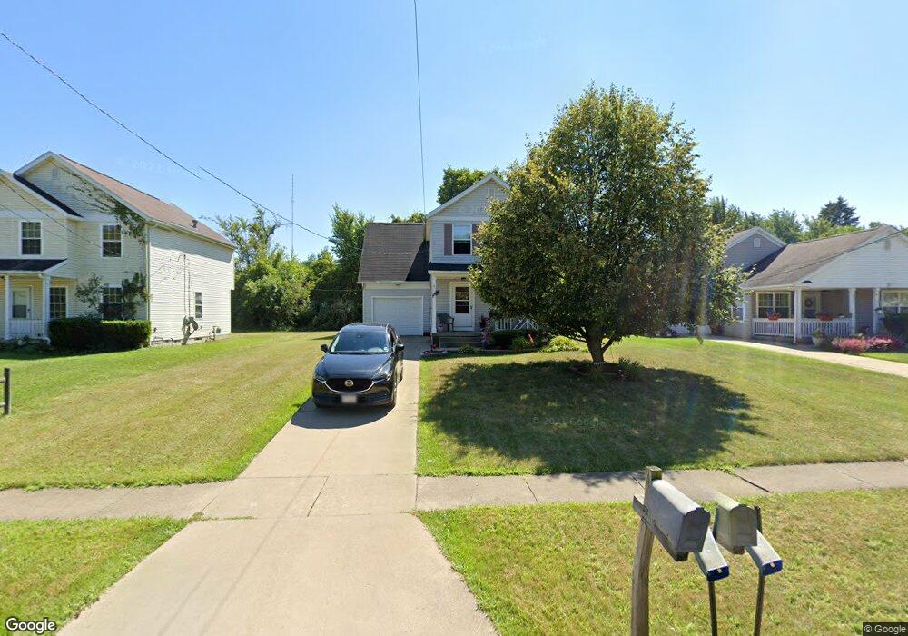
821 King St Mansfield, OH 44903
Estimated Value: $121,200 - $129,000
3
Beds
2
Baths
1,483
Sq Ft
$85/Sq Ft
Est. Value
About This Home
This home is located at 821 King St, Mansfield, OH 44903 and is currently estimated at $126,050, approximately $84 per square foot. 821 King St is a home located in Richland County with nearby schools including Mansfield Elective Academy, Foundation Academy, and Goal Digital Academy.
Create a Home Valuation Report for This Property
The Home Valuation Report is an in-depth analysis detailing your home's value as well as a comparison with similar homes in the area
Home Values in the Area
Average Home Value in this Area
Tax History
| Year | Tax Paid | Tax Assessment Tax Assessment Total Assessment is a certain percentage of the fair market value that is determined by local assessors to be the total taxable value of land and additions on the property. | Land | Improvement |
|---|---|---|---|---|
| 2024 | $794 | $16,570 | $2,980 | $13,590 |
| 2023 | $793 | $16,570 | $2,980 | $13,590 |
| 2022 | $453 | $7,930 | $2,710 | $5,220 |
| 2021 | $456 | $7,930 | $2,710 | $5,220 |
| 2020 | $467 | $7,930 | $2,710 | $5,220 |
| 2019 | $517 | $7,930 | $2,710 | $5,220 |
| 2018 | $510 | $7,930 | $2,710 | $5,220 |
| 2017 | $504 | $7,930 | $2,710 | $5,220 |
| 2016 | $512 | $7,930 | $2,580 | $5,350 |
| 2015 | $512 | $7,930 | $2,580 | $5,350 |
| 2014 | $483 | $7,930 | $2,580 | $5,350 |
| 2012 | $194 | $8,340 | $2,710 | $5,630 |
Source: Public Records
Map
Nearby Homes
- 641 Averill Ave
- 688 Mcpherson St
- 0 State Route 314 Unit 9069650
- 492 Stark St
- 739 Armstrong St
- 572 France St
- 728 N Trimble Rd
- 0 Highway 30
- 340 Boston Ave
- 480 Mcpherson St
- 891 Springmill Rd
- 0 W Fourth St - Trimble Lenox
- 230 Rae Ave
- 878 Fairfax Ave
- 701 Springmill St
- 933 Fairfax Ave
- 212 Penn Ave
- 0 Voegele Ave Unit Lot 6048, 6049, 6
- 362-364 W 6th St
- 368 W 6th St
Your Personal Tour Guide
Ask me questions while you tour the home.