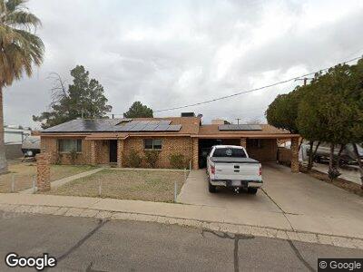
821 W Stirrup Dr Safford, AZ 85546
Estimated Value: $292,803 - $335,000
--
Bed
--
Bath
2,302
Sq Ft
$135/Sq Ft
Est. Value
About This Home
This home is located at 821 W Stirrup Dr, Safford, AZ 85546 and is currently estimated at $309,701, approximately $134 per square foot. 821 W Stirrup Dr is a home located in Graham County with nearby schools including Dorothy Stinson School, Ruth Powell Elementary School, and Lafe Nelson School.
Ownership History
Date
Name
Owned For
Owner Type
Purchase Details
Closed on
Aug 30, 2018
Sold by
Haralson Bradley S and Murphy Kim J
Bought by
Hockersmith Mike and Hockersmith Melissa
Current Estimated Value
Home Financials for this Owner
Home Financials are based on the most recent Mortgage that was taken out on this home.
Original Mortgage
$162,526
Interest Rate
5.12%
Mortgage Type
FHA
Purchase Details
Closed on
Nov 9, 2012
Sold by
Harralson Bradley S
Bought by
Haralson Bradley S and Murphy Kim J
Create a Home Valuation Report for This Property
The Home Valuation Report is an in-depth analysis detailing your home's value as well as a comparison with similar homes in the area
Home Values in the Area
Average Home Value in this Area
Purchase History
| Date | Buyer | Sale Price | Title Company |
|---|---|---|---|
| Hockersmith Mike | $165,525 | Pioneer Title Agency | |
| Haralson Bradley S | -- | None Available |
Source: Public Records
Mortgage History
| Date | Status | Borrower | Loan Amount |
|---|---|---|---|
| Open | Hockers Mith Mike | $5,742 | |
| Open | Hockersmith Mike | $231,990 | |
| Closed | Hockersmith Mike | $159,021 | |
| Closed | Hockersmith Mike | $162,526 |
Source: Public Records
Tax History Compared to Growth
Tax History
| Year | Tax Paid | Tax Assessment Tax Assessment Total Assessment is a certain percentage of the fair market value that is determined by local assessors to be the total taxable value of land and additions on the property. | Land | Improvement |
|---|---|---|---|---|
| 2026 | $936 | -- | -- | -- |
| 2025 | $936 | $23,773 | $1,638 | $22,135 |
| 2024 | $972 | $22,211 | $1,638 | $20,573 |
| 2023 | $972 | $17,669 | $1,638 | $16,031 |
| 2022 | $955 | $15,636 | $1,638 | $13,998 |
| 2021 | $1,054 | $0 | $0 | $0 |
| 2020 | $1,013 | $0 | $0 | $0 |
| 2019 | $1,067 | $0 | $0 | $0 |
| 2018 | $1,196 | $0 | $0 | $0 |
| 2017 | $955 | $0 | $0 | $0 |
| 2016 | $882 | $0 | $0 | $0 |
| 2015 | $805 | $0 | $0 | $0 |
Source: Public Records
Map
Nearby Homes
- 1785 Camilla Cir
- 1609 S 12th Ave
- 2107 S 10th Ave
- 1309 S Bingham Place
- 401 W Bonita St
- 1207 W Tucson St
- 1206 S 6th Ave
- 2215 S Lamonica Way
- 1204 S 5th Ave
- 545 W Keisha Ln
- 816 W 11th St
- 1670 W Relation St
- 115 W 15th St
- 1405 W 24th St
- 835 W 25th St
- 1879 W Peppertree Dr
- 1895 W 26th St
- 0 S 20th Ave Unit no 22325261
- 130 E Montana Way
- 1105 S 1st Ave
- 821 W Stirrup Dr
- 815 W Stirrup Dr
- 819 W Stirrup Dr
- 832 W Stirrup Dr
- 823 W Stirrup Dr
- 817 W Stirrup Dr
- 817 W Stirrup Dr
- 813 W Stirrup Dr
- 830 W Stirrup Dr
- 825 W Stirrup Dr
- 834 W Stirrup Dr
- 816 W Stirrup Dr
- 0 W Stirrup Dr
- 811 W Stirrup Dr
- 828 W Stirrup Dr
- 818 W Stirrup Dr
- 1863 Mesa Cir
- 826 W Stirrup Dr
- 826 W Stirrup Dr
- 824 W Stirrup Dr