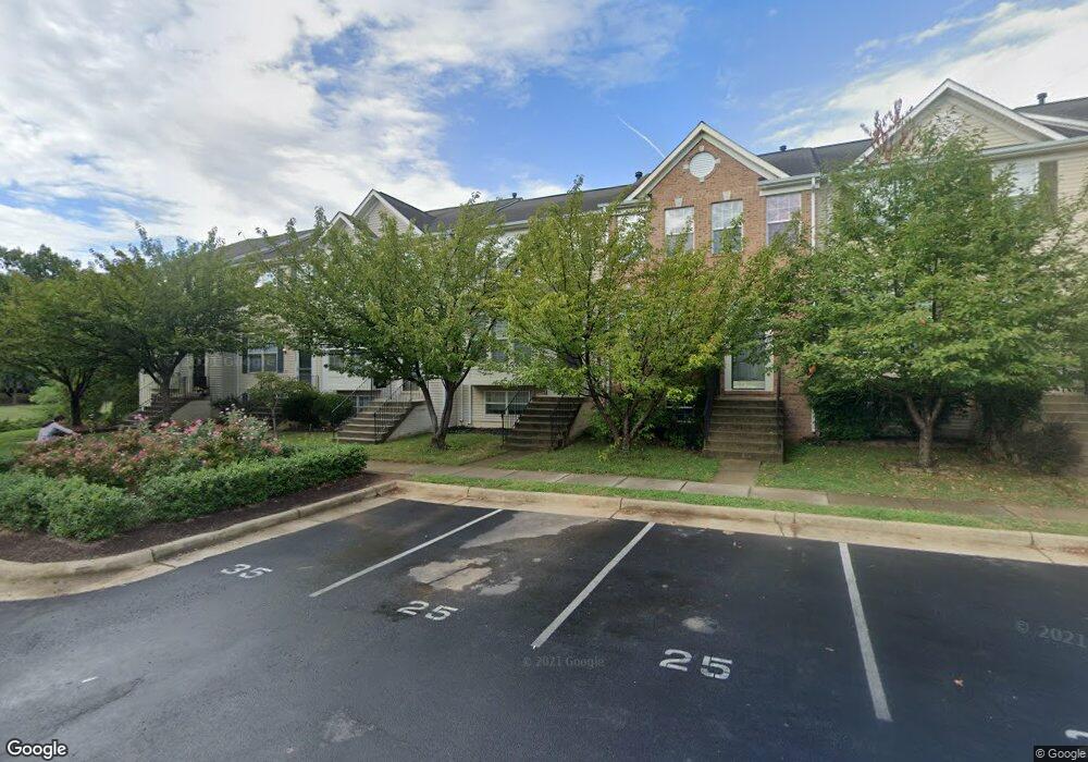
8220 Humphrey Ln Manassas, VA 20109
Estimated Value: $439,101 - $503,000
3
Beds
2
Baths
1,380
Sq Ft
$343/Sq Ft
Est. Value
About This Home
This home is located at 8220 Humphrey Ln, Manassas, VA 20109 and is currently estimated at $474,025, approximately $343 per square foot. 8220 Humphrey Ln is a home located in Prince William County with nearby schools including George P. Mullen Elementary School, Unity Braxton Middle School, and Unity Reed High School.
Ownership History
Date
Name
Owned For
Owner Type
Purchase Details
Closed on
Dec 15, 2000
Sold by
Richmond American Home So
Bought by
Edwards Doris C
Current Estimated Value
Home Financials for this Owner
Home Financials are based on the most recent Mortgage that was taken out on this home.
Original Mortgage
$150,363
Outstanding Balance
$55,410
Interest Rate
7.7%
Estimated Equity
$418,615
Create a Home Valuation Report for This Property
The Home Valuation Report is an in-depth analysis detailing your home's value as well as a comparison with similar homes in the area
Home Values in the Area
Average Home Value in this Area
Purchase History
| Date | Buyer | Sale Price | Title Company |
|---|---|---|---|
| Edwards Doris C | $150,440 | -- |
Source: Public Records
Mortgage History
| Date | Status | Borrower | Loan Amount |
|---|---|---|---|
| Open | Edwards Doris C | $150,363 |
Source: Public Records
Tax History Compared to Growth
Tax History
| Year | Tax Paid | Tax Assessment Tax Assessment Total Assessment is a certain percentage of the fair market value that is determined by local assessors to be the total taxable value of land and additions on the property. | Land | Improvement |
|---|---|---|---|---|
| 2025 | $4,008 | $445,000 | $131,800 | $313,200 |
| 2024 | $4,008 | $403,000 | $122,000 | $281,000 |
| 2023 | $4,049 | $389,100 | $117,700 | $271,400 |
| 2022 | $3,974 | $358,800 | $105,000 | $253,800 |
| 2021 | $4,099 | $334,600 | $95,000 | $239,600 |
| 2020 | $4,830 | $311,600 | $95,000 | $216,600 |
| 2019 | $4,552 | $293,700 | $82,200 | $211,500 |
| 2018 | $3,301 | $273,400 | $76,200 | $197,200 |
| 2017 | $3,258 | $262,300 | $74,700 | $187,600 |
| 2016 | $3,170 | $257,500 | $72,800 | $184,700 |
| 2015 | $2,988 | $254,600 | $72,800 | $181,800 |
| 2014 | $2,988 | $237,200 | $65,500 | $171,700 |
Source: Public Records
Map
Nearby Homes
- 11074 Wainwright Place
- 8141 Bayonet Way
- 8312 Wallace Ln
- 11185 Wortham Crest Cir
- 8107 Lacy Dr Unit 201
- 8091 Lacy Dr Unit 101
- 8091 Lacy Dr Unit 201
- 11005 Kinship Ct Unit 303
- 8083 Lacy Dr Unit 101
- 11010 Koman Cir
- 11006 Koman Cir Unit 202
- 11002 Koman Cir Unit 104
- 11002 Koman Cir Unit 103
- 10946 Mission Ridge Dr
- 10875 Stone Hill Ln
- 7967 Calvary Ct
- 11054 Clovertree Ct
- 10812 Caraway Cir
- 8239 Blue Ridge Ct
- 7913 Rebel Walk Dr
- 8222 Humphrey Ln
- 8218 Humphrey Ln
- 8216 Humphrey Ln
- 8224 Humphrey Ln
- 8226 Humphrey Ln
- 8214 Humphrey Ln
- 8230 Humphrey Ln
- 11058 Doubleday Ln
- 11060 Doubleday Ln
- 11056 Doubleday Ln
- 11062 Doubleday Ln
- 11054 Doubleday Ln
- 8210 Humphrey Ln
- 8232 Humphrey Ln
- 11064 Doubleday Ln
- 11052 Doubleday Ln
- 8234 Humphrey Ln
- 8208 Humphrey Ln
- 8236 Humphrey Ln
- 8237 Humphrey Ln