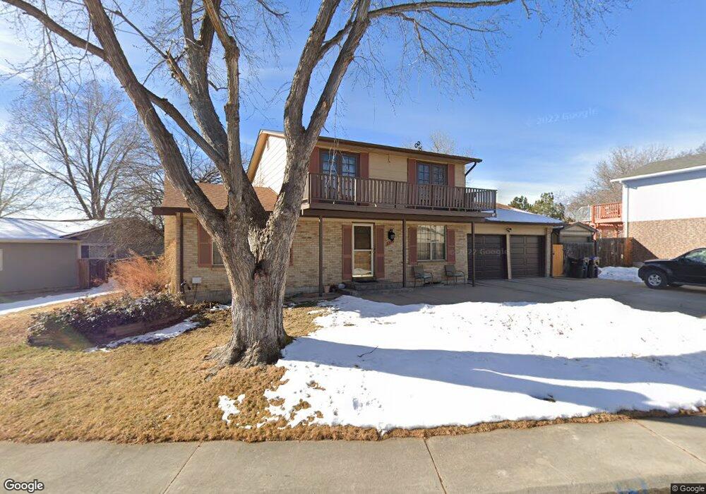
8229 Newland Ct Arvada, CO 80003
Lake Arbor NeighborhoodEstimated Value: $561,351 - $654,000
5
Beds
4
Baths
2,651
Sq Ft
$230/Sq Ft
Est. Value
About This Home
This home is located at 8229 Newland Ct, Arvada, CO 80003 and is currently estimated at $610,588, approximately $230 per square foot. 8229 Newland Ct is a home located in Jefferson County with nearby schools including Little Elementary School, Pomona High School, and Shepherd Of The Valley Lutheran School.
Ownership History
Date
Name
Owned For
Owner Type
Purchase Details
Closed on
Aug 14, 2013
Sold by
Kania Stanislaw
Bought by
Buckner David and Buckner Adrienne
Current Estimated Value
Home Financials for this Owner
Home Financials are based on the most recent Mortgage that was taken out on this home.
Original Mortgage
$260,988
Outstanding Balance
$189,023
Interest Rate
3.75%
Mortgage Type
FHA
Estimated Equity
$421,565
Purchase Details
Closed on
Jan 28, 2009
Sold by
Kania Sandra Marie
Bought by
Kania Stanislaw
Create a Home Valuation Report for This Property
The Home Valuation Report is an in-depth analysis detailing your home's value as well as a comparison with similar homes in the area
Home Values in the Area
Average Home Value in this Area
Purchase History
| Date | Buyer | Sale Price | Title Company |
|---|---|---|---|
| Buckner David | $270,000 | Ht | |
| Kania Stanislaw | -- | None Available |
Source: Public Records
Mortgage History
| Date | Status | Borrower | Loan Amount |
|---|---|---|---|
| Open | Buckner David | $260,988 |
Source: Public Records
Tax History
| Year | Tax Paid | Tax Assessment Tax Assessment Total Assessment is a certain percentage of the fair market value that is determined by local assessors to be the total taxable value of land and additions on the property. | Land | Improvement |
|---|---|---|---|---|
| 2024 | $3,032 | $31,262 | $11,919 | $19,343 |
| 2023 | $3,032 | $31,262 | $11,919 | $19,343 |
| 2022 | $2,742 | $27,996 | $8,319 | $19,677 |
| 2021 | $2,787 | $28,802 | $8,559 | $20,243 |
| 2020 | $2,576 | $26,695 | $8,011 | $18,684 |
| 2019 | $2,541 | $26,695 | $8,011 | $18,684 |
| 2018 | $2,233 | $22,808 | $6,409 | $16,399 |
| 2017 | $2,044 | $22,808 | $6,409 | $16,399 |
| 2016 | $2,101 | $22,085 | $5,910 | $16,175 |
| 2015 | $1,869 | $22,085 | $5,910 | $16,175 |
| 2014 | $1,869 | $18,456 | $5,895 | $12,561 |
Source: Public Records
Map
Nearby Homes
- 8221 Marshall Ct
- 6620 W 84th Cir Unit 111
- 6400 W 83rd Place
- 6810 W 84th Cir Unit 49
- 6816 W 84th Cir Unit 38
- 6545 W 84th Way Unit 124
- 6545 W 84th Way Unit 127
- 8397 Chase Dr
- 6672 W 81st Ave
- 6785 W 84th Way Unit 51
- 6855 W 84th Way Unit 32
- 7237 W 83rd Way
- 7936 Marshall Cir
- 6637 W 79th Ave
- 7217 W 79th Dr
- 6941 W 87th Way Unit 294
- 8136 Gray Ct Unit 509
- 6463 W 85th Ave
- 7852 Saulsbury St
- 8227 Depew Way
- 8249 Newland Ct
- 8219 Newland Ct
- 8220 Newland Cir
- 8228 Newland Ct
- 8230 Newland Cir
- 8238 Newland Ct
- 8209 Newland Ct
- 8259 Newland Ct
- 8218 Newland Ct
- 8248 Newland Ct
- 8200 Newland Cir
- 8208 Newland Ct
- 8258 Newland Ct
- 8231 Newland Cir
- 8269 Newland Ct
- 8213 Marshall Ct
- 8209 Marshall Ct
- 8217 Marshall Ct
- 8221 Newland Cir
- 8225 Marshall Ct
Your Personal Tour Guide
Ask me questions while you tour the home.