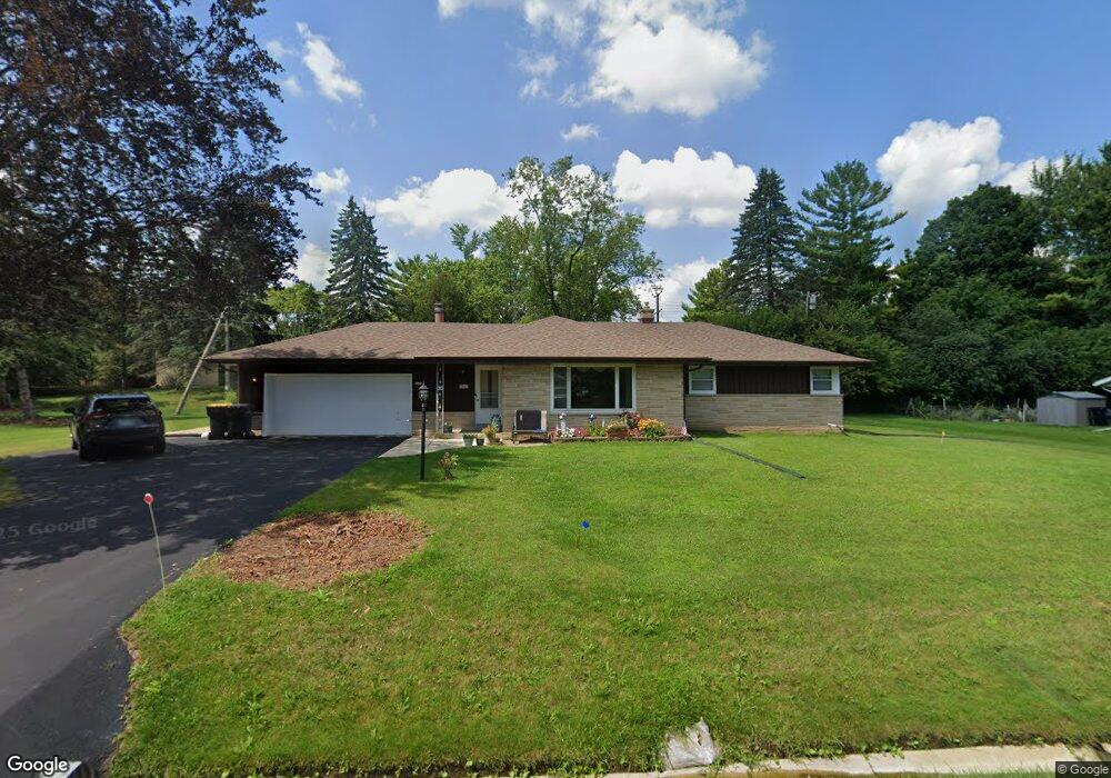
8231 N 67th St Milwaukee, WI 53223
Estimated Value: $277,046 - $317,000
--
Bed
--
Bath
--
Sq Ft
0.34
Acres
About This Home
This home is located at 8231 N 67th St, Milwaukee, WI 53223 and is currently estimated at $304,012. 8231 N 67th St is a home located in Milwaukee County with nearby schools including Brown Deer Elementary School, Brown Deer Middle/High School, and Institute of Technology and Academics.
Ownership History
Date
Name
Owned For
Owner Type
Purchase Details
Closed on
Nov 14, 2003
Sold by
Mortgage Guaranty Insurance Corp
Bought by
Knight William D and Knight Gale L
Current Estimated Value
Home Financials for this Owner
Home Financials are based on the most recent Mortgage that was taken out on this home.
Original Mortgage
$116,800
Interest Rate
5.84%
Mortgage Type
Purchase Money Mortgage
Purchase Details
Closed on
Jul 15, 2003
Sold by
Ohio Savings Bank
Bought by
Mortgage Guaranty Insurance Corp
Purchase Details
Closed on
Apr 15, 2003
Sold by
Amos Murial
Bought by
Ohio Savings Bank
Purchase Details
Closed on
Feb 23, 2001
Sold by
Zuba Joanne
Bought by
Amos Muriel
Home Financials for this Owner
Home Financials are based on the most recent Mortgage that was taken out on this home.
Original Mortgage
$118,710
Interest Rate
7.18%
Mortgage Type
Purchase Money Mortgage
Create a Home Valuation Report for This Property
The Home Valuation Report is an in-depth analysis detailing your home's value as well as a comparison with similar homes in the area
Home Values in the Area
Average Home Value in this Area
Purchase History
| Date | Buyer | Sale Price | Title Company |
|---|---|---|---|
| Knight William D | $146,000 | -- | |
| Mortgage Guaranty Insurance Corp | $138,000 | -- | |
| Ohio Savings Bank | -- | -- | |
| Amos Muriel | $131,900 | -- |
Source: Public Records
Mortgage History
| Date | Status | Borrower | Loan Amount |
|---|---|---|---|
| Previous Owner | Knight William D | $116,800 | |
| Previous Owner | Amos Muriel | $118,710 |
Source: Public Records
Tax History Compared to Growth
Tax History
| Year | Tax Paid | Tax Assessment Tax Assessment Total Assessment is a certain percentage of the fair market value that is determined by local assessors to be the total taxable value of land and additions on the property. | Land | Improvement |
|---|---|---|---|---|
| 2024 | $5,269 | $271,100 | $39,500 | $231,600 |
| 2023 | $5,269 | -- | -- | -- |
| 2022 | $5,269 | $242,300 | $39,500 | $202,800 |
| 2021 | $5,014 | $208,300 | $39,500 | $168,800 |
| 2020 | $4,853 | $186,400 | $39,500 | $146,900 |
| 2019 | $4,551 | $153,000 | $39,500 | $113,500 |
| 2018 | $4,475 | $153,000 | $39,500 | $113,500 |
| 2017 | $4,289 | $153,000 | $39,500 | $113,500 |
| 2016 | $4,401 | $153,000 | $39,500 | $113,500 |
| 2015 | $4,504 | $153,000 | $39,500 | $113,500 |
| 2014 | $4,412 | $150,900 | $47,500 | $103,400 |
| 2013 | $4,522 | $150,900 | $47,500 | $103,400 |
Source: Public Records
Map
Nearby Homes
- 6206 W Fairlane Ave
- 7979 N 66th St
- 8025 N 62nd St
- 6039 W Tower Ave
- 7901 N 66th St
- 8498 N 68th St
- 7871 N 60th St
- 8680 N 63rd St
- 8657 N 72nd St
- 8684 N 62nd St
- 8657 N 73rd St
- 8574 N 58th St
- 8254 N 55th St
- 8274 N 55th St
- 6254 W Port Ave Unit C18
- 5400 W Dean Rd
- 5665 W Range Ave
- 8067 N 54th St
- 7714 W Lolita Ave
- 7731 N 60th St Unit G
- 8242 N Edge O Woods Dr
- 8253 N 67th St
- 8205 N 67th St
- 8226 N Edge O Woods Dr
- 8254 N Edge O Woods Dr
- 8226 N 67th St
- 8244 N 67th St
- 8204 N Edge O Woods Dr
- 8208 N 67th St
- 8262 N 67th St
- 8277 N 67th St
- 8288 N Edge O Woods Dr
- 8187 N 67th St
- 8190 N 67th St
- 8233 N Edge O Woods Dr
- 8321 N Grandview Dr
- 8249 N Edge O Woods Dr
- 8192 N Edge O Woods Dr
- 8280 N 67th St
- 8301 N Grandview Dr