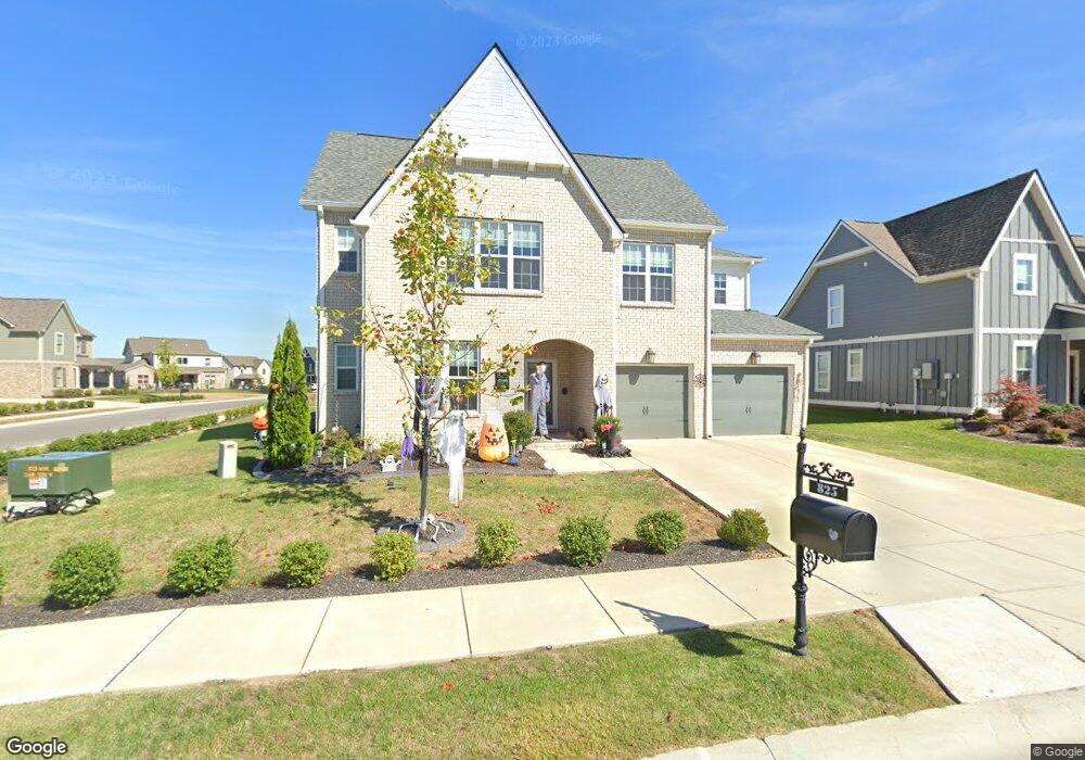
825 Plowson Rd Unit 656 Mt. Juliet, TN 37122
Estimated Value: $743,519 - $782,000
--
Bed
3
Baths
2,958
Sq Ft
$260/Sq Ft
Est. Value
About This Home
This home is located at 825 Plowson Rd Unit 656, Mt. Juliet, TN 37122 and is currently estimated at $769,630, approximately $260 per square foot. 825 Plowson Rd Unit 656 is a home located in Wilson County with nearby schools including Stoner Creek Elementary School, West Wilson Middle School, and Mt. Juliet High School.
Ownership History
Date
Name
Owned For
Owner Type
Purchase Details
Closed on
Aug 9, 2024
Sold by
Sumrack Matthew and Sumrack Julie
Bought by
Julie Sumrack Living Trust and Sumrack
Current Estimated Value
Purchase Details
Closed on
Jan 22, 2020
Sold by
Jackson Hills Partners Llc
Bought by
Sumrack Matthew and Sumrack Julie
Home Financials for this Owner
Home Financials are based on the most recent Mortgage that was taken out on this home.
Original Mortgage
$451,705
Interest Rate
3.73%
Mortgage Type
New Conventional
Purchase Details
Closed on
Aug 23, 2019
Sold by
Propst Realty Nashville Llc
Bought by
Jackson Hills Partners Llc
Home Financials for this Owner
Home Financials are based on the most recent Mortgage that was taken out on this home.
Original Mortgage
$3,500,000
Interest Rate
3.7%
Mortgage Type
Credit Line Revolving
Create a Home Valuation Report for This Property
The Home Valuation Report is an in-depth analysis detailing your home's value as well as a comparison with similar homes in the area
Home Values in the Area
Average Home Value in this Area
Purchase History
| Date | Buyer | Sale Price | Title Company |
|---|---|---|---|
| Julie Sumrack Living Trust | -- | None Listed On Document | |
| Sumrack Matthew | $497,345 | Windmill Title Llc | |
| Jackson Hills Partners Llc | $424,000 | Windmill Title Llc |
Source: Public Records
Mortgage History
| Date | Status | Borrower | Loan Amount |
|---|---|---|---|
| Previous Owner | Sumrack Matthew | $451,705 | |
| Previous Owner | Jackson Hills Partners Llc | $3,500,000 |
Source: Public Records
Tax History Compared to Growth
Tax History
| Year | Tax Paid | Tax Assessment Tax Assessment Total Assessment is a certain percentage of the fair market value that is determined by local assessors to be the total taxable value of land and additions on the property. | Land | Improvement |
|---|---|---|---|---|
| 2024 | $2,513 | $131,625 | $20,000 | $111,625 |
| 2022 | $2,433 | $127,450 | $20,000 | $107,450 |
| 2021 | $2,493 | $127,450 | $20,000 | $107,450 |
| 2020 | $2,576 | $123,500 | $20,000 | $103,500 |
| 2019 | $0 | $16,725 | $16,250 | $475 |
Source: Public Records
Map
Nearby Homes
- 309 Croft Way
- 270 Croft Way
- 863 Plowson Rd
- 27 Yearling Way
- 243 Croft Way
- 247 Croft Way
- Weston Plan at Bradshaw Farms - Estates
- Ansley Plan at Bradshaw Farms - Estates
- Buchanan Plan at Bradshaw Farms - Estates
- Kingston Plan at Bradshaw Farms - Estates
- Ashford Plan at Bradshaw Farms - Estates
- 1012 Zane Dr
- 1010 Zane Dr
- 1019 Zane Dr
- 1014 Zane Dr
- 1015 Zane Dr
- 1018 Zane Dr
- 1022 Zane Dr
- 1101 Codah Dr
- 1100 Codah Dr
- 825 Plowson Rd
- 827 Plowson Rd
- 824 Plowson Rd
- 821 Plowson Rd
- 68 Haystack Way
- 829 Plowson Rd
- 826 Plowson Rd
- 822 Plowson Rd
- 66 Haystack Way
- 69 Haystack Way #651
- 819 Plowson Rd
- 820 Plowson Rd
- 820 Plowson Rd Unit 641
- 820 Plowson Rd
- 831 Plowson Rd
- 828 Plowson Rd
- 64 Haystack Way
- 830 Plowson Rd
- 830 Plowson Rd
- 830 Plowson Rd Unit 636