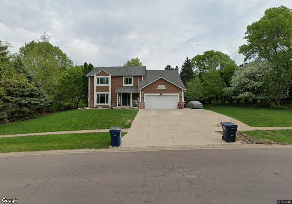
8255 137th St W Saint Paul, MN 55124
Alimagnet NeighborhoodEstimated Value: $476,294 - $563,000
4
Beds
4
Baths
1,998
Sq Ft
$259/Sq Ft
Est. Value
About This Home
This home is located at 8255 137th St W, Saint Paul, MN 55124 and is currently estimated at $517,824, approximately $259 per square foot. 8255 137th St W is a home located in Dakota County with nearby schools including Westview Elementary School, Falcon Ridge Middle School, and Apple Valley Senior High School.
Ownership History
Date
Name
Owned For
Owner Type
Purchase Details
Closed on
Nov 7, 2000
Sold by
Day Steven T and Day Nicole B
Bought by
Ramoutar Rajindra N
Current Estimated Value
Purchase Details
Closed on
Aug 14, 1998
Sold by
Western United Life Assurance Co
Bought by
Foster Rocky and Foster Karmyn
Create a Home Valuation Report for This Property
The Home Valuation Report is an in-depth analysis detailing your home's value as well as a comparison with similar homes in the area
Home Values in the Area
Average Home Value in this Area
Purchase History
| Date | Buyer | Sale Price | Title Company |
|---|---|---|---|
| Ramoutar Rajindra N | $238,000 | -- | |
| Foster Rocky | $180,000 | -- | |
| Day Steven T | $190,000 | -- |
Source: Public Records
Tax History Compared to Growth
Tax History
| Year | Tax Paid | Tax Assessment Tax Assessment Total Assessment is a certain percentage of the fair market value that is determined by local assessors to be the total taxable value of land and additions on the property. | Land | Improvement |
|---|---|---|---|---|
| 2024 | $4,966 | $441,600 | $93,100 | $348,500 |
| 2023 | $4,966 | $437,700 | $93,300 | $344,400 |
| 2022 | $4,238 | $419,800 | $93,000 | $326,800 |
| 2021 | $4,046 | $367,000 | $80,900 | $286,100 |
| 2020 | $4,062 | $344,200 | $77,800 | $266,400 |
| 2019 | $3,638 | $335,600 | $74,100 | $261,500 |
| 2018 | $3,564 | $315,800 | $70,600 | $245,200 |
| 2017 | $3,683 | $297,300 | $67,200 | $230,100 |
| 2016 | $3,441 | $291,700 | $64,000 | $227,700 |
| 2015 | $3,101 | $258,477 | $59,832 | $198,645 |
| 2014 | -- | $234,061 | $56,893 | $177,168 |
| 2013 | -- | $226,104 | $52,315 | $173,789 |
Source: Public Records
Map
Nearby Homes
- 13761 Hollybrook Cir
- 13751 Hollybrook Cir
- 14132 Heywood Path
- 13731 Hollybrook Cir
- 13727 Hollybrook Cir
- The Sophia Plan at Eagle Pointe - Townhomes
- The Amelia Plan at Eagle Pointe - Townhomes
- The Magnolia Plan at Eagle Pointe - Townhomes
- The Nolan Plan at Eagle Pointe - Townhomes
- 13345 Huntington Cir
- 14172 Heywood Path
- 13420 Gull Ct
- 13613 Hollybrook Dr
- 13609 Hollybrook Dr
- 13306 Huntington Cir
- 13599 Hollybrook Dr
- 13591 Hollybrook Way
- 13820 Holyoke Path
- 14080 Guthrie Ave
- 14010 140th Ct
- 13635 Havelock Trail
- 8275 137th St W
- 8295 137th St W
- 13595 Havelock Trail
- 13600 Hemlock Ct
- 13590 Hemlock Ct
- 13690 Havelock Trail
- 13650 Havelock Trail
- 13620 Havelock Trail
- 13575 Havelock Trail
- 13680 Henna Ave
- 13595 Hemlock Ct
- 13600 Havelock Trail
- 13580 Hemlock Ct
- 13650 Henna Ave
- 13580 Havelock Trail
- 13685 Harwell Path
- 13555 Havelock Trail
- 13675 Harwell Path
- 13560 Hemlock Ct