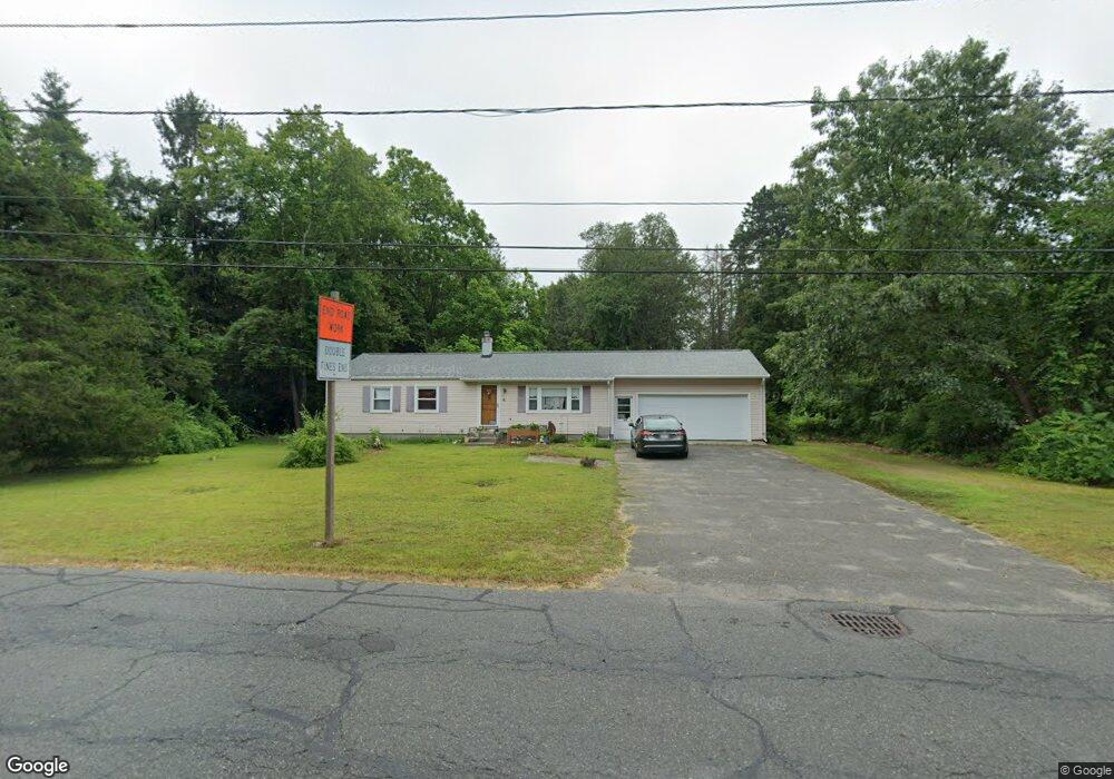
827 Maple Rd Longmeadow, MA 01106
Estimated Value: $344,000 - $402,000
3
Beds
2
Baths
1,144
Sq Ft
$322/Sq Ft
Est. Value
About This Home
This home is located at 827 Maple Rd, Longmeadow, MA 01106 and is currently estimated at $368,418, approximately $322 per square foot. 827 Maple Rd is a home located in Hampden County with nearby schools including Wolf Swamp Road School, Glenbrook Middle School, and Longmeadow High School.
Ownership History
Date
Name
Owned For
Owner Type
Purchase Details
Closed on
Apr 2, 2018
Sold by
Payson Mark
Bought by
Santaniello Mary Beth
Current Estimated Value
Home Financials for this Owner
Home Financials are based on the most recent Mortgage that was taken out on this home.
Original Mortgage
$60,000
Outstanding Balance
$51,078
Interest Rate
4.38%
Mortgage Type
New Conventional
Estimated Equity
$317,340
Purchase Details
Closed on
Oct 8, 2003
Sold by
Payson Angeline M
Bought by
Payson Angeline M and Payson Mark
Create a Home Valuation Report for This Property
The Home Valuation Report is an in-depth analysis detailing your home's value as well as a comparison with similar homes in the area
Home Values in the Area
Average Home Value in this Area
Purchase History
| Date | Buyer | Sale Price | Title Company |
|---|---|---|---|
| Santaniello Mary Beth | $120,000 | -- | |
| Payson Angeline M | -- | -- |
Source: Public Records
Mortgage History
| Date | Status | Borrower | Loan Amount |
|---|---|---|---|
| Open | Santaniello Mary Beth | $60,000 |
Source: Public Records
Tax History
| Year | Tax Paid | Tax Assessment Tax Assessment Total Assessment is a certain percentage of the fair market value that is determined by local assessors to be the total taxable value of land and additions on the property. | Land | Improvement |
|---|---|---|---|---|
| 2025 | $6,106 | $289,100 | $145,200 | $143,900 |
| 2024 | $5,979 | $289,100 | $145,200 | $143,900 |
| 2023 | $5,673 | $247,500 | $100,300 | $147,200 |
| 2022 | $5,781 | $234,600 | $115,800 | $118,800 |
| 2021 | $5,722 | $231,300 | $117,600 | $113,700 |
| 2020 | $5,246 | $216,700 | $103,000 | $113,700 |
| 2019 | $5,179 | $215,000 | $110,300 | $104,700 |
| 2018 | $4,612 | $189,500 | $119,800 | $69,700 |
| 2017 | $4,468 | $189,500 | $119,800 | $69,700 |
| 2016 | $4,477 | $184,000 | $117,300 | $66,700 |
| 2015 | $4,318 | $182,800 | $116,100 | $66,700 |
Source: Public Records
Map
Nearby Homes
- 357 N Maple St
- 208 Birch Rd
- 449 The Meadows
- 53 Meadowlark Dr
- 63 Meadowlark Dr
- 302 Ashmead Commons Unit 302
- 64 Brookwood Dr
- 68 Hazardville Rd
- 184 Cambridge Cir
- 39 Liberty Ln
- 54 Liberty Ln
- 56 Liberty Ln
- 46 Liberty Ln
- 43 Liberty Ln
- 41 Liberty Ln
- 15 Pine Hill Rd
- 59 Liberty Ln
- 44 Liberty Ln
- 60 Liberty Ln
- 42 Liberty Ln
- 839 Maple Rd
- 388 N Maple St
- 386 N Maple St
- 851 Maple Rd
- 246 Sheffield Ave
- 384 N Maple St
- 812 Maple Rd
- 259 Sheffield Ave
- 382 N Maple St
- 863 Maple Rd
- 856 Maple Rd
- 241 Sheffield Ave
- 230 Sheffield Ave
- 380 N Maple St
- 385 N Maple St
- 186 Cedar Rd
- 227 Sheffield Ave
- 875 Maple Rd
- 383 N Maple St
- 378 N Maple St
Your Personal Tour Guide
Ask me questions while you tour the home.