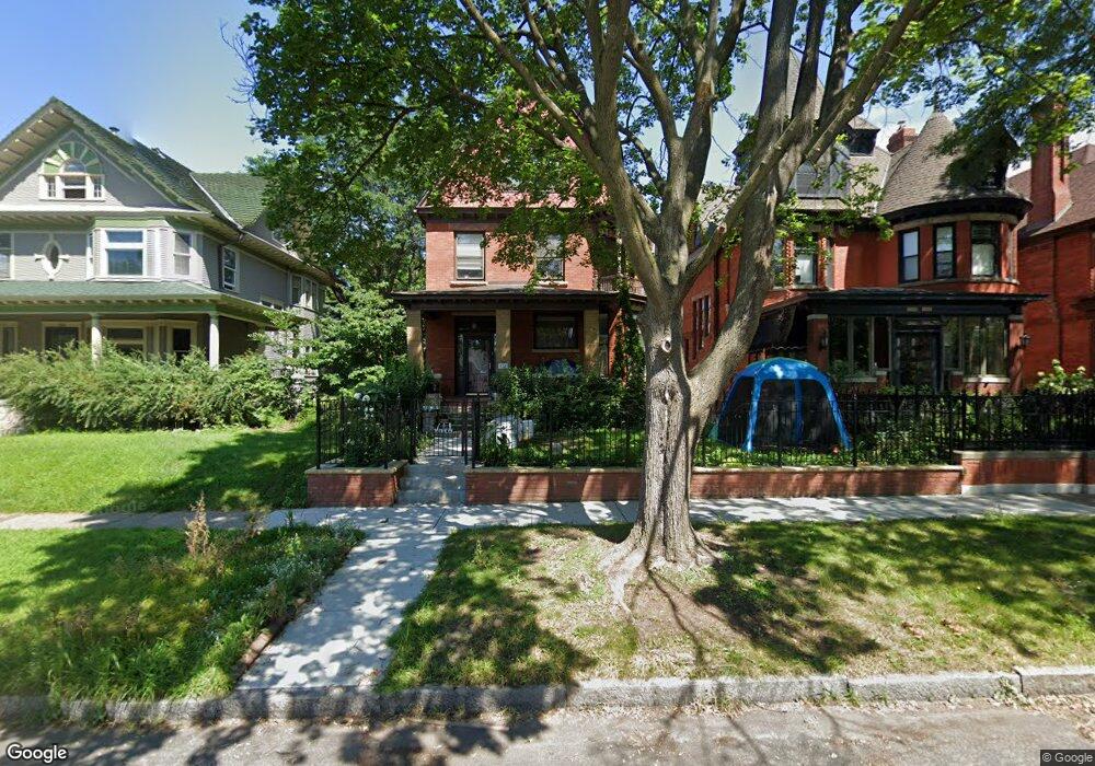
829 Portland Ave Saint Paul, MN 55104
Summit-University NeighborhoodEstimated Value: $771,382 - $811,000
5
Beds
3
Baths
3,214
Sq Ft
$244/Sq Ft
Est. Value
About This Home
This home is located at 829 Portland Ave, Saint Paul, MN 55104 and is currently estimated at $784,096, approximately $243 per square foot. 829 Portland Ave is a home located in Ramsey County with nearby schools including Maxfield Magnet Elementary School, Hidden River Middle School, and Central Senior High School.
Ownership History
Date
Name
Owned For
Owner Type
Purchase Details
Closed on
Aug 24, 2022
Sold by
Orion Dampier Todd and Orion Erin Whitney
Bought by
First Amendment And Restatement Of Trust
Current Estimated Value
Purchase Details
Closed on
Aug 19, 2019
Sold by
Lund Cohen Katherine Mary
Bought by
Dampier Todd Orion and Boesel Whitney Erin
Home Financials for this Owner
Home Financials are based on the most recent Mortgage that was taken out on this home.
Original Mortgage
$250,000
Interest Rate
3.7%
Mortgage Type
New Conventional
Create a Home Valuation Report for This Property
The Home Valuation Report is an in-depth analysis detailing your home's value as well as a comparison with similar homes in the area
Home Values in the Area
Average Home Value in this Area
Purchase History
| Date | Buyer | Sale Price | Title Company |
|---|---|---|---|
| First Amendment And Restatement Of Trust | $485 | None Listed On Document | |
| Dampier Todd Orion | $620,000 | Burnet Title |
Source: Public Records
Mortgage History
| Date | Status | Borrower | Loan Amount |
|---|---|---|---|
| Previous Owner | Dampier Todd Orion | $250,000 |
Source: Public Records
Tax History Compared to Growth
Tax History
| Year | Tax Paid | Tax Assessment Tax Assessment Total Assessment is a certain percentage of the fair market value that is determined by local assessors to be the total taxable value of land and additions on the property. | Land | Improvement |
|---|---|---|---|---|
| 2025 | $12,880 | $768,800 | $128,700 | $640,100 |
| 2023 | $12,880 | $781,600 | $128,700 | $652,900 |
| 2022 | $10,022 | $683,800 | $128,700 | $555,100 |
| 2021 | $9,932 | $599,800 | $128,700 | $471,100 |
| 2020 | $10,458 | $614,200 | $128,700 | $485,500 |
| 2019 | $10,704 | $602,200 | $128,700 | $473,500 |
| 2018 | $10,094 | $608,200 | $128,700 | $479,500 |
| 2017 | $9,178 | $592,000 | $128,700 | $463,300 |
| 2016 | $8,452 | $0 | $0 | $0 |
| 2015 | $5,232 | $508,400 | $118,800 | $389,600 |
| 2014 | $5,586 | $0 | $0 | $0 |
Source: Public Records
Map
Nearby Homes
- 811 Ashland Ave
- 818 Summit Ave
- 742 Holly Ave
- 21 Avon St S Unit 21
- 786 Summit Ave
- 742 Hague Ave
- 51 Avon St S Unit 24
- 704 Holly Ave
- 957 Ashland Ave
- 63 Avon St S Unit 36
- 745 Grand Ave Unit 404
- 937 Hague Ave
- 676 Ashland Ave Unit 6
- 28 Saint Albans St N Unit 4N
- 884 Lincoln Ave
- 793 Goodrich Ave
- 909 Marshall Ave
- 695 Lincoln Ave
- 681 Dayton Ave
- 968 Lincoln Ave
- 823 Portland Ave
- 833 Portland Ave
- 819 Portland Ave
- 817 Portland Ave
- 841 Portland Ave
- 815 Portland Ave
- 815 Portland Ave Unit 815
- 828 Holly Ave
- 824 Holly Ave
- 830 Holly Ave
- 820 Holly Ave
- 811 Portland Ave
- 826 Portland Ave
- 830 Portland Ave
- 836 Holly Ave
- 814 Holly Ave
- 849 Portland Ave
- 816 Portland Ave
- 834 Portland Ave
- 846 Holly Ave