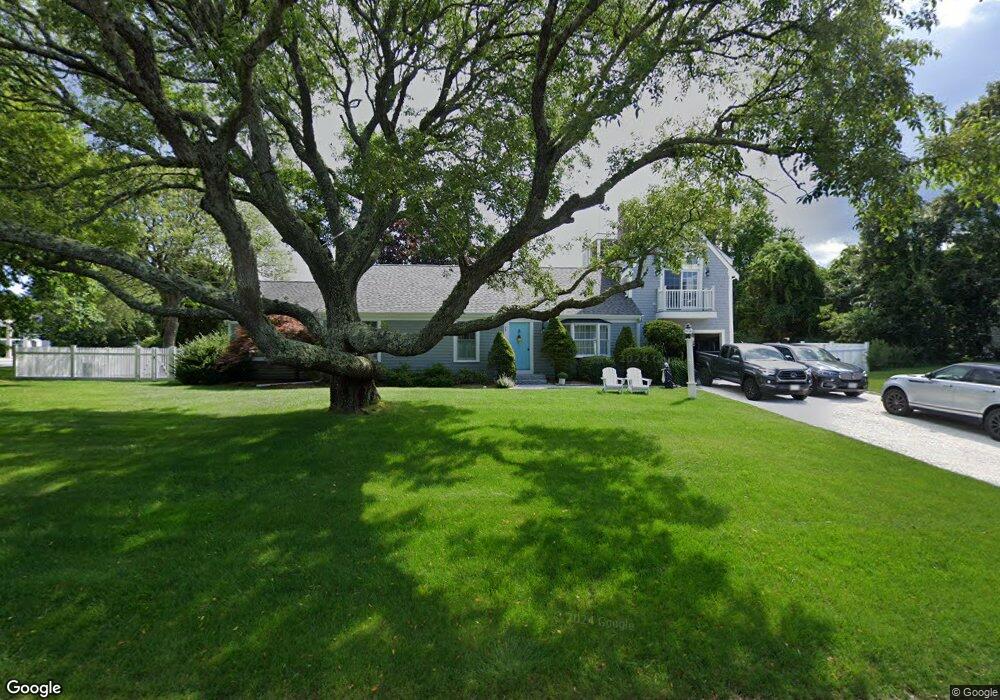
83 Ambergris Cir Brewster, MA 02631
Estimated Value: $1,620,444 - $1,717,000
4
Beds
3
Baths
1,501
Sq Ft
$1,107/Sq Ft
Est. Value
About This Home
This home is located at 83 Ambergris Cir, Brewster, MA 02631 and is currently estimated at $1,661,111, approximately $1,106 per square foot. 83 Ambergris Cir is a home located in Barnstable County with nearby schools including Stony Brook Elementary School, Eddy Elementary School, and Nauset Regional Middle School.
Ownership History
Date
Name
Owned For
Owner Type
Purchase Details
Closed on
Oct 11, 2002
Sold by
Balfour Andrew L
Bought by
Friedman Stephen T and Friedman Karen E
Current Estimated Value
Home Financials for this Owner
Home Financials are based on the most recent Mortgage that was taken out on this home.
Original Mortgage
$350,000
Outstanding Balance
$147,592
Interest Rate
6.24%
Mortgage Type
Purchase Money Mortgage
Estimated Equity
$1,513,519
Purchase Details
Closed on
May 6, 1994
Sold by
Czerniakowski Edward A
Bought by
Balfour Andrew L and Lacroix Pierrette
Home Financials for this Owner
Home Financials are based on the most recent Mortgage that was taken out on this home.
Original Mortgage
$203,000
Interest Rate
7.7%
Mortgage Type
Purchase Money Mortgage
Create a Home Valuation Report for This Property
The Home Valuation Report is an in-depth analysis detailing your home's value as well as a comparison with similar homes in the area
Home Values in the Area
Average Home Value in this Area
Purchase History
| Date | Buyer | Sale Price | Title Company |
|---|---|---|---|
| Friedman Stephen T | $530,000 | -- | |
| Balfour Andrew L | $227,700 | -- |
Source: Public Records
Mortgage History
| Date | Status | Borrower | Loan Amount |
|---|---|---|---|
| Open | Balfour Andrew L | $350,000 | |
| Previous Owner | Balfour Andrew L | $192,000 | |
| Previous Owner | Balfour Andrew L | $203,000 | |
| Previous Owner | Balfour Andrew L | $99,900 |
Source: Public Records
Tax History Compared to Growth
Tax History
| Year | Tax Paid | Tax Assessment Tax Assessment Total Assessment is a certain percentage of the fair market value that is determined by local assessors to be the total taxable value of land and additions on the property. | Land | Improvement |
|---|---|---|---|---|
| 2025 | $9,565 | $1,390,200 | $744,900 | $645,300 |
| 2024 | $8,530 | $1,252,500 | $702,700 | $549,800 |
| 2023 | $6,330 | $905,600 | $501,800 | $403,800 |
| 2022 | $5,938 | $756,400 | $418,100 | $338,300 |
| 2021 | $5,688 | $662,900 | $363,500 | $299,400 |
| 2020 | $5,593 | $648,800 | $363,500 | $285,300 |
| 2019 | $5,278 | $615,100 | $349,600 | $265,500 |
| 2018 | $5,203 | $629,900 | $374,600 | $255,300 |
| 2017 | $5,557 | $662,300 | $437,000 | $225,300 |
| 2016 | $5,477 | $649,700 | $428,500 | $221,200 |
| 2015 | $5,276 | $638,700 | $420,000 | $218,700 |
Source: Public Records
Map
Nearby Homes
- 16 Sand Bar Ln
- 61 Ambergris Cir
- 103 Ambergris Cir
- 82 Ambergris Cir
- 28 Sand Bar Ln
- 96 Ambergris Cir
- 72 Ambergris Cir
- 131 Ambergris Cir
- 40 Sand Bar Ln
- 17 Sand Bar Ln
- 60 Ambergris Cir
- 7 Sand Bar Ln
- 27 Sand Bar Ln
- 211 Robbins Hill Rd
- 5 Salt Hole Ln
- 52 Ambergris Cir
- 229 Robbins Hill Rd
- 187 Robbins Hill Rd
- 42 Ambergris Cir
- 41 George Porter Cartway