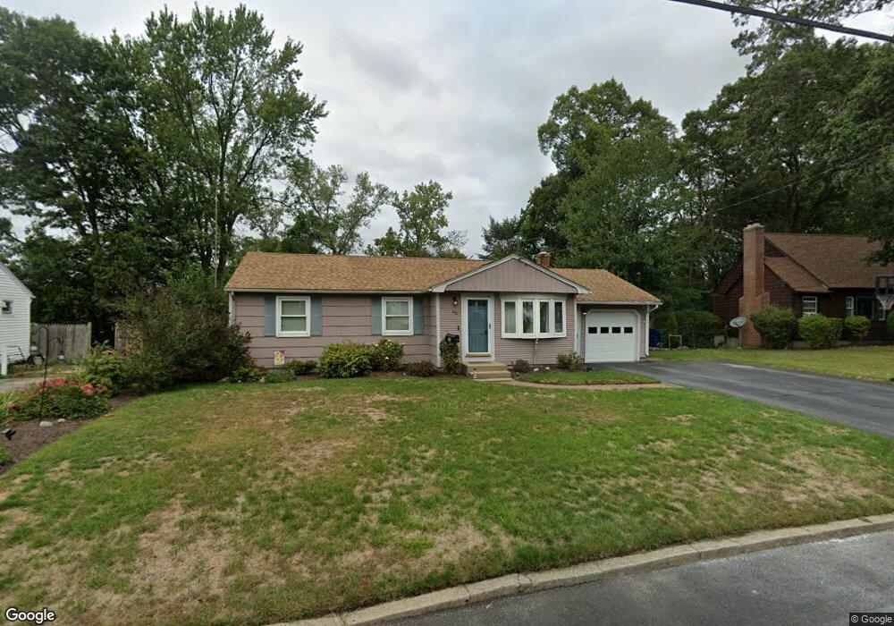
83 Cushing Rd Warwick, RI 02888
Spring Green NeighborhoodEstimated Value: $401,132 - $451,000
3
Beds
2
Baths
1,654
Sq Ft
$263/Sq Ft
Est. Value
About This Home
This home is located at 83 Cushing Rd, Warwick, RI 02888 and is currently estimated at $434,283, approximately $262 per square foot. 83 Cushing Rd is a home located in Kent County with nearby schools including St. Peter School and Saint Paul School.
Ownership History
Date
Name
Owned For
Owner Type
Purchase Details
Closed on
Dec 9, 1997
Sold by
Plante Stephen M
Bought by
Emilio Steven E and Emilio Rose
Current Estimated Value
Purchase Details
Closed on
Mar 1, 1994
Sold by
Jennings Helen
Bought by
Plante Stephen M
Create a Home Valuation Report for This Property
The Home Valuation Report is an in-depth analysis detailing your home's value as well as a comparison with similar homes in the area
Home Values in the Area
Average Home Value in this Area
Purchase History
| Date | Buyer | Sale Price | Title Company |
|---|---|---|---|
| Emilio Steven E | $108,500 | -- | |
| Plante Stephen M | $98,000 | -- |
Source: Public Records
Mortgage History
| Date | Status | Borrower | Loan Amount |
|---|---|---|---|
| Open | Plante Stephen M | $130,186 | |
| Closed | Plante Stephen M | $150,000 | |
| Closed | Plante Stephen M | $35,000 |
Source: Public Records
Tax History
| Year | Tax Paid | Tax Assessment Tax Assessment Total Assessment is a certain percentage of the fair market value that is determined by local assessors to be the total taxable value of land and additions on the property. | Land | Improvement |
|---|---|---|---|---|
| 2025 | $4,595 | $361,800 | $112,500 | $249,300 |
| 2024 | $4,510 | $311,700 | $97,800 | $213,900 |
| 2023 | $4,423 | $311,700 | $97,800 | $213,900 |
| 2022 | $4,149 | $221,500 | $61,400 | $160,100 |
| 2021 | $4,149 | $221,500 | $61,400 | $160,100 |
| 2020 | $4,149 | $221,500 | $61,400 | $160,100 |
| 2019 | $4,149 | $221,500 | $61,400 | $160,100 |
| 2018 | $3,403 | $163,600 | $54,600 | $109,000 |
| 2017 | $3,311 | $163,600 | $54,600 | $109,000 |
| 2016 | $3,311 | $163,600 | $54,600 | $109,000 |
| 2015 | $3,463 | $166,900 | $74,000 | $92,900 |
| 2014 | $3,348 | $166,900 | $74,000 | $92,900 |
| 2013 | $3,303 | $166,900 | $74,000 | $92,900 |
Source: Public Records
Map
Nearby Homes
- 821 Post Rd
- 80 George St
- 63 Benbridge Ave
- 25 Newfield Ave
- 136 Sherwood Ave
- 120 Sherwood Ave
- 127 Sherwood Ave
- 111 Sherwood Ave
- 171 Sherwood Ave
- 1020 Warwick Ave
- 1052 Post Rd
- 56 Errol St
- 210 Irving Rd
- 15 Christopher Rhodes Way
- 6 Christopher Rhodes Way
- 0 Elmwood Ave
- 115 Irving Rd
- 35 Welfare Ave
- 94 Holmes Rd
- 123 Harrington Ave
Your Personal Tour Guide
Ask me questions while you tour the home.