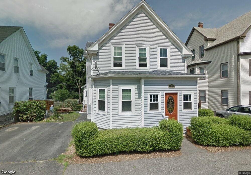
83 Stanton St Worcester, MA 01605
Bell Hill NeighborhoodEstimated Value: $435,857 - $714,000
4
Beds
2
Baths
1,546
Sq Ft
$338/Sq Ft
Est. Value
About This Home
This home is located at 83 Stanton St, Worcester, MA 01605 and is currently estimated at $522,714, approximately $338 per square foot. 83 Stanton St is a home located in Worcester County with nearby schools including Jacob Hiatt Magnet School, Chandler Magnet, and Worcester East Middle School.
Ownership History
Date
Name
Owned For
Owner Type
Purchase Details
Closed on
May 1, 2017
Sold by
Amlaw Shirley E
Bought by
Amlaw Robert E
Current Estimated Value
Purchase Details
Closed on
Dec 18, 2007
Sold by
Amlaw Shirley E
Bought by
Amlaw Robert E
Create a Home Valuation Report for This Property
The Home Valuation Report is an in-depth analysis detailing your home's value as well as a comparison with similar homes in the area
Home Values in the Area
Average Home Value in this Area
Purchase History
| Date | Buyer | Sale Price | Title Company |
|---|---|---|---|
| Amlaw Robert E | -- | -- | |
| Amlaw Robert E | -- | -- |
Source: Public Records
Tax History
| Year | Tax Paid | Tax Assessment Tax Assessment Total Assessment is a certain percentage of the fair market value that is determined by local assessors to be the total taxable value of land and additions on the property. | Land | Improvement |
|---|---|---|---|---|
| 2025 | $5,429 | $411,600 | $81,200 | $330,400 |
| 2024 | $5,180 | $376,700 | $81,200 | $295,500 |
| 2023 | $4,844 | $337,800 | $70,600 | $267,200 |
| 2022 | $4,697 | $308,800 | $56,500 | $252,300 |
| 2021 | $4,090 | $251,200 | $45,200 | $206,000 |
| 2020 | $3,808 | $224,000 | $44,900 | $179,100 |
| 2019 | $3,920 | $217,800 | $39,200 | $178,600 |
| 2018 | $3,818 | $201,900 | $39,200 | $162,700 |
| 2017 | $3,598 | $187,200 | $39,200 | $148,000 |
| 2016 | $3,568 | $173,100 | $28,300 | $144,800 |
| 2015 | $3,474 | $173,100 | $28,300 | $144,800 |
| 2014 | $3,382 | $173,100 | $28,300 | $144,800 |
Source: Public Records
Map
Nearby Homes
- 67 Rodney St
- Lot 2 Ararat
- 38 Johnson St
- 256 Belmont St
- 109 Merrifield St
- 24 Catharine St
- 25 Johnson St
- 26 Orne St
- 107 Eastern Ave
- 82 Green Hill Pkwy
- 78 Green Hill Pkwy
- 74 Green Hill Pkwy
- 29 Chilmark St
- 28 Adams St Unit 304
- 21 Kendall St
- 3 Perkins St
- 25 Mckinley Rd
- 33 Denmark St
- 1 Verdi Rd
- 65 Paine St
- 85 Stanton St
- 79 Stanton St
- 79 Stanton St Unit 2
- 58 Everard St
- 75 Stanton St
- 56 Everard St
- 91 Stanton St
- 84 Stanton St
- 84 Stanton St Unit 2
- 54 Everard St
- 71 Stanton St
- 19 Vinson St
- 19 Vinson St Unit 2
- 19 Vinson St Unit 1
- 19 Vinson St Unit 3
- 19 Vinson St Unit Varies
- 64 Everard St
- 88 Stanton St
- 92 Stanton St Unit 3
- 92 Stanton St Unit 3rd Floor 4 bedrooms
Your Personal Tour Guide
Ask me questions while you tour the home.