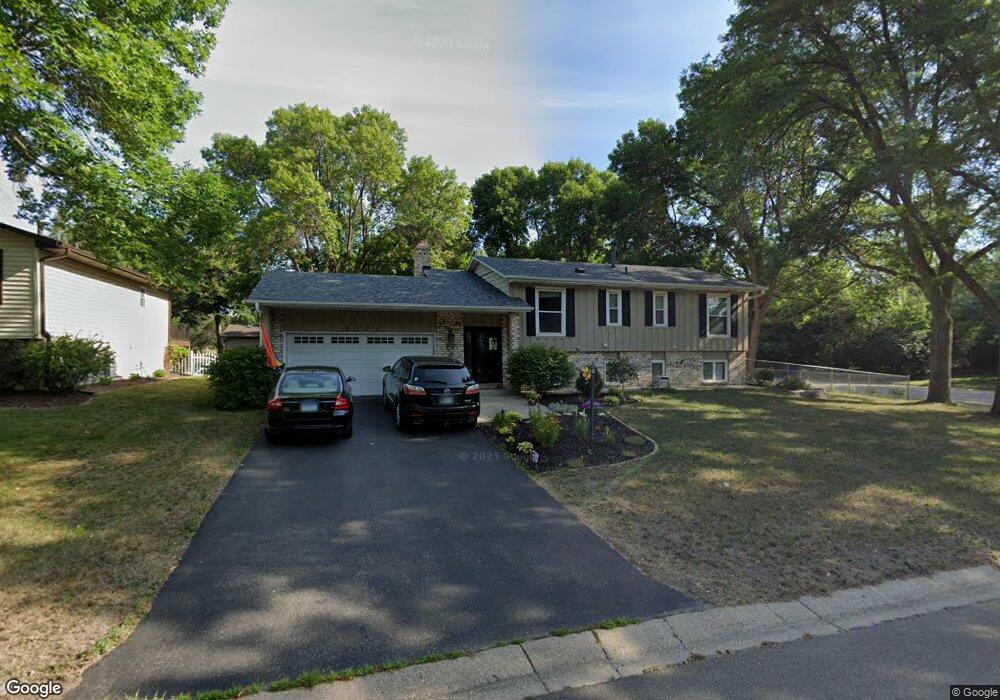
8300 W 104th St Bloomington, MN 55438
West Bloomington NeighborhoodEstimated Value: $436,118 - $472,000
5
Beds
2
Baths
1,406
Sq Ft
$321/Sq Ft
Est. Value
About This Home
This home is located at 8300 W 104th St, Bloomington, MN 55438 and is currently estimated at $451,530, approximately $321 per square foot. 8300 W 104th St is a home located in Hennepin County with nearby schools including Normandale Hills Elementary School, Olson Middle School, and Jefferson Senior High School.
Ownership History
Date
Name
Owned For
Owner Type
Purchase Details
Closed on
Feb 25, 2023
Sold by
Benson Joan L
Bought by
Benson Joan L and Schwanz Matthew E
Current Estimated Value
Purchase Details
Closed on
Jun 12, 2017
Sold by
Gess James J and Gess Meghan L
Bought by
Schwanz Michael D and Schwanz Brooke E
Home Financials for this Owner
Home Financials are based on the most recent Mortgage that was taken out on this home.
Original Mortgage
$293,250
Interest Rate
4.02%
Mortgage Type
New Conventional
Create a Home Valuation Report for This Property
The Home Valuation Report is an in-depth analysis detailing your home's value as well as a comparison with similar homes in the area
Home Values in the Area
Average Home Value in this Area
Purchase History
| Date | Buyer | Sale Price | Title Company |
|---|---|---|---|
| Benson Joan L | -- | None Listed On Document | |
| Schwanz Michael D | $345,000 | Monnesota Title |
Source: Public Records
Mortgage History
| Date | Status | Borrower | Loan Amount |
|---|---|---|---|
| Previous Owner | Schwanz Michael D | $293,250 |
Source: Public Records
Tax History
| Year | Tax Paid | Tax Assessment Tax Assessment Total Assessment is a certain percentage of the fair market value that is determined by local assessors to be the total taxable value of land and additions on the property. | Land | Improvement |
|---|---|---|---|---|
| 2024 | $5,402 | $420,700 | $160,200 | $260,500 |
| 2023 | $5,228 | $430,800 | $170,300 | $260,500 |
| 2022 | $4,383 | $414,000 | $150,100 | $263,900 |
| 2021 | $4,037 | $343,900 | $132,100 | $211,800 |
| 2020 | $4,150 | $321,900 | $128,400 | $193,500 |
| 2019 | $4,250 | $321,400 | $128,400 | $193,000 |
| 2018 | $3,567 | $322,700 | $126,900 | $195,800 |
| 2017 | $3,334 | $255,500 | $113,900 | $141,600 |
| 2016 | $3,484 | $253,600 | $108,400 | $145,200 |
| 2015 | $3,330 | $235,300 | $105,100 | $130,200 |
| 2014 | -- | $221,000 | $101,900 | $119,100 |
Source: Public Records
Map
Nearby Homes
- 10434 Decatur Ave S
- 10500 Wyoming Ave S
- 10512 Decatur Ave S
- 10700 Aquila Ave S
- 10433 Utah Rd
- 9634 Belmont Ln
- 7534 Landau Dr
- 7616 Landau Dr
- 7601 W 101st St Unit 216
- 7401 W 101st St Unit 111
- 10127 Trotters Path
- 10512 Quebec Rd
- 7501 W 100th St
- 7404 Landau Dr
- 7401 Landau Dr Unit 12
- 10326 Balsam Ln
- 10905 Rhode Island Ave S
- 8527 W 97th Street Cir
- 7555 W 110th St
- 7525 W 110th St Unit 7
- 8308 W 104th St
- 8232 W 104th Street Cir
- 8316 W 104th St
- 8301 W 104th St
- 8309 W 104th St
- 8324 W 104th St
- 8230 W 104th Street Cir
- 8226 W 104th Street Cir
- 8225 W 104th St
- 8216 W 104th St
- 8317 W 104th St
- 8228 W 104th Street Cir
- 10410 Aquila Ave S
- 8217 W 104th St
- 8208 W 104th St
- 8325 W 104th St
- 10411 Aquila Ave S
- 10420 Aquila Cir
- 8209 W 104th St
- 10342 Zinran Ave S
Your Personal Tour Guide
Ask me questions while you tour the home.