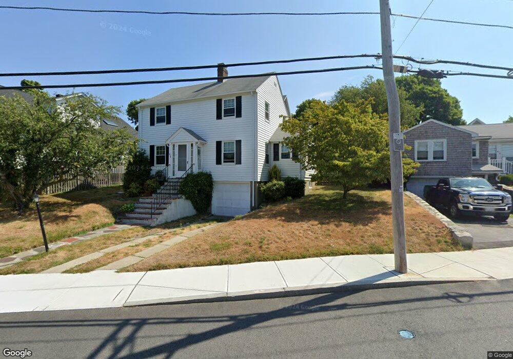
832 E Squantum St Quincy, MA 02171
Squantum NeighborhoodEstimated Value: $723,000 - $854,000
3
Beds
2
Baths
1,378
Sq Ft
$563/Sq Ft
Est. Value
About This Home
This home is located at 832 E Squantum St, Quincy, MA 02171 and is currently estimated at $775,942, approximately $563 per square foot. 832 E Squantum St is a home located in Norfolk County with nearby schools including Squantum Elementary School, Atlantic Middle School, and North Quincy High School.
Ownership History
Date
Name
Owned For
Owner Type
Purchase Details
Closed on
Jan 7, 2021
Sold by
Hanrahan James C
Bought by
James C Hanrahan Ret
Current Estimated Value
Purchase Details
Closed on
Mar 29, 2013
Sold by
Hanrahan Thomas B and Hanrahan Mary A
Bought by
Hanrahan James C
Home Financials for this Owner
Home Financials are based on the most recent Mortgage that was taken out on this home.
Original Mortgage
$250,000
Interest Rate
3.56%
Mortgage Type
New Conventional
Purchase Details
Closed on
Nov 14, 2006
Sold by
Hanrahan Rosemary E
Bought by
Hanrahan Thomas B and Hanrahan Mary A
Create a Home Valuation Report for This Property
The Home Valuation Report is an in-depth analysis detailing your home's value as well as a comparison with similar homes in the area
Home Values in the Area
Average Home Value in this Area
Purchase History
| Date | Buyer | Sale Price | Title Company |
|---|---|---|---|
| James C Hanrahan Ret | -- | None Available | |
| Hanrahan James C | $300,000 | -- | |
| Hanrahan James C | $300,000 | -- | |
| Hanrahan Thomas B | -- | -- | |
| Hanrahan James C | $300,000 | -- |
Source: Public Records
Mortgage History
| Date | Status | Borrower | Loan Amount |
|---|---|---|---|
| Previous Owner | Hanrahan James C | $250,000 |
Source: Public Records
Tax History Compared to Growth
Tax History
| Year | Tax Paid | Tax Assessment Tax Assessment Total Assessment is a certain percentage of the fair market value that is determined by local assessors to be the total taxable value of land and additions on the property. | Land | Improvement |
|---|---|---|---|---|
| 2025 | $7,893 | $684,600 | $415,900 | $268,700 |
| 2024 | $7,430 | $659,300 | $396,000 | $263,300 |
| 2023 | $6,910 | $620,800 | $377,200 | $243,600 |
| 2022 | $6,442 | $537,700 | $314,300 | $223,400 |
| 2021 | $6,427 | $529,400 | $314,300 | $215,100 |
| 2020 | $5,969 | $480,200 | $285,700 | $194,500 |
| 2019 | $5,911 | $471,000 | $285,700 | $185,300 |
| 2018 | $5,918 | $443,600 | $272,100 | $171,500 |
| 2017 | $5,555 | $392,000 | $236,600 | $155,400 |
| 2016 | $5,283 | $367,900 | $215,100 | $152,800 |
| 2015 | $5,187 | $355,300 | $215,100 | $140,200 |
| 2014 | $5,109 | $343,800 | $215,100 | $128,700 |
Source: Public Records
Map
Nearby Homes
- 37 Huckins Ave
- 22 Winslow Rd
- 1 Parke Ave
- 43 Parke Ave
- 2 Parke Ave
- 935 E Squantum St
- 19 Knollwood Rd
- 15 Knollwood Rd
- 87 Dorchester St
- 50 Surfside Ln
- 153 Bayside Rd
- 62 Bay St
- 58 Brunswick St
- 10 Sloop Ln
- 9 Whaler Ln
- 1001 Marina Dr Unit 801
- 1001 Marina Dr Unit 507
- 1001 Marina Dr Unit 213
- 1001 Marina Dr Unit 612
- 25 Tilden Commons Dr
- 828 E Squantum St
- 833 E Squantum St
- 13 Dundee Rd
- 822 E Squantum St
- 839 E Squantum St
- 829 E Squantum St
- 844 E Squantum St
- 845 E Squantum St
- 3 Aberdeen Rd
- 818 E Squantum St
- 14 Aberdeen Rd
- 9 Aberdeen Rd
- 9 Aberdeen Rd Unit Single
- 125 Mayflower Rd
- 23 Dundee Rd
- 814 E Squantum St
- 821 E Squantum St
- 11 Aberdeen Rd
- 27 Dundee Rd
- 119 Mayflower Rd