Estimated Value: $456,913 - $498,000
4
Beds
3
Baths
2,916
Sq Ft
$166/Sq Ft
Est. Value
About This Home
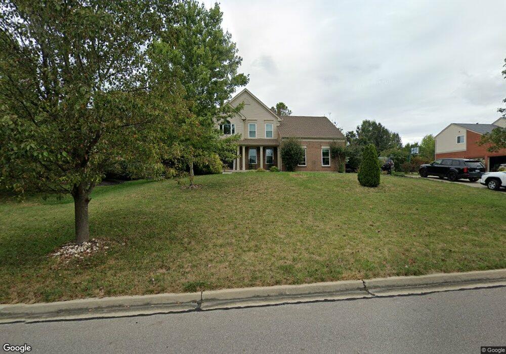
This home is located at 8328 Orleans Blvd Unit LM12, Union, KY 41091 and is currently estimated at $484,228, approximately $166 per square foot. 8328 Orleans Blvd Unit LM12 is a home located in Boone County with nearby schools including Erpenbeck Elementary School, Ockerman Middle School, and Randall K. Cooper High School.
Ownership History
Date
Name
Owned For
Owner Type
Purchase Details
Closed on
Nov 19, 2010
Sold by
Kane Charles J and Kane Denise Michelle
Bought by
Kane Denise Michelle and Mcintosh Mary
Current Estimated Value
Purchase Details
Closed on
Dec 14, 2004
Sold by
Fischer Single Family Homes Ii Llc
Bought by
Bandy Charles J and Bandy Denise Michelle
Home Financials for this Owner
Home Financials are based on the most recent Mortgage that was taken out on this home.
Original Mortgage
$222,800
Interest Rate
5.66%
Mortgage Type
Future Advance Clause Open End Mortgage
Create a Home Valuation Report for This Property
The Home Valuation Report is an in-depth analysis detailing your home's value as well as a comparison with similar homes in the area
Home Values in the Area
Average Home Value in this Area
Purchase History
| Date | Buyer | Sale Price | Title Company |
|---|---|---|---|
| Kane Denise Michelle | -- | 360 American Title Svcs Llc | |
| Bandy Charles J | $278,500 | Homestead Title Agency Ltd |
Source: Public Records
Mortgage History
| Date | Status | Borrower | Loan Amount |
|---|---|---|---|
| Closed | Bandy Charles J | $222,800 |
Source: Public Records
Tax History Compared to Growth
Tax History
| Year | Tax Paid | Tax Assessment Tax Assessment Total Assessment is a certain percentage of the fair market value that is determined by local assessors to be the total taxable value of land and additions on the property. | Land | Improvement |
|---|---|---|---|---|
| 2024 | $2,519 | $316,800 | $50,000 | $266,800 |
| 2023 | $2,625 | $316,800 | $50,000 | $266,800 |
| 2022 | $2,619 | $316,800 | $50,000 | $266,800 |
| 2021 | $3,380 | $316,800 | $50,000 | $266,800 |
| 2020 | $2,691 | $316,800 | $50,000 | $266,800 |
| 2019 | $2,462 | $291,000 | $35,000 | $256,000 |
| 2018 | $2,510 | $291,000 | $35,000 | $256,000 |
| 2017 | $2,453 | $291,000 | $35,000 | $256,000 |
| 2015 | $2,439 | $291,000 | $35,000 | $256,000 |
| 2013 | -- | $291,000 | $35,000 | $256,000 |
Source: Public Records
Map
Nearby Homes
- 8601 Marais Dr
- 8645 Marais Dr
- 9024 Old Union Rd
- 2381 Longbranch-New Build Rd
- 2381 Longbranch Rd-Lot 3 Rd
- 2381 Longbranch Rd-Lot 1 Rd
- 2381 Longbranch Rd-Lot 4 Rd
- 2695 Saint Charles Cir
- 2647 Saint Charles Cir
- 3029 Nottoway Ct
- 8809 Marais Dr
- 8791 Marais Dr
- 8784 Marais Dr
- 8812 Marais Dr
- 9190 Royal Oak Ln
- 2719 Chateau Ct
- 1804 Rosecrans Cir
- 4113 Cardiff St
- 4117 Cardiff St
- The Westchester Plan at Hunter's Ridge
- 8328 Orleans Blvd
- 8332 Orleans Blvd
- 8324 Orleans Blvd
- 2243 Bourbon St Unit 22
- 2239 Bourbon St
- 2239 Bourbon
- 2247 Bourbon St
- 2235 Bourbon St
- 8336 Orleans Blvd
- 8320 Orleans Blvd
- 2251 Bourbon St
- 8327 Orleans Blvd
- 8323 Orleans Blvd
- 2231 Bourbon St
- 2404 Bellegarde Ct
- 2255 Bourbon St
- 8340 Orleans Blvd
- 2227 Bourbon St
- 8316 Orleans Blvd
- 8319 Orleans Blvd