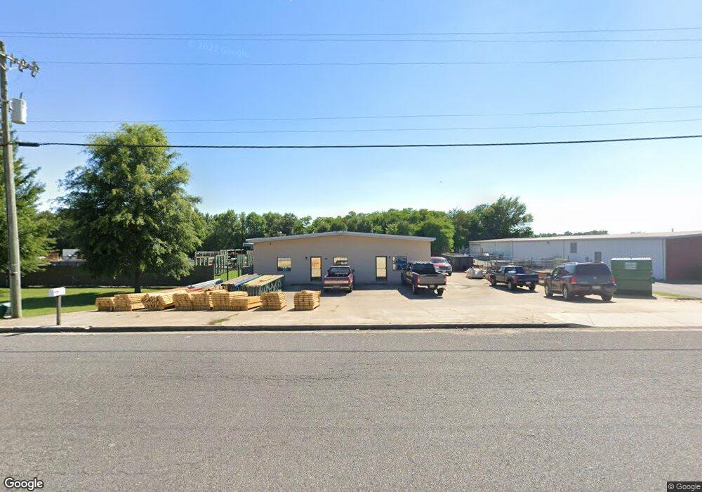
8331 Industrial Dr Olive Branch, MS 38654
--
Bed
--
Bath
3,825
Sq Ft
0.69
Acres
About This Home
This home is located at 8331 Industrial Dr, Olive Branch, MS 38654. 8331 Industrial Dr is a home located in DeSoto County with nearby schools including Olive Branch Elementary School, Chickasaw Elementary School, and Olive Branch Middle School.
Ownership History
Date
Name
Owned For
Owner Type
Purchase Details
Closed on
May 21, 2024
Sold by
Hood Robert D and Hood Nancy E
Bought by
Pollard Ronnie W and Pollard Lisa A
Home Financials for this Owner
Home Financials are based on the most recent Mortgage that was taken out on this home.
Original Mortgage
$240,000
Outstanding Balance
$226,354
Interest Rate
6.06%
Mortgage Type
New Conventional
Purchase Details
Closed on
Jul 3, 2018
Sold by
Robert W Butler
Bought by
Hood Robert and Hood Nancy
Home Financials for this Owner
Home Financials are based on the most recent Mortgage that was taken out on this home.
Original Mortgage
$212,000
Interest Rate
4.55%
Purchase Details
Closed on
Mar 9, 2009
Sold by
English Tracy W
Bought by
Butler Robert
Home Financials for this Owner
Home Financials are based on the most recent Mortgage that was taken out on this home.
Original Mortgage
$139,871
Interest Rate
5.15%
Mortgage Type
Commercial
Create a Home Valuation Report for This Property
The Home Valuation Report is an in-depth analysis detailing your home's value as well as a comparison with similar homes in the area
Home Values in the Area
Average Home Value in this Area
Purchase History
| Date | Buyer | Sale Price | Title Company |
|---|---|---|---|
| Pollard Ronnie W | -- | Guardian Title | |
| Pollard Ronnie W | -- | Guardian Title | |
| Hood Robert | -- | -- | |
| Butler Robert | -- | None Available |
Source: Public Records
Mortgage History
| Date | Status | Borrower | Loan Amount |
|---|---|---|---|
| Open | Pollard Ronnie W | $240,000 | |
| Closed | Pollard Ronnie W | $240,000 | |
| Previous Owner | Hood Robert | $212,000 | |
| Previous Owner | Hood Robert | -- | |
| Previous Owner | Butler Robert | $139,871 |
Source: Public Records
Tax History Compared to Growth
Tax History
| Year | Tax Paid | Tax Assessment Tax Assessment Total Assessment is a certain percentage of the fair market value that is determined by local assessors to be the total taxable value of land and additions on the property. | Land | Improvement |
|---|---|---|---|---|
| 2024 | $3,357 | $24,595 | $4,500 | $20,095 |
| 2023 | $3,357 | $24,595 | $0 | $0 |
| 2022 | $3,357 | $24,595 | $4,500 | $20,095 |
| 2021 | $3,357 | $24,595 | $4,500 | $20,095 |
| 2020 | $3,038 | $22,259 | $4,500 | $17,759 |
| 2019 | $3,038 | $22,259 | $4,500 | $17,759 |
| 2017 | $3,002 | $39,260 | $21,880 | $17,380 |
| 2016 | $3,002 | $21,880 | $4,500 | $17,380 |
| 2015 | $3,002 | $39,260 | $21,880 | $17,380 |
| 2014 | $3,128 | $22,800 | $0 | $0 |
| 2013 | $3,037 | $22,800 | $0 | $0 |
Source: Public Records
Map
Nearby Homes
- 8700 Old Craft Rd
- 8778 Mwc Rd
- 4406 John Wood Ln
- 4432 John Wood Ln
- 8939 Youngblood Rd
- 4435 Bolivar Trail S
- 9142 Mineral Wells Rd
- 9091 Hunters Ridge Dr
- 7905 Gardendale Dr
- 7899 Gardendale Dr
- 7881 Gardendale Dr
- 7875 Gardendale Dr
- 7867 Gardendale Dr
- 7859 Gardendale Dr
- 7851 Gardendale Dr
- 7885 Hunters Bend Cove
- 7839 Gardendale Dr
- 1930 Plan at Allendale
- 7736 Ferndale Dr
- 7721 Ferndale Dr
- 8357 Industrial Dr
- 8291 Industrial Dr
- 40 Industrial Dr
- 8363 Industrial Dr
- 36 Industrial Dr
- 0 Industrial Dr
- 31 Industrial Dr
- 10 Mwc Rd
- 8330 Industrial Dr Unit A
- 8330 Industrial Dr
- 8465 Industrial Dr
- 00 Frontage Rd
- 8196 Industrial Dr
- 8174 Industrial Dr
- 8158 Industrial Dr
- 8429 Industrial Dr
- 12 Mwc Rd
- 9 Mwc Rd
- 1538 Old Craft Rd
- 8441 Industrial Dr