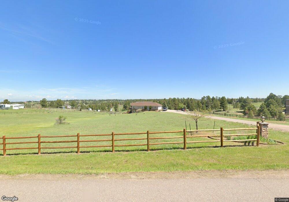
8337 Homestead Rd Parker, CO 80138
Estimated Value: $1,229,000 - $1,309,000
4
Beds
4
Baths
3,987
Sq Ft
$319/Sq Ft
Est. Value
About This Home
This home is located at 8337 Homestead Rd, Parker, CO 80138 and is currently estimated at $1,273,312, approximately $319 per square foot. 8337 Homestead Rd is a home located in Douglas County with nearby schools including Pine Lane Elementary School, Sierra Middle School, and Chaparral High School.
Ownership History
Date
Name
Owned For
Owner Type
Purchase Details
Closed on
Jan 11, 2021
Sold by
Kent Ray L and Kent Donna J
Bought by
Maddox Chad and Maddox Heather
Current Estimated Value
Purchase Details
Closed on
Jul 16, 2004
Sold by
Evans Thomas E and Evans Bette Jo
Bought by
Kent Ray L and Kent Donna J
Home Financials for this Owner
Home Financials are based on the most recent Mortgage that was taken out on this home.
Original Mortgage
$200,000
Interest Rate
6.32%
Mortgage Type
Unknown
Purchase Details
Closed on
Apr 17, 1991
Sold by
Fillingham Robert A
Bought by
Fillingham Norma G
Purchase Details
Closed on
May 27, 1984
Sold by
Hopple Lynwood M and Hopple Lois E
Bought by
Fillingham Robert A and Fillingham Norma G
Create a Home Valuation Report for This Property
The Home Valuation Report is an in-depth analysis detailing your home's value as well as a comparison with similar homes in the area
Home Values in the Area
Average Home Value in this Area
Purchase History
| Date | Buyer | Sale Price | Title Company |
|---|---|---|---|
| Maddox Chad | $1,011,200 | Land Title Guarantee Co | |
| Kent Ray L | $250,000 | Chicago Title Co | |
| Fillingham Norma G | -- | -- | |
| Fillingham Robert A | $70,000 | -- |
Source: Public Records
Mortgage History
| Date | Status | Borrower | Loan Amount |
|---|---|---|---|
| Previous Owner | Kent Ray L | $200,000 |
Source: Public Records
Tax History Compared to Growth
Tax History
| Year | Tax Paid | Tax Assessment Tax Assessment Total Assessment is a certain percentage of the fair market value that is determined by local assessors to be the total taxable value of land and additions on the property. | Land | Improvement |
|---|---|---|---|---|
| 2024 | $6,703 | $83,990 | $35,830 | $48,160 |
| 2023 | $6,777 | $83,990 | $35,830 | $48,160 |
| 2022 | $4,547 | $56,370 | $24,370 | $32,000 |
| 2021 | $4,735 | $56,370 | $24,370 | $32,000 |
| 2020 | $3,907 | $47,630 | $25,340 | $22,290 |
| 2019 | $3,922 | $47,630 | $25,340 | $22,290 |
| 2018 | $3,653 | $43,600 | $21,200 | $22,400 |
| 2017 | $3,381 | $43,600 | $21,200 | $22,400 |
| 2016 | $3,605 | $45,520 | $16,720 | $28,800 |
| 2015 | $3,697 | $45,520 | $16,720 | $28,800 |
| 2014 | $4,039 | $44,470 | $18,710 | $25,760 |
Source: Public Records
Map
Nearby Homes
- 8092 Ponderosa Ln
- 11340 Deer Ln
- 12380 Forest Canyon Dr
- 8855 E Parker Rd
- 9050 Mary Clarke Place
- 11634 Bell Cross Cir
- 10760 Mount Antero Way
- 21770 Mount Elbert Place
- 21822 Longs Peak Ln
- 7390 Sagebrush Dr
- 7330 Centennial Dr
- 22428 Quail Run Ln
- 22389 Quail Run Dr
- 22380 Quail Run Dr
- 7285 Sagebrush Dr
- 7372 Talon Trail
- 11001 Cardinal Dr
- 12250 Evergreen Trail
- 12391 Evergreen Trail
- 21807 Silver Meadow Cir
- 8405 Homestead Rd
- 8275 Homestead Rd
- 8282 Ponderosa Ln
- 11563 Antelope Ln
- 8404 Ponderosa Ln
- 8459 Homestead Rd
- 8410 Homestead Rd
- 8217 Homestead Rd
- 8342 E Ponderosa Ln
- 8276 Homestead Rd
- 8460 Homestead Rd
- 8464 E Ponderosa Ln
- 8218 Homestead Rd
- 8216 E Ponderosa Ln
- 8181 Homestead Rd
- 8535 Homestead Rd
- 8532 Ponderosa Ln
- 8534 Homestead Rd
- 8403 Ponderosa Ln
- 11481 Antelope Ln