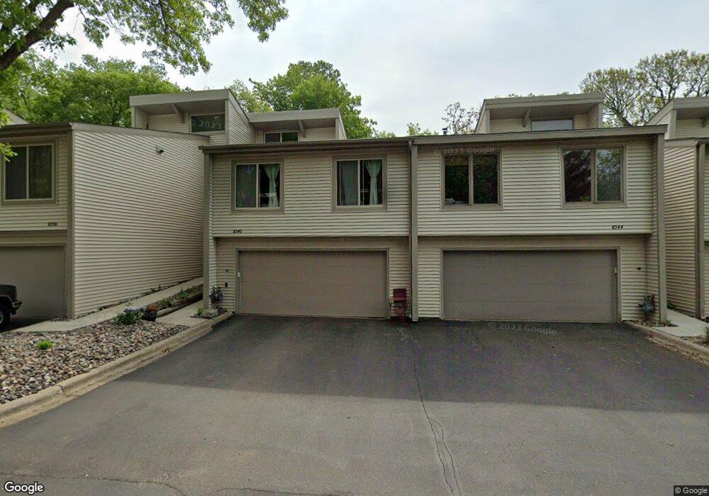
8340 Upper 138th Ct Saint Paul, MN 55124
Alimagnet NeighborhoodEstimated Value: $289,000 - $348,000
2
Beds
2
Baths
1,866
Sq Ft
$166/Sq Ft
Est. Value
About This Home
This home is located at 8340 Upper 138th Ct, Saint Paul, MN 55124 and is currently estimated at $310,546, approximately $166 per square foot. 8340 Upper 138th Ct is a home located in Dakota County with nearby schools including Westview Elementary School, Falcon Ridge Middle School, and Apple Valley Senior High School.
Ownership History
Date
Name
Owned For
Owner Type
Purchase Details
Closed on
Mar 20, 2006
Sold by
Not Provided and Nelson James B
Bought by
Torrini Joseph
Current Estimated Value
Purchase Details
Closed on
Apr 16, 2004
Sold by
Youngquist Nancy R
Bought by
Nelson Jim and Shoemake Nancy
Purchase Details
Closed on
Sep 25, 1998
Sold by
Larson Lorraine J
Bought by
Youngquist Nancy R
Create a Home Valuation Report for This Property
The Home Valuation Report is an in-depth analysis detailing your home's value as well as a comparison with similar homes in the area
Home Values in the Area
Average Home Value in this Area
Purchase History
| Date | Buyer | Sale Price | Title Company |
|---|---|---|---|
| Torrini Joseph | $199,900 | -- | |
| Nelson Jim | $190,000 | -- | |
| Youngquist Nancy R | $114,260 | -- |
Source: Public Records
Tax History
| Year | Tax Paid | Tax Assessment Tax Assessment Total Assessment is a certain percentage of the fair market value that is determined by local assessors to be the total taxable value of land and additions on the property. | Land | Improvement |
|---|---|---|---|---|
| 2024 | $2,924 | $285,200 | $43,600 | $241,600 |
| 2023 | $2,924 | $267,300 | $42,700 | $224,600 |
| 2022 | $2,448 | $266,300 | $42,600 | $223,700 |
| 2021 | $1,056 | $222,600 | $37,000 | $185,600 |
| 2020 | $2,024 | $108,200 | $35,200 | $73,000 |
| 2019 | $1,945 | $179,700 | $33,600 | $146,100 |
| 2018 | $1,858 | $181,200 | $31,100 | $150,100 |
| 2017 | $1,775 | $167,800 | $28,800 | $139,000 |
| 2016 | $1,709 | $154,500 | $27,400 | $127,100 |
| 2015 | $1,592 | $124,516 | $22,571 | $101,945 |
| 2014 | -- | $116,559 | $20,487 | $96,072 |
| 2013 | -- | $98,574 | $17,642 | $80,932 |
Source: Public Records
Map
Nearby Homes
- 13732 Hemlock Ct
- 13763 Hollybrook Dr
- 13761 Hollybrook Cir
- 13751 Hollybrook Cir
- 13751 Hollybrook Dr
- 13731 Hollybrook Dr
- 13731 Hollybrook Cir
- 13594 Hollybrook Dr
- 13621 Hollybrook Dr
- 13598 Hollybrook Dr
- 13590 Hollybrook Dr
- 14160 Heritage Ct
- 13595 Hollybrook Dr
- 14207 Hibiscus Ct
- 13301 Huntington Cir
- 8906 138th Street Ct
- 14349 Hemlock Ct S
- 14391 Hickory Way
- 13529 Gossamer Way
- 13850 Pennock Ave
- 8344 Upper 138th Ct
- 8336 Upper 138th Ct
- 8348 Upper 138th Ct
- 8332 Upper 138th Ct
- 8328 Upper 138th Ct
- 8324 Upper 138th Ct
- 8339 Upper 138th Ct
- 8343 Upper 138th Ct
- 8335 Upper 138th Ct
- 8331 Upper 138th Ct
- 8379 Lower 138th Ct
- 8387 Lower 138th Ct
- 8383 Lower 138th Ct
- 8375 Lower 138th Ct
- 8391 Lower 138th Ct
- 13736 Hemlock Ct
- 13740 Hemlock Ct
- 13744 Hemlock Ct
- 13748 Hemlock Ct
- 13728 Hemlock Ct
Your Personal Tour Guide
Ask me questions while you tour the home.